Moose Lake

Date: Friday-Sunday June 24-26, 2022
Area: Boundary Waters Canoe Area Wilderness
Trip Plan: Launch at the Moose Lake entry point in the BWCA, go straight to the US/Canada border, then travel east along the border to Lake Saganaga. Merge south to Trails End of the Gunflint Trail, then back west to Sea Gull Lake, Kekakabic Lake, and Ensign Lake, then to Newfound and Moose Lakes to complete a loop.
Day 1 – Either rack a huge day of 40-60 miles past Trails End, or a more conservative day of around 30 miles before Lake Saganaga.
Day 2 – Either a lower-mileage, potentially late-start day of 15-30 miles, or a more even day of around 30 miles.
Day 3 – Make it back home my any means necessary.
Trip Synopsis:
Day 1: Friday June 24, 2022
Garmin Data:
My journey to paddle across the Boundary Waters on a stand up paddleboard starts here. As I sat on my inflatable air mattress in my van at the Moose Lake entry point to the BWCA, muggy with the windows rolled up and trapped mosquitoes buzzing in my ears, re-packing for the third time, I wondered what the hell I was doing. This is fairly ridiculous. All of it. Unpacking and re-packing anxiously, sleeping in my van in the entry point parking lot, going out solo in the BWCA for training in hopes of at attempt for perhaps the stupidest of it all – attempting to go west to east along the entire million-acre federally-designated wilderness area in a speedy time. Oh well, just a fleeting thought. KEEP PACKING AND GET TO BED!
To get to just this point was a long, long time coming. I can’t pinpoint exactly how or when I stumbled across the Krueger-Waddell Route on the wide depths of the internet, but I feel like I learned about the “Border Route”, WaterTribe, and racing-style stand up paddleboards all around the same time. For some reason, travel via SUP seemed more appealing or cool than a canoe or kayak. A kayak is probably much more efficient and reasonable for solo wilderness travel across lakes and rivers but something gravitated me towards the stand up. Perhaps it was my running background and boredom from sitting for long periods. Perhaps it was my running background causing me to have a bony butt? Either way, like the proverbial seed or tiny spark that results in a forest fire, an idea and concept clicked. I knew I’d need to amass gear, knowledge, time and fitness to actually get there. The first step was the board. I bought a board in 2019 and it was on. The world opened up somewhat, as Duluth has a substantial number of paddling options within city limits (or within a half-hour drive), and nearly unlimited, very cool and adventuresome options within a 2-3 hour drive. Just like trail running or gravel biking (to name a few passions of mine…), Duluth seemed to be a mecca for paddling and I was so excited to have a new adventure tool with a financially questionable purchase of a Surftech Generator all-around 11’6″ board.
The idea festered for a few years, through the 2020 pandemic and into 2021 I was getting a little more serious and researching different types of paddleboards. I knew the recreational one I purchased out of the gate wasn’t the best option out there for carrying gear and paddling fast, and I pondered what would be. For such a niche and expensive sport, how can there be that many options? All racing-style paddleboard options are hard to find, and requires pretty much exclusively online research. I was lucky enough to find a local paddleboard enthusiast to buy a racing board off of for relatively cheap – $750 for a 10-year old model in good condition that probably cost over $2k new – and even got a couple races in. The stage was set to plan out the big one. So, come January 21st or so, the day BWCA permits opened for the 2022 season, I secured three. A trip in June and a trip in July for two nights a piece, and the trip for the first week of September.
So, to get to the Moose Lake entry parking lot, I had rushed to actually get my permit, finish packing, strap on my board and drive north to get there by 9pm, and now by 10pm I should be sleeping for an early-as-possible start time the next morning. My gear was a point of anxiety and I wanted to make sure I had everything I need but nothing I didn’t, and all my gear would be either accessible or watertight, and I could mitigate anything sinking to the bottom of a lake. Because if anything sunk, depending on the item could create a critical situation except on Sunday where I could simply limp back to my van. I didn’t want to think about the potential issues, but it was prohibiting my sound sleep, and re-packing helped quell my anxiety. When I finally had everything in order I laid down and it was the uncomfortable humidity and sound of bugs in the van that now prohibited my sleep. I turned on my van’s engine for AC but knew I couldn’t and shouldn’t keep it on all night. I drifted off a bit, then woke up to turn off my van and stick it out. It was a pretty terrible first night of sleep out there. I couldn’t believe I had never camped actually in my van before, and told myself I’d make some dramatic changes before trying it again. Tent is way better.
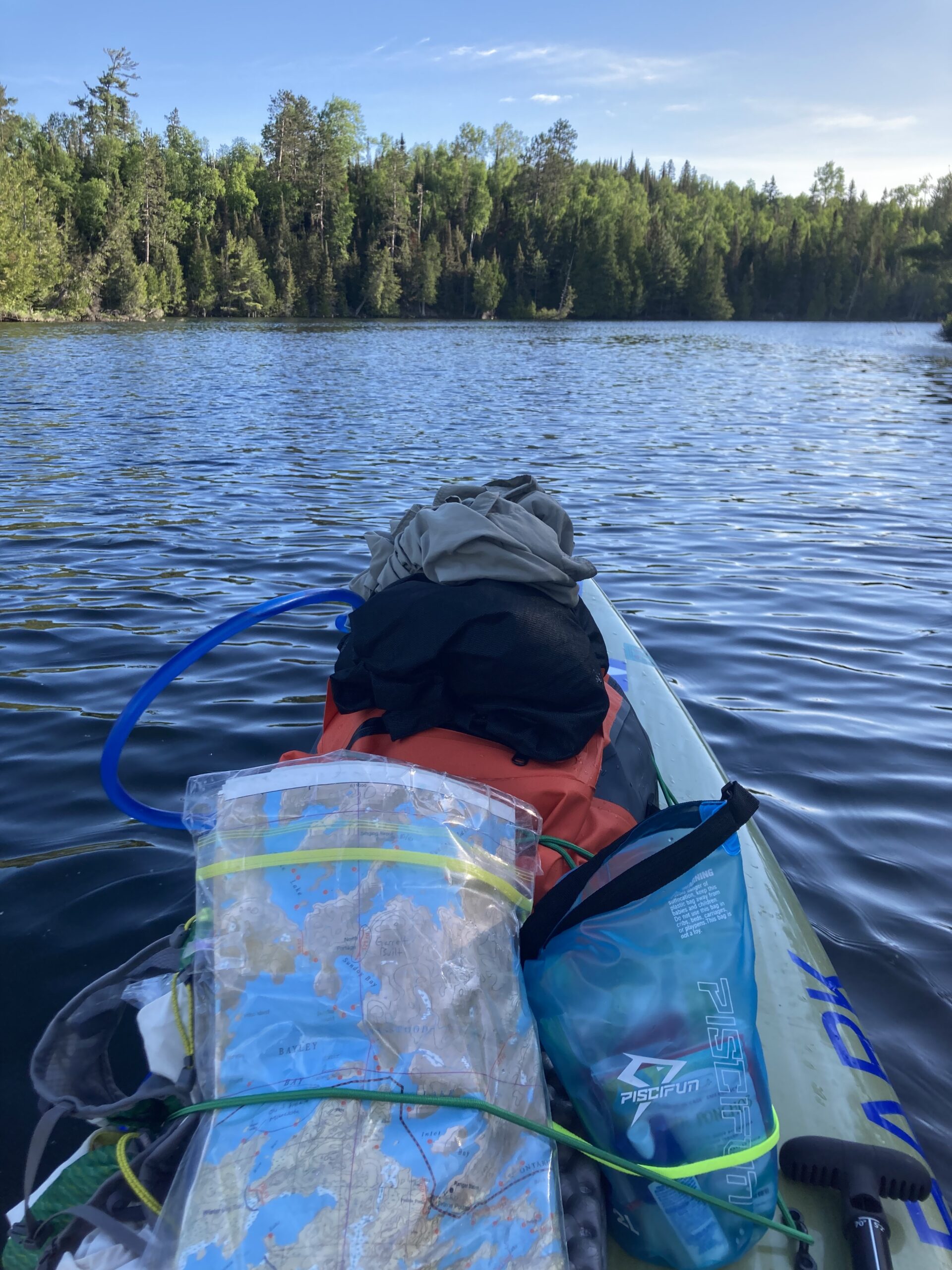
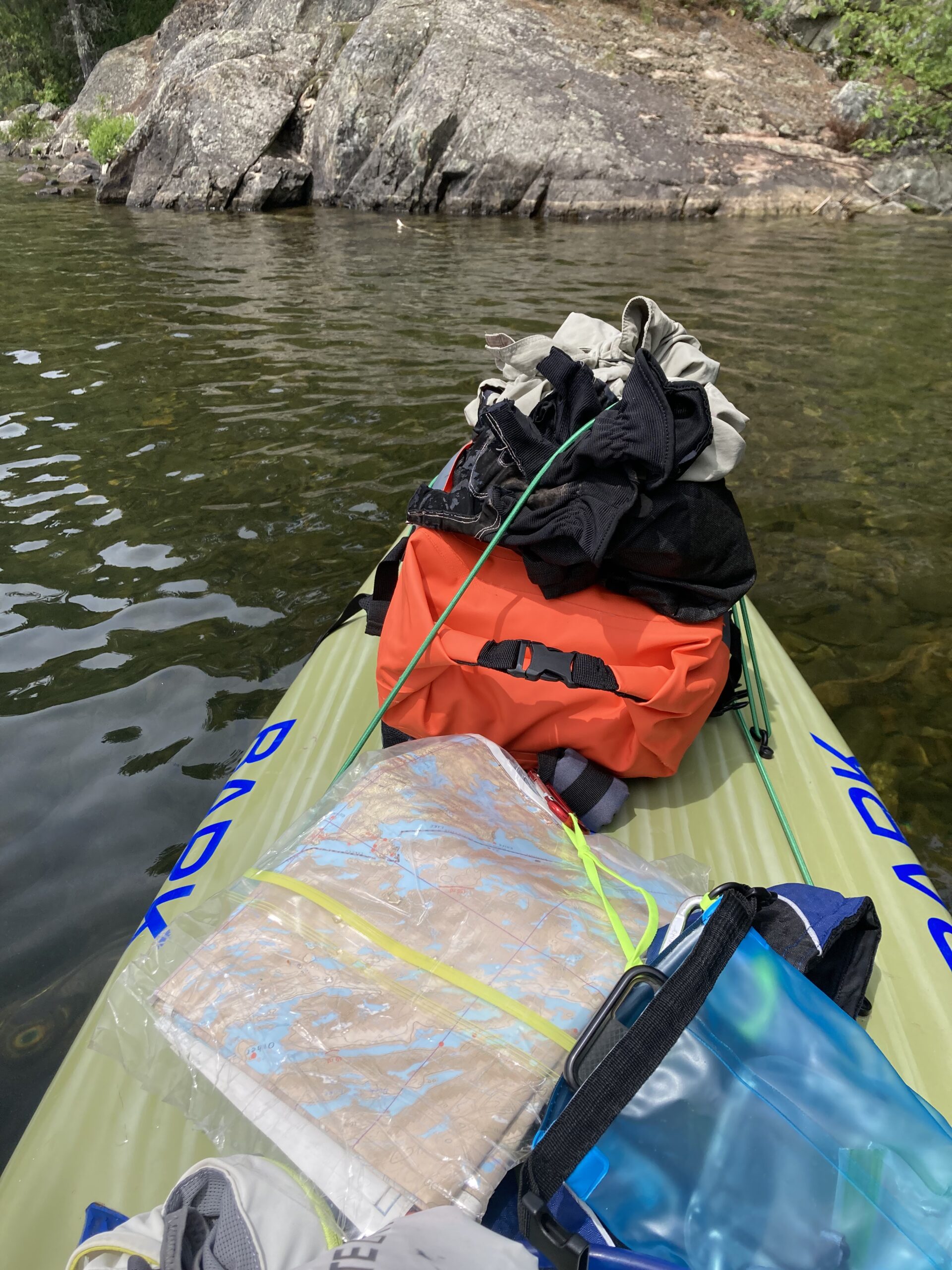
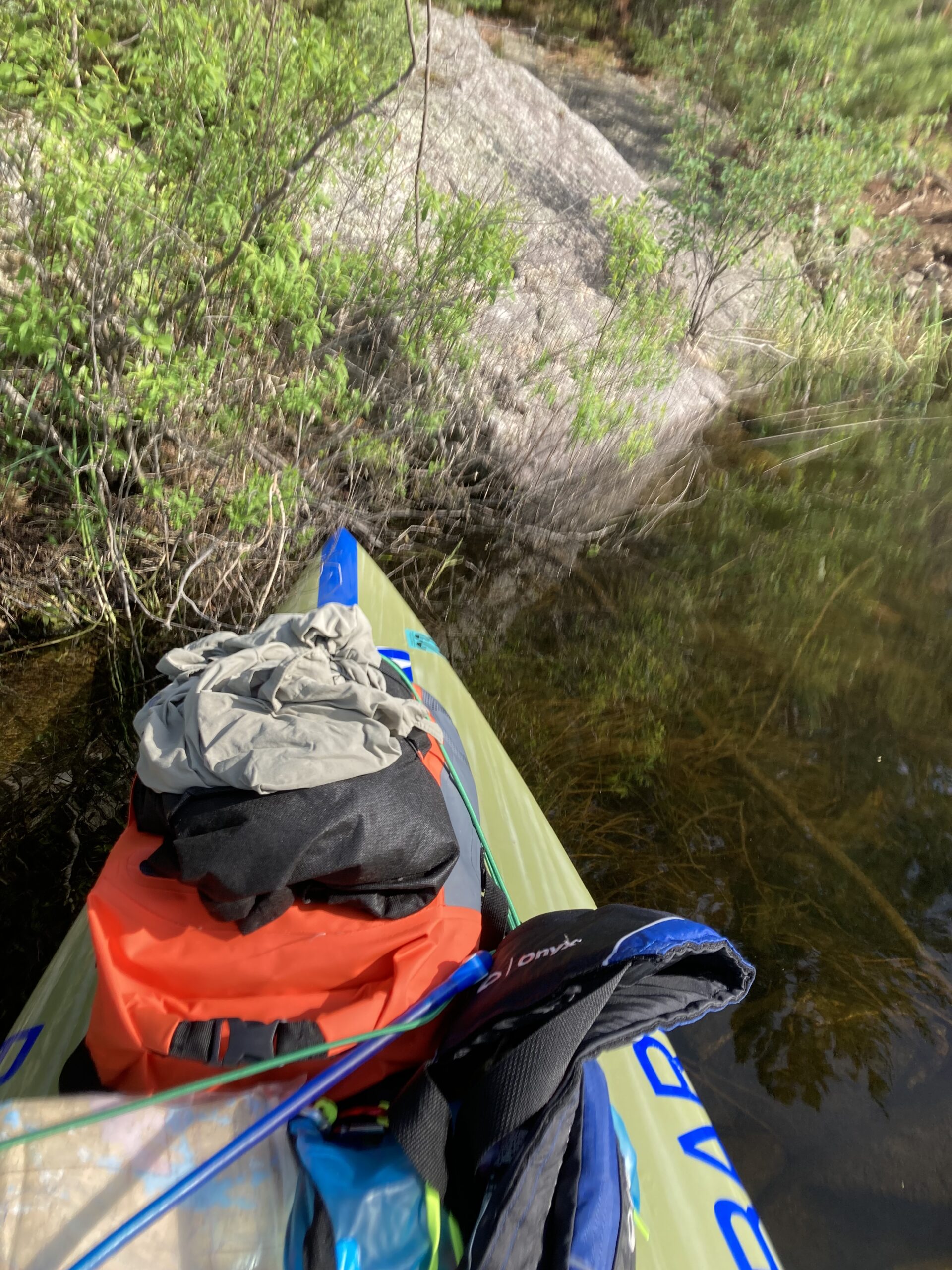
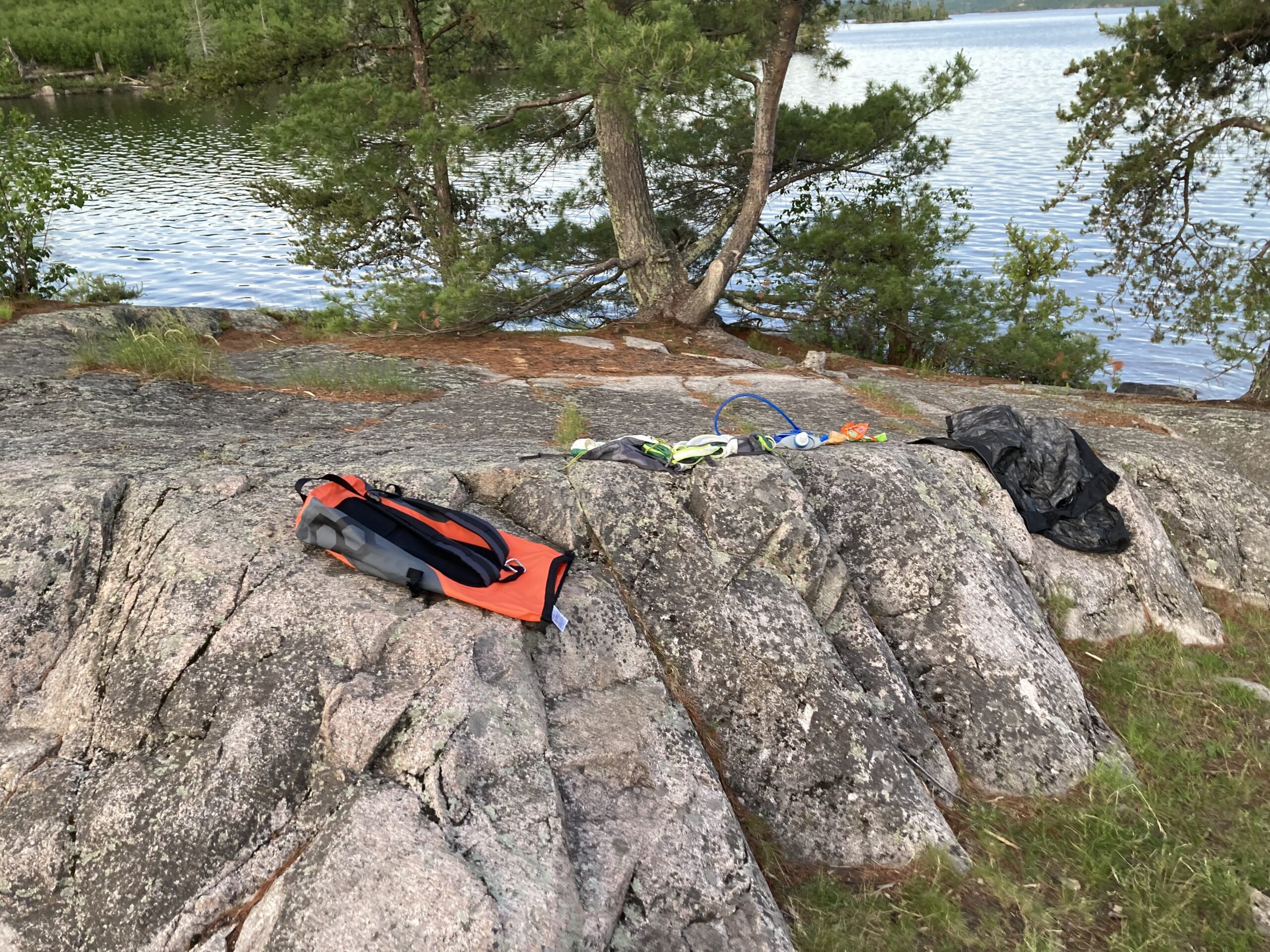
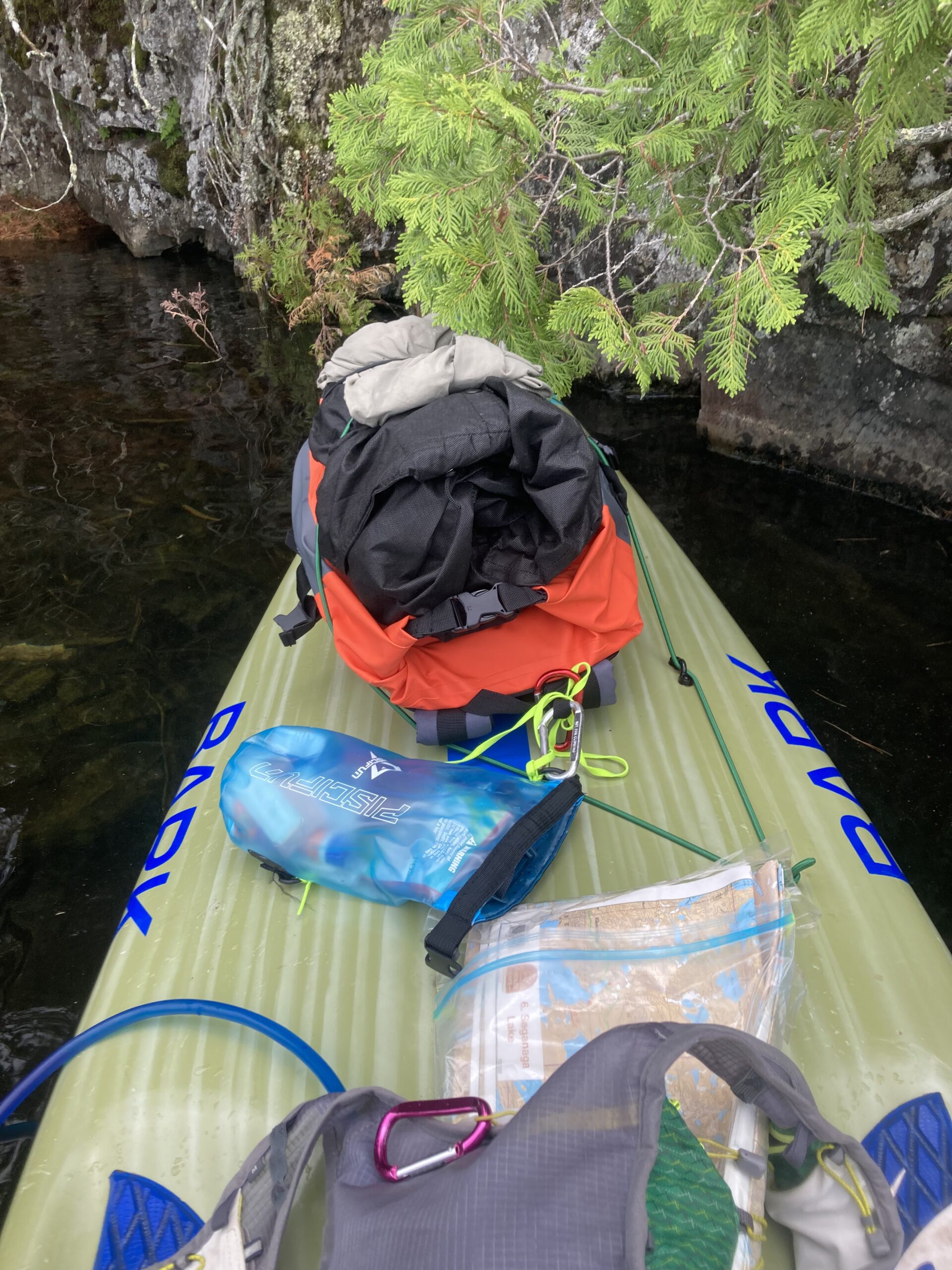
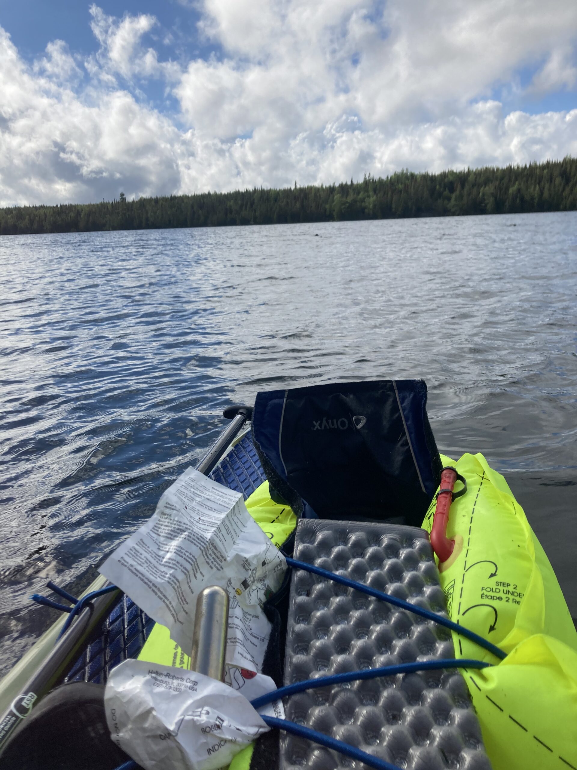
I woke up naturally very early in the morning, as hoped and expected, thanks to the early June sunrise. I started by cracking a caffeinated fizzy water and eating breakfast bars. I could see hungry mosquitoes buzzing outside my windows. Thanks to the prep work just a handful of hours prior, it took no time at all to re-park my car, schlep the board and gear down to the lake, and I set off paddling earlier than expected on a perfect glass morning. It was a bit chilly but I warmed up quick. My gear fit nicely on the board and everything seemed very secure, which was a relief. I checked my gear a few times and it was nice to have simply my main pack, hydration vest, emergency kit dry bag all up front, then the lifejacket either on myself or strapped on the back next to my foam sleeping pad. I could check all three items up front just like that: one, two, three.
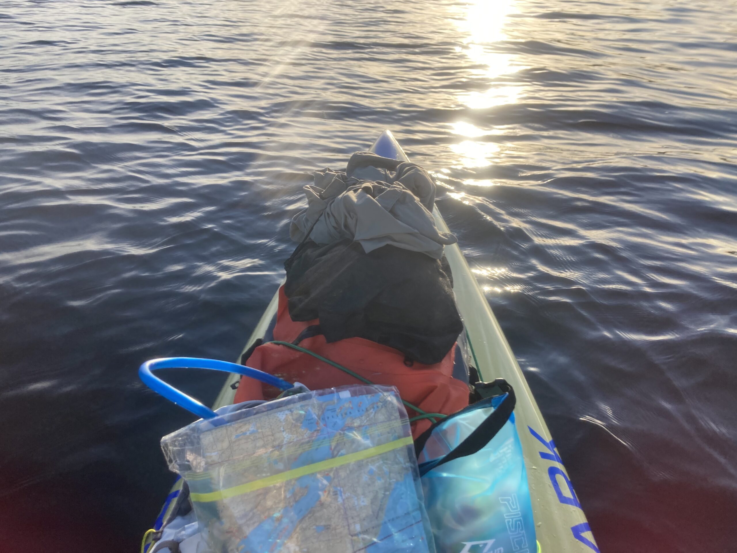
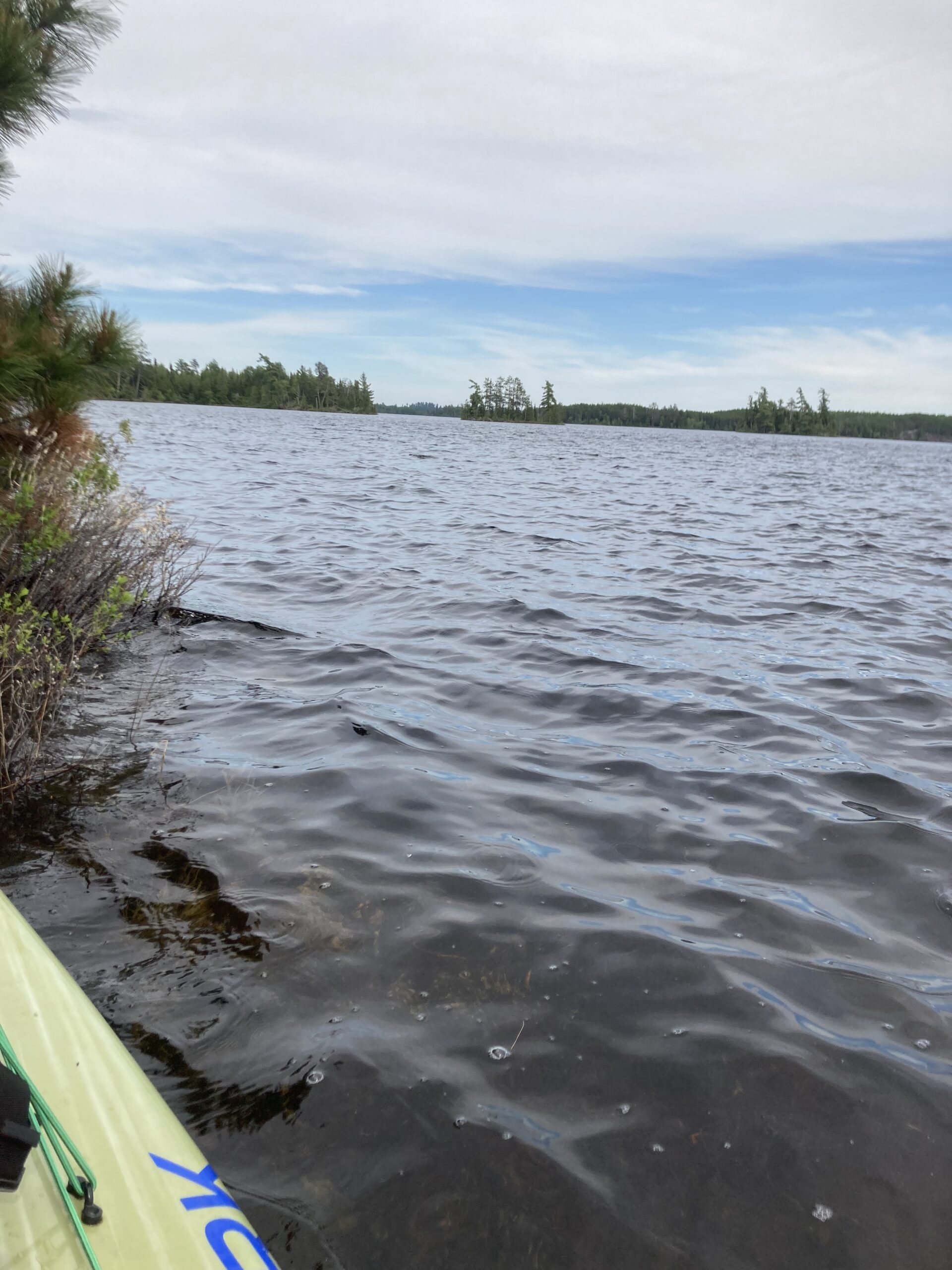
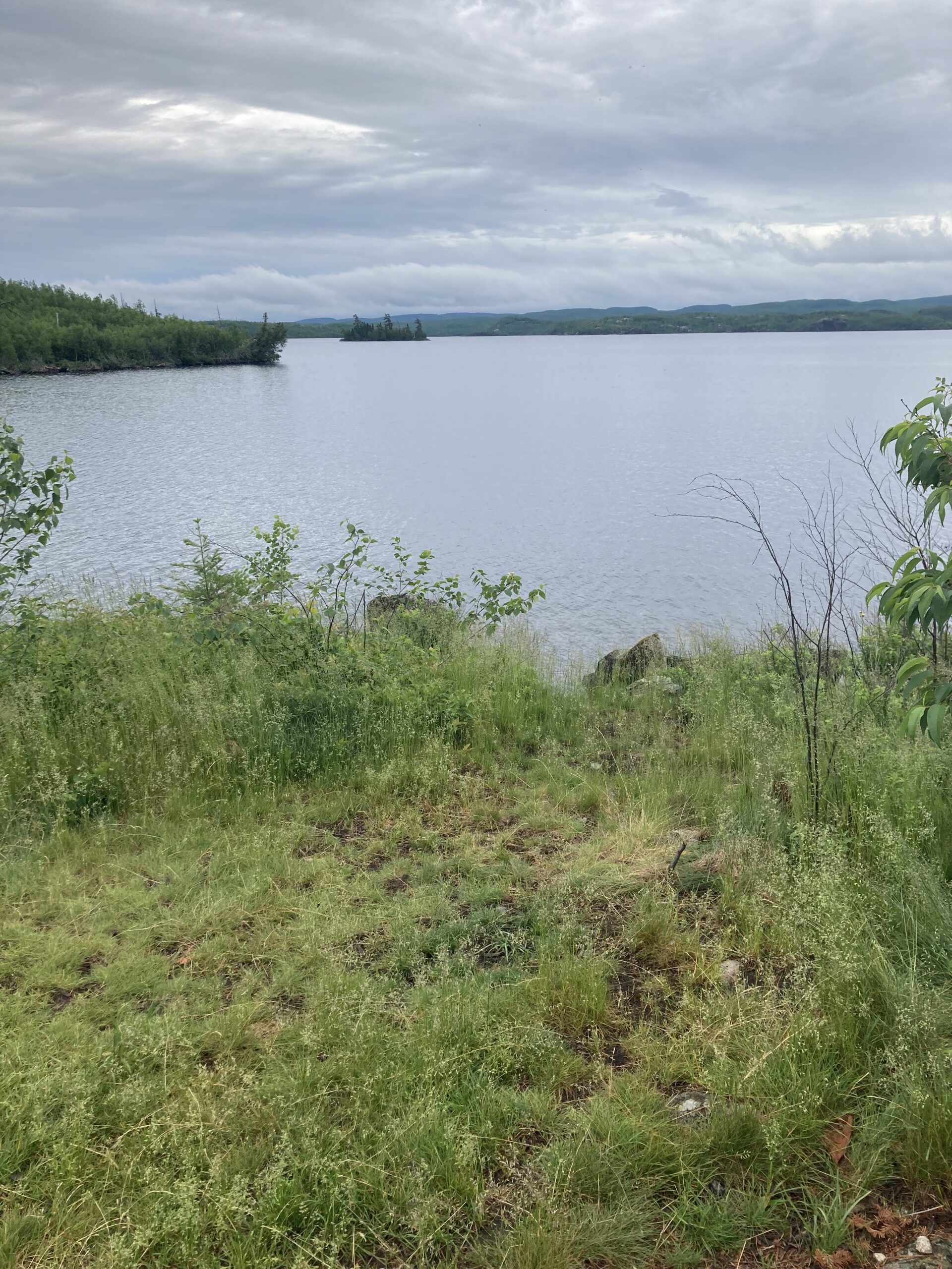
Moose Lake was long and it took me hours to get to the end. It was fun to curve around islands and points to get to Newfound Lake, and after a the first few hours clicked off I was nearing my first portage. I saw many campers at sites waking up, and few motored boats zipping around. Their waves were easy to handle and I felt pretty cool out there. How fun and how beautiful is it out here? So fun and beautiful. Checking on my stuff again, which was a very frequent occurrence through the trip, and I was a bit confused why my blue bungee cord in the back was slack. Huh. I turned the other way for a better look at realized one of the glued tie-downs had come up. Ohhhh no. This could be bad. I kneeled down, and the plastic u-shaped component was laying sideways, entangled in the bungee but clearly unattached. I put it in a pocket of my water pack and re-organized. Well, there were still five tie-downs left but they’re all clearly compromised. I kept paddling knowing that nothing would fall right off, but with the pretty serious concern that more tie-downs could pop off. Then what? I pondered what I could do, for this trip and for the future. Would it be smart to have super glue? Can duct tape fix this somehow? I have duct tape… old duct tape wrapped fairly tightly around a pen. Is that even sticky anymore?
As I got closer to the my first portage I saw Prairie Portage on the map and to my left. I started seeing other paddlers as the day progressed. Then, I heard a pop, a plink and a plunk. It was the sound of one of the front tie-downs popping off, bungeeing into the air, then bouncing off the front of my board into the lake. Ohhhhhhhh no. That is critical. One bungee on the back is fine to sacrifice, but my vital gear is all on front, and to lose one tiedown up front was a punch to the gut. I was able to readjust and my front bags were still stable, but to have two pop off within the first half-day was very concerning and the front popping off made me question proceeding. But, I realized there were ways to strap everything down without any tie-downs at all. Not perfect, not optimal, but certainly do-able. I might have misread the map because there was no portage to Birch Lake. It narrowed, I skirted between an island and then it opened up. The entire lake was glass and the paddling was immaculate. I used campsites, easy to find due to the lingering morning with campers still present, as a confirmation that I was where I thought I was on the map. Scanning the horizon to find the most direct route, I wondered if my watch would help get my sense of direction. I looked at my watch and sure enough, the map was right there. I wondered if I should use that tool… As helpful as it is, I had read a few Border Route paddlers who insist on using the same tools as the voyageurs and indigenous people – maps and compass as the most technologically advanced wayfinding devices of the 1800’s. So I looked away from my watch and looked back at my map.
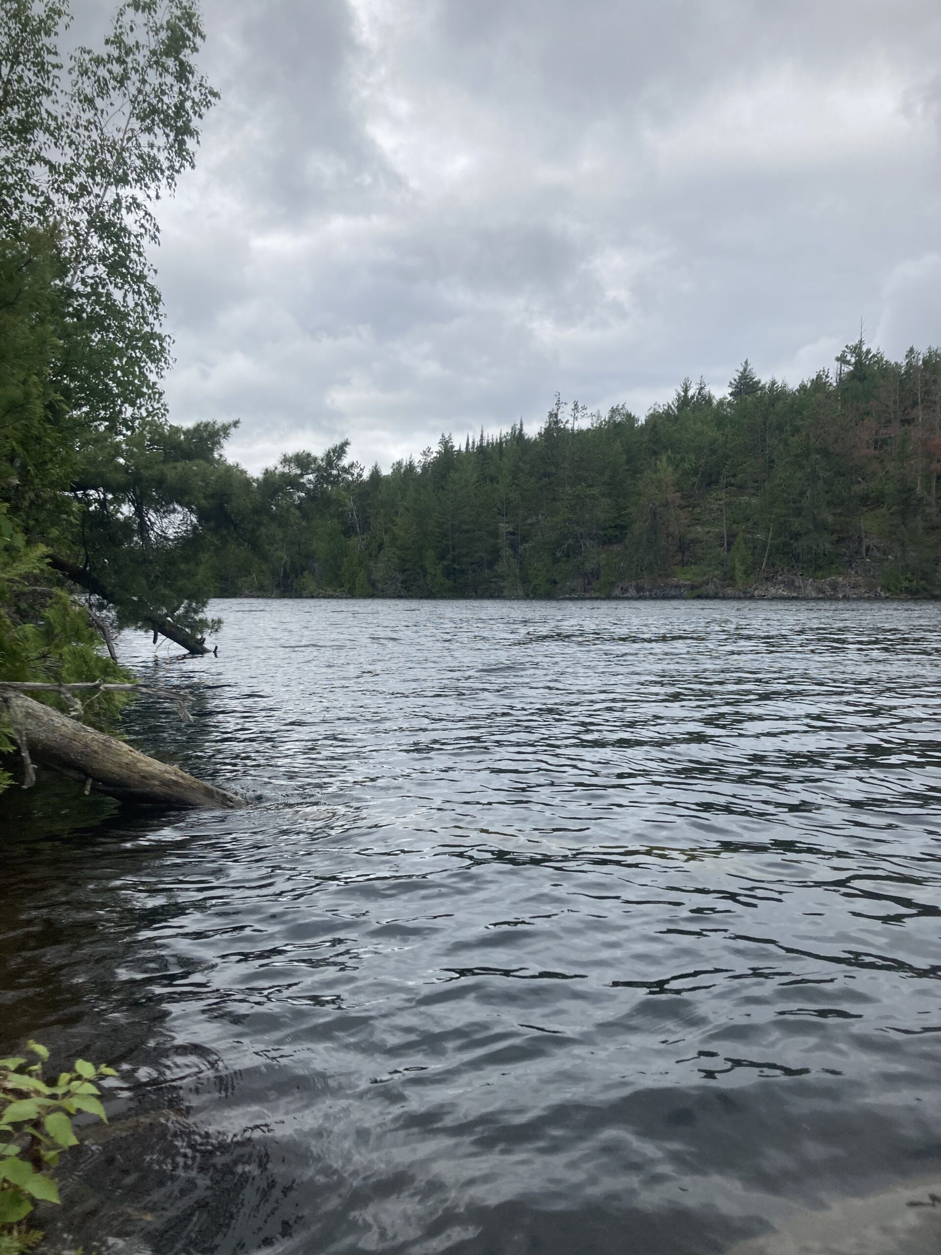
I was on the US/Canada border at this point, and it was so cool. The sun was getting higher and hotter in the sky, and I was enjoying a mix of a slight tailwind or complete glassy water. I figured I’d jump in the lake by the end of this one leading to the portage. By the time I got there, I didn’t feel like it. There was a group just paddling off from the portage as I got closer. One person mentioned the paddleboard as very interesting. Another person in the group asked where I was headed to. I said “Sea Gull” and it took a bit to think about it and they said “wow, OK, go you!” and paddled off. I said it, but knew that’d be a stretch. I have no idea what the dude put together in his head, but I knew myself that’d be at least 40 miles. At this point, I was over 10 miles in and 2.5 hours from my nearly 6am start time. I was making good time right about 4 miles per hour. That is speedy. The first portage was relatively long in the grand scheme of things, but it was easy. There were a few more portages in rapid succession, and I got an idea of how much slower portages go. My steady mile splits were decimated and I was a bit confused why it took me that much longer to walk. I figured I could walk at 3mph or slightly less. But before and after each portage I was essentially stopped for at least a few minutes to get my gear ready to carry, and then back strapped on board. The latter took longer than it should because of my anxiety around my bungee system. I didn’t want to pop any more tie-downs off. I would always take the time at the end of a portage after launching my board and killing mosquitoes to re-examine my map, and I had already re-folded the first map several times and even switched to the second map as I got closer to Knife Lake, which was as a solid northeast/southwest-oriented lake, narrow and several miles long.
I noticed the heat and said I’d definitely jump in the lake before lunch. I loved Knife Lake. The conditions were unbelievably prime and it was easy to determine where I was and where I was going. I stopped paddling only to drink water and refold my map section once I passed the old and was on to the new, although I was constantly scanning the treelines to guess about what was an island, what was a jut-out, or what was a bay. Then I’d look down at the map strapped to my water bladder to confirm my notion. I got a good sense of how far on the map correlated with the real-life landforms as I scanned the horizon.
Splashing water was was a welcome relief and I could feel the sun rays beating onto my shoulders. I became increasingly excited to jump in. As I paddled, I thought about if I should right now. I deliberated that for a solid hour until I made it to the end of Knife Lake where I knew there was a portage to the next lake. I figured I’d finally jump in there, then hang at the end of the lake and eat lunch. At that point, I was already many hours in, getting to the lunch hour and over 20 on the day. Since I was feeling pretty good, the wind would be in my favor for at least another 10 or 15 miles, I figured I should absolutely push through Saganaga Lake, into the light south wind and onto my professed ending point of Sea Gull Lake. As I got to the back bay of Knife Lake, I saw a campsite and camper at the site to the left, then the indistinguishable shoreline where there was supposed to be my portage. There was an island with seagulls laying down and sunning, and a few others swarming around the rocky outcrop. I harmlessly asked one of them what way I was supposed to go, but figured if I just shot for the back left part of the bay where the portage looked to be, I’d see it eventually. Plus, I was really close to my swimming and lunch spot, and eager to take a break. I reflected on how my arms, hands and shoulders were feeling good. I had been standing all day, and I was worst off on my toes, which had been tingly for hours. But, that’s not too bad. I heard birds squawking above my head, then sensed one getting close to me. I stopped paddling and looked up to a swooping sea gull angrily looking at me, yelling. It was soaring maybe 50 feet up from me, then slowly dropped its left wing, turning its body towards me and orienting its head down, then in a snap, it dive bombed straight towards me. It was staring me down, zeroed in on its target, which was my face. It took me a little bit to actually feel threatened. Huh. What the… But it was coming right towards me before pulling up seemingly 5 feet above from me, squawking after the attempted attack. It’s dive-bombing me! I looked the other way to see the one bird preparing for another dive bomb, and communicating to the others. I couldn’t comprehend, but I’m pretty sure they were plotting to kill me. The shore was right there… I suddenly increased my stroke rate to get the heck out of there, and sensed a bird very close to me and saw it swoop up on the other side. I immediately hopped down to a kneeling position and saw the flock – at least 5 birds circling above me. Oh no, oh no, oh no. I yelled back at it – “STOP IT!!” Nope, that made it more angry. Bottom wing dropped, beak pointed directly at me, angry dark eyes focused on my head as it swooped down. Again, it looked like it was going to hit me but pulled up at the last minute to miss me. While one bird regrouped, another one dove. I held up my paddle not to fight back but to guard myself and threaten the bird. Yeah, you’ll hit my paddle first bro. Don’t try me! But they kept trying. I sat down and realized I was probably better off to get out of there than to defend myself to the point where they’ll stop attacking me. I’d never heard of seagulls being aggressive like that – especially out in the middle of the wilderness while I’m paddling in the middle of the lake. I would expect that behavior in Canal Park of Duluth where there are commonly hundreds of humans eating tasty food on land. It was scary compared to my otherwise tranquil and lovely morning thus far, and I wondered if that’d happen at all the rest of the trip. I hoped not for the primary fact that it slowed me down. The other issue of course is that I could be injured and not have the resources to address it. Luckily they flew off as I got closer to shore and I was able to swim and eat my lunch in peace.
Just like I suspected, once I got to the back shoreline and bay of Knife Lake with a very scenic and beautiful rock face adjacent to the portage’s lowland, the portage was easy to spot. They always seem to be in the valleys of the horizon, I remembered, with an excellent example right in front of me. I scanned the air for any birds. Nope, good to jump in. It felt great but was a little stressful just because of the preparation – take off my gloves, take off my lifejacket and shoes, precariously stack those on the board’s deck. Jump off, then crawl back on the crowded board without any big mishaps. Feeling refreshed and back on board, I searched through my pack for lunch items with wet hands. I noticed my water low and filled up my bladder with some fresh filtered water. That was an easy process and my water system was working perfectly. Lunch was good and I was feeling pretty confident on the day so far. However, the wind of long Knife Lake was pushing me towards the back shore and I wondered about the big wide open Saganaga Lake, in the middle of which I was planning a change of direction. I unfolded the map I was on to see the daunting western half of Saganaga, or Big Sag as Jack was calling in earlier in the week. It just opens right up into this huge exposed lake. With a suspected southerly wind, I could be pushed right to Canada! I’d have to hop islands to avoid a challenging predicament of going off course with a cross-wind. At this point, I was off the mileage I’d plotted out and written on the map in 5-mile increments. I thought my lunch spot was closer to 21 miles but my watch had over 23 already. I took all the time I needed and continued on my way with an easy portage. I snaked through the narrow Ottertrack Lake with a keen eye for birds. I was still moving good and the conditions were still prime.

Monument Portage, as it’s listed on the map, was a killer. It was very steep and just didn’t stop going up and up and up to these metal pylons to denote the international border of USA and Canada. It was hot, buggy and I struggled across the 80 rod carry. I started planning out the rest of my day and evening… I figured as I was nearing 30 miles, I could make it to Sea Gull Lake by roughly 40 miles then find a campsite before dusk drags on too far. That would require a fairly efficient paddle across Saganaga. I kept trying to say it and forgot what I thought was the correct way. Is it like “sog-uh-nog-uh”? Or “sag-ah-nag-ah”? Or “sag-uh-nog-uh”? Saggy Naggy? I don’t know. I wondered what the indigenous pronunciation is… probably none of the above, but the correct one. I pondered the thousands of visitors to this exact spot decades and centuries before this was a designated wilderness area. They had to go 40 miles for work. This was their work. I didn’t think I’d like it was much if it was my work. But, this is what I work FOR! How weird is that. They weren’t on carbon fiber stand up paddleboards with 30 pounds of gear, either.
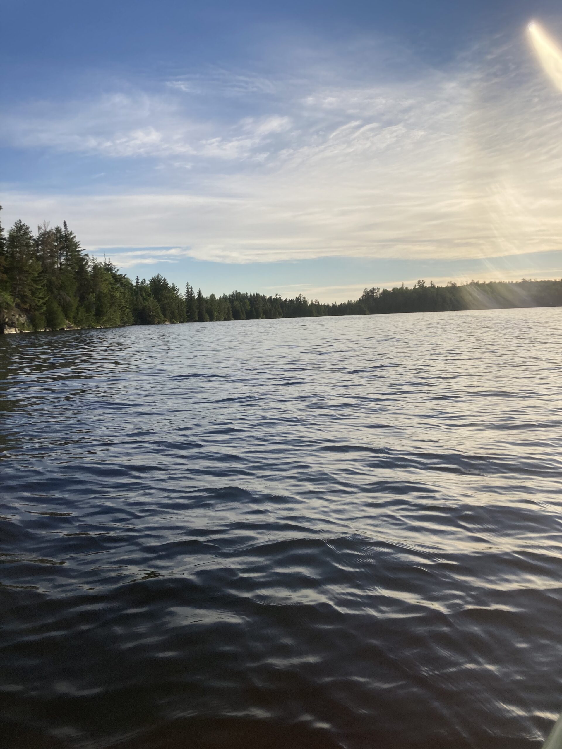
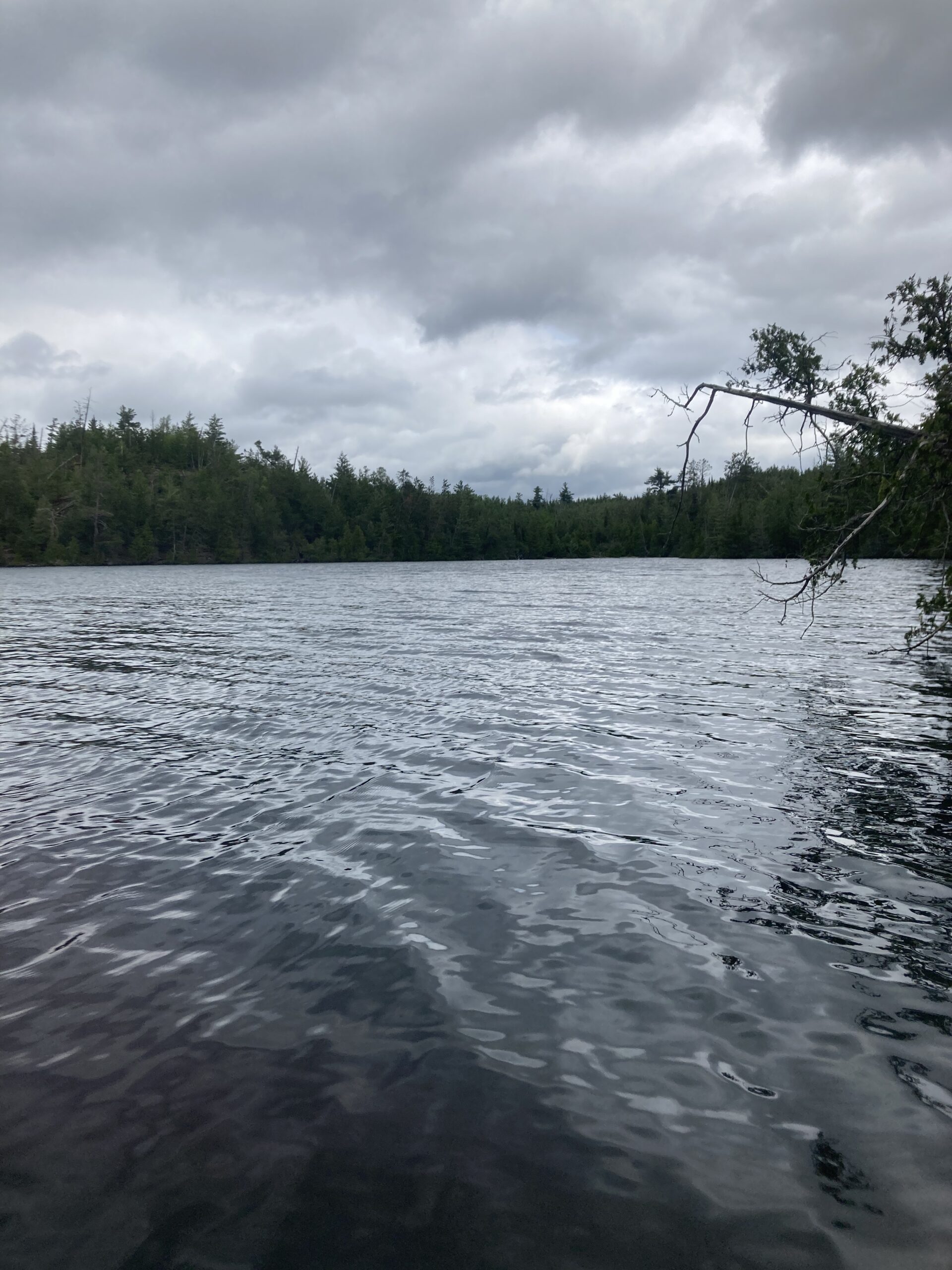
By the time I got to Saganaga Lake, I knew I had a pretty easy shot to the scary open waters of the lake with a nice leeward shoreline blocking the potentially challenging south winds that were forecasted. I started feeling a little tired by that point, and told myself I could take an hour or so along the southeast shoreline leading to Rocky Point on the map. I swapped my maps, and got a better picture of where to go. The second map showed my course all the way through Big Sag, down to Trail’s End and the entire Sea Gull Lake, so I was pretty relieved to know I could keep this one map accessible for the rest of the day. I made really good time getting to Rocky Point and planned my tough push along the big open waters to the first clump of islands. Yep, here we go! Let’s do this! When I got to the open water I was already kneeling in preparation for raunchy waves. They weren’t bad at all, except maybe the wrong orientation for optimal paddling. It’s easy enough if the waves are a direct downwind, or even direct headwind, but the cross-wind waves are a little harder to efficiently paddle in because you have to zig-zag constantly and get pushed around. I was a little disoriented because the lake and islands in my view looked so much smaller than I imagined from studying the map. In no time at all, I was pretty much to the first island group of islands. My plan was to skirt in between two large blocker islands and I had to adjust my course a bit to get there. Zig-zag, no matter. It’s never a bad idea to paddle along a shoreline and so that’s what I did. Around the gap and I felt so relieved. For hours I was concerned about the wide open-looking gap between this Rocky Point and Long Island and I did it in a half hour or so, mostly standing up at a normal effort from the rest of the day. So, it was mid-afternoon and I granted myself a really nice break on a leeward island. I checked my phone just to see, and was pleased to have some service. I sent a few safety messages out and my plans for the remaining hours in the day – make it to Sea Gull. Just like I told that canoe paddler many hours prior! Things were looking up for ole Mikey. After a little rest, I packed up and kept on my way after some orientation. The rest of Saganaga looked very analogous. Jut-outs and islands and trees and water and I didn’t know where to go! But, I had a general direction so set off knowing I had to go east and south. I was 10 and a half hours in for the day, it was about 4:30pm and I had logged about 36 miles so far.


The rest of Saganaga was easy… almost underwhelming. But, at that point I wasn’t looking to be surprised or wow’ed or anything. I wanted a smooth southerly travel and an easy time finding a spot to sleep. The wind had certainly shifted. More accurately, I shifted from a northeast to a straight south bearing and was in a headwind after hours and hours of glassy waters. It was a light wind, but enough to make the miles out of the BWCA, to Trail’s End and into Sea Gull Lake, slow. Despite the minor headwind, it was panning out to be a beautiful evening. Just like that, the day seemingly shifted from regular daytime to evening. The sun seemed suddenly lower and more orange and glowing as opposed to blindingly bright and yellow. I knew I got sunburned during the day and regretted not putting on more sunscreen. I could see the red in my shoulders and forearms, and then I felt it whenever in direct sun. Ouch. It was interesting seeing houses again, and almost unsettling to leave the BWCA proper by paddling past the welcome signs. I wondered if that’d have an effect on my permit. Nah…
Out of Saganaga, it was like a loop…. Narrow paddling with houses on both sides. Go around a corner, narrow paddling with houses on both sides. Go around a corner, narrow paddling with houses on both sides. Go around a corner, and there was a waterfall, several canoes and kids on shore. That’s gotta be my portage. I was using my watch heavily at this point, because the map had so many very small bays and peninsulas, plus the markings – entry points, boat landings, roads and trails everywhere. The difference in scale from my watch to the map was confusing and I got a bit frustrated trying to find where I was. But, when I got to the portage, small and marked on the map, I at least had a sense of direction and knew that I was very close to my last lake. This monster day was coming to an end. At this point, I was confident that I’d achieve my primary goal for the trip, which was to see if 50 miles in a day was possible. If I took one of the first Sea Gull sites, I’d be just above 40. If I kept going, or went for an evening loop after setting up camp, I could easily get to 45 miles, which is a nice milestone. If I had to paddle across Sea Gull… if ALL of the sites were taken, I’d get to 50. I didn’t want to paddle 50 miles. If so, it’d be in the dark. Well, I’d at least be setting up my tent, cooking and eating in the dark. It had been along day.
I asked one of the clearly struggling kids who didn’t look like they were having fun at all how the portage was. They said it was too hard that they went around on the road. Huh… I wondered what that meant. As the adults schlepped another canoe down the rocky embankment, I snugged my board under my armpit and lunged upwards in the same direction they came. I got to a road. Huh. I just started walking the way I thought it’d be. Campsites, campsites, all campsites. It looked very familiar – clearly a Superior National Forest campground. The mosquitoes were getting bad and I could feel them eating on my arms and fingers without a way to kill them. I was getting really frustrated and wanted to keep walking but knew I had to re-orient myself. Two dudes were walking on the road with a bucket of cleaned fish, looking excited for a nice dinner and relaxing evening. I had paddling in store, and had to ask them where the portage was. They knew exactly where it was and I was pretty bummed to realized that I had to do a loop. I got right back where I started. What a waste. I entered the portage trail and found my way again. There were campers at a sweet site right below the waterfall as I clamored into the water for the fifth portage or so on the day, hopped on my board and readjusted all my crap for the final push. It looked like I’d be able to paddle south through a narrow channel, then right onto Sea Gull Lake with no more portages and my pick of island campsites. Yeeeppp, let’s go!! I saw the pinch point straight ahead and on my map. The entrance to Sea Gull. So I stood up and headed towards it.
I was gleaming knowing I had this one feature right ahead to clear and I was right on to Sea Gull. As I got closer, I could tell the water was moving. Aha, yet another flowage! It seemed like all the water was moving in one direction or another, and certain pinch points simply made that more apparent than the otherwise stagnant big lakes. Yeah, this spot was moving pretty good! I’d have to work to get through this! Ok, let’s go! I headed at it aiming towards my right. I knew I was traveling south and right after this ridge would turn due west. I hit the rapids at a slight angle, and it just took my board and tossed it. I had no reaction whatsoever and before I realized what was going on, my gear flopped over the side of my board and I couldn’t stay on. The sheer force of water tumbled me after 40 miles and no close calls to falling off, even by a long shot. Even the swooping birds didn’t shake me close to this! My automatically inflating lifejacket exploded and added to the surprise and shock of the situation. I immediately considered my precious cargo and was able to one-arm swoop it back onto the deck. The lifejacket worked perfectly as intended, at least, but it was quite tight. I slightly adjusted the tension around my neck and hopped onto my board. God damn it… what the hell!!? My last feature… the entry to my last lake and I totally eat SHIT!! WHY?!?! I was pretty frustrated. But, it was good learning experience. The last piece was my paddle, floating down towards Trail’s End portage. Yep, not going back that way again… I paddled both hands on either side and quickly caught up to the paddle. Grabbed it, stood up, then sat back down. Nah, I’m gonna hit this straight on from a lower center of gravity, I told myself. That worked much better, and although I was not grateful to feel the power of the flowing water again, I felt pretty good about conquering what I figured was my last challenge of the night. Now, dripping wet and on to Sea Gull Lake, I was more ready and determined than ever to find a site. In the calm waters I considered and planned out site options. The very first option was right on the optimal course across the lake, if I was to take the direct path to the next portage to be taken tomorrow. Yeah, I was in no way going to be doing any more portages tonight. There’s no way all the sites were taken. Although the very first one was taken, which was a mile from the access point, that was kind of expected and if I was to take a direct route across the lake I’d closely pass five or more sites, by the look of it. The second one was right there, too. And, nobody there! I’m stopping, I told myself. I’m done. But, I couldn’t find the actual site. I didn’t stop to look hard, though and paddled right past after not spotting a landing right away. Oh well, there’s another one here, too. Maybe this site was on the other side of the narrow island. Huh. On to the next site – taken. Another site was visibly taken. Then to the next island heading further south with the wind. I couldn’t find it. Ah! Wait! A landing! I stopped and removed all my gear from the board, and brought my board ashore. Wait… there is no clearing here. This was a fake clearing. Well, the site is close, it’s right here on the map, I told myself. I’d find it… so started tromping through the thick forest up a very steep embankment and stopped. No, nope, not it. I asked out loud if this was a site and nobody answered. I begrudgingly piled all my gear BACK on the board, with two busted tie-downs, kept going around the perimeter of the island was was crushed to see several canoes on shore, hammocks and people talking loudly. Oooohhhkkkkk here… I stopped paddling, kneeled down and inspected my map. Plenty of options, and I wanted to get to a site now. Right now. I scanned the horizon to see two canoes making excellent time to the north, heading east. I looked on the map, and surmised they had no luck at one site and were heading to another site. It was late, probably 8pm, and nobody would be paddling like that unless there were in the same boat as me. Not literally in the same boat of course… no pun intended… but similarly desperate to find a campsite for the night. Well, I said, I’m not going to that one. I figured I could scoop around Miles Island where there were two options, then head due west for three other options. If I’m zero for five, that’d suck ass. Then again, I’m paddling right towards where a group of two canoes were headed away from, likely because they were all full! Oh well, I’ll make the portage if it comes to that. I couldn’t see the very west end of the lake on the map due to how I had it folded. Mile Island, taken and taken. Next island and I had one of my fastest miles of the day for number 45. 13:42. Cool. I liked the mileage. I got to the next island in no time. Again, I thought I got to the site but when I landed, it clearly wasn’t it. I got out again, and figured this island was small enough that I could find the site. But, I couldn’t. I strongly considered just camping on the rocky outcropping. Nah, that’s not smart, I told myself. The last thing I need to do is blatantly break an easily-enforceable rule and put this whole summer’s plan in jeopardy. I paddled around the north side of the island. Yep… bigger than I thought it was. Back around… I’d find this damn site. Around a bend, and I spotted the landing due to two kayaks stuffed into a sheltered bay. NOOOO. I started getting panicky… the feeling of “what am I going to do what am I going to do what am I going to do”. I remembered that feeling from my childhood at the cabin, when I took the canoe by myself on a beautiful glassy morning to the point. At the point, the wind pushed me out from shore and I couldn’t fight it. I decided to paddle backwards across the lake with the wind then back home. I cried like a little girl. Well, I was just a little boy… but I remember the fear and the sense of panic that I had at that time. It was all coming back to me – why the fuck am I out here, I asked myself. Don’t you remember, you idiot?!?
I took the time to re-fold my map to show my portage for the next day and was extremely relieved to find that there were plentiful sites leading into a nice protected bay with two portage options to get to Alpine Lake. And, the wind was pretty calm, AND it was only 8pm now. I had misjudged the time a bit. Still, I was getting hungry, it was getting darker every minute, and I reminded myself of the to-do list for when I got to camp: set up the tent and it was supposed to storm pretty bad overnight, cook my mystery dinner with very little fuel and a micro-sized wood stove, and get to sleep at a reasonable hour. I started paddling southwest towards my portage at the west end of Sea Gull Lake and a treasure of potential sites. One has got to be open…
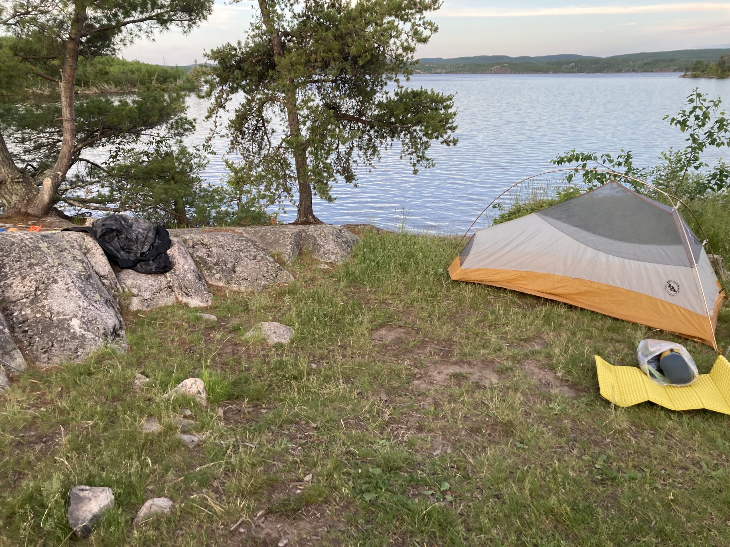
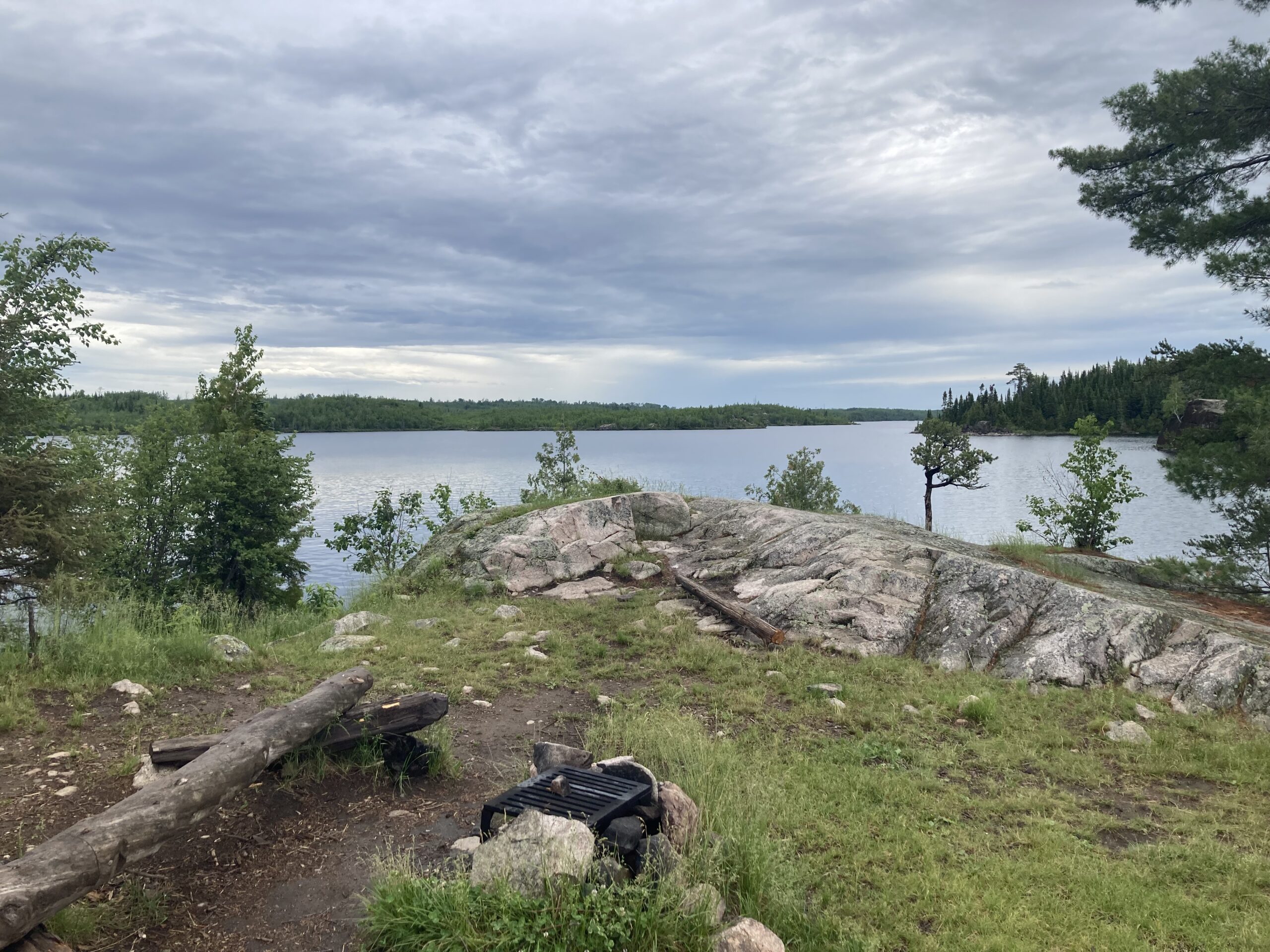
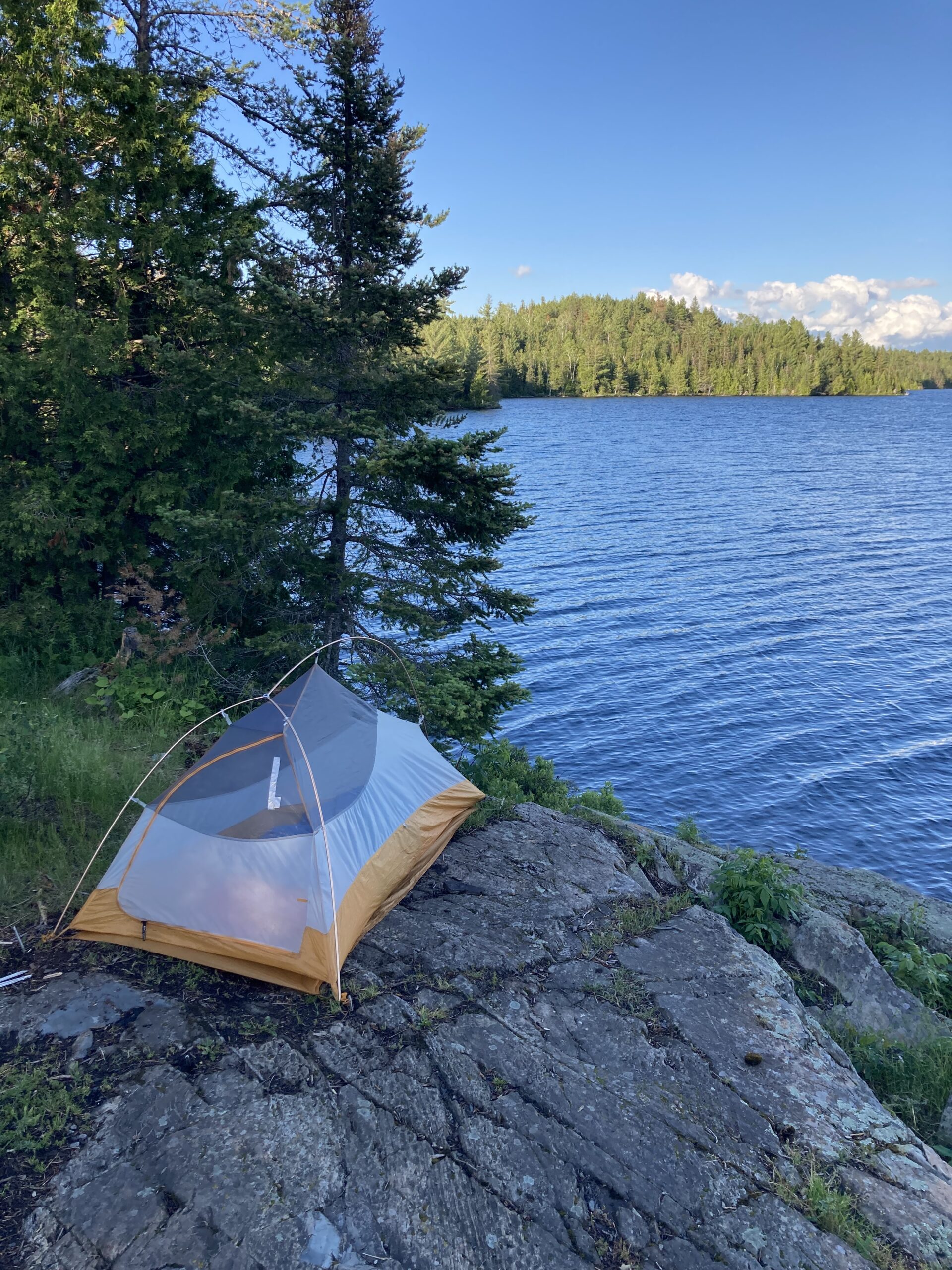
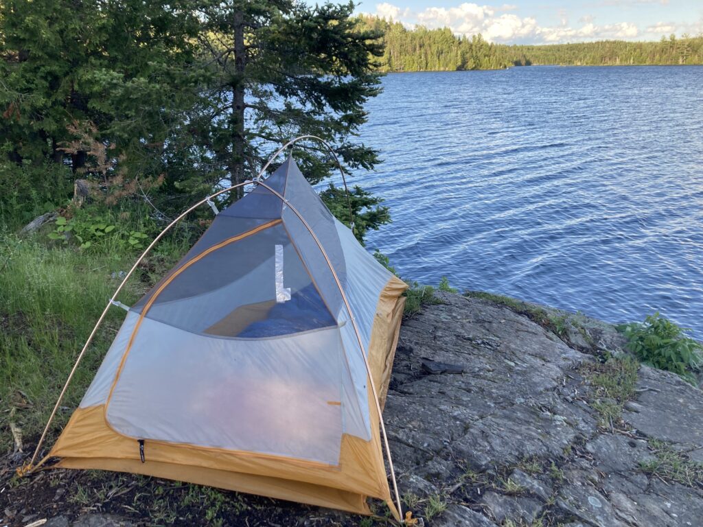
I planned out the group of five islands. Check out the first one first. Then, one, two, three other islands to skirt around, and the fifth has a site on it. Then, there are three additional sites on a peninsula that I’ll ultimately be aiming for. Not too bad. I was right here. They’re all clumped. Two more strokes, and I could see a raging campfire on the first island. Ok… skip that one. I went on the north side of each island and counted them off: one, two, three, and dead on to the fourth island and I could see the site. Oh, how glorious it was! A bald rocky outcropping. No mistaking… I could see the firepit. I paddled faster to claim it, even though there is no way there were other parties around. I almost didn’t believe it, though, after the frustration of probably 10 sites that I would have stopped at on Sea Gull Lake if they weren’t all taken. This one was mine, though. Let’s goo!! What a relief. I saw the fire grate, then the landing. No boats, I’m home.
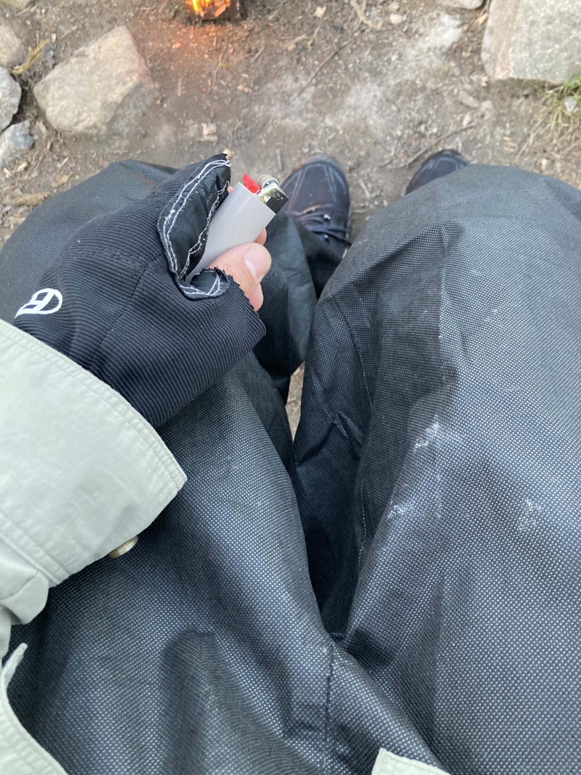
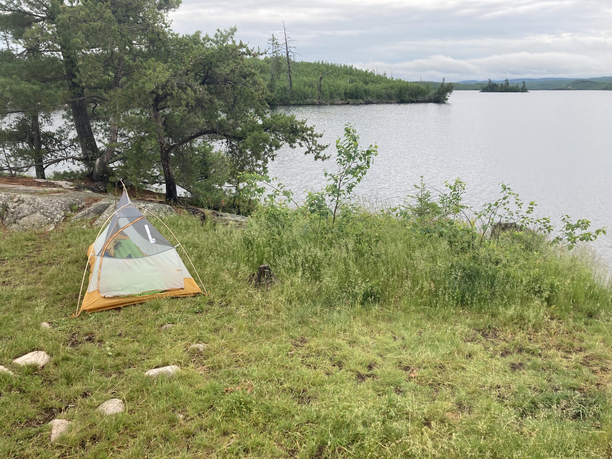
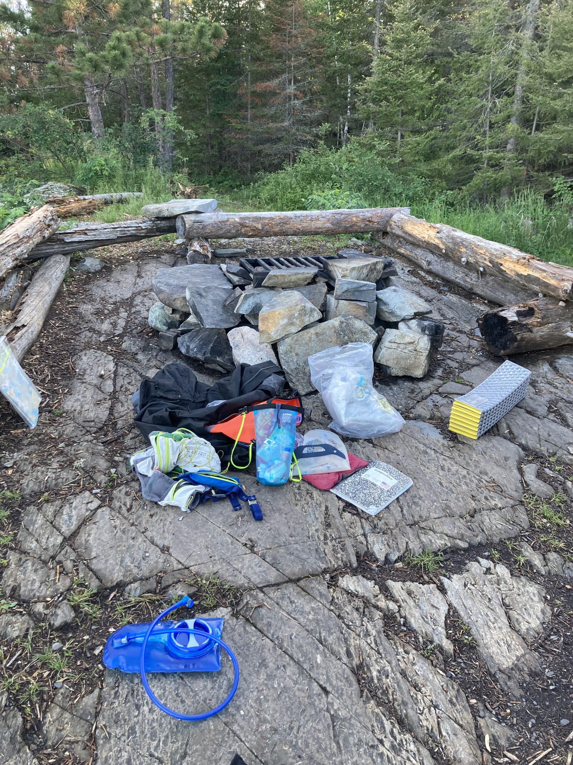
As I sluggishly pulled to the slab rock landing and took my gear off, I started planning my evening. It was getting to my normal bedtime by now, and I still had to set up my tent, make a fire, cook over the fire and eat dinner. I wasn’t super hungry despite probably being in a major calorie deficit. The adrenaline of not finding a site put me in a fight-or-flight mode and any accumulated hunger waned, but I figured I’d start feeling it soon, so planned to set up my tent first and foremost, then get cooking immediately while I re-organize and try to dry out my gear a little bit, and get my pads and bag set up for sleeping. Luckily everything was really well intact and pretty dry, but I still dumped everything out and scattered it around the site. I got sticks broken and ready for the fire, lit it up and started to boil water. The small wood stove was maybe not the best option for cooking, because it took nearly constant attention to keep a consistent heat and even a couple minutes with no fresh twigs would stop the boil. Once I was certain enough that the boil had killed any germs I added my super-duper tasty meal of a Knorr Rice Side packet. In the meantime I got my pads set up, my mattress blown up, top quilt laid out, took my soaking wet shoes off and put on my rain suit to help with the bugs. It wasn’t that warm out where the rain suit was unbearable. I saw a beaver nearby, it was a truly beautiful night.


I realized I had internet service on my cell phone, which was a big relief because I could send out some check-in text messages and more importantly check the weather. It was set to storm overnight with what looked to be a sweeping system in the middle of the night around 3am. In and out. Then, tomorrow was looking not as sunny, which was great for my increasingly uncomfortable sunburn, but definitely a little bit windier from the southwest which was essentially a direct headwind to where I was planning to go tomorrow. Although, there are always options… I took a peek at my wet maps and laid those out try to dry as well. I figured I’d stick to the plan. I got my big long day in – a total of almost 47 miles – and it was late now, so I was definitely OK with a nice slow morning and the knowledge that I could take it pretty slow tomorrow if I wanted to, get pretty dang close to Newfound Lake and Moose Lake for a short day on Sunday.
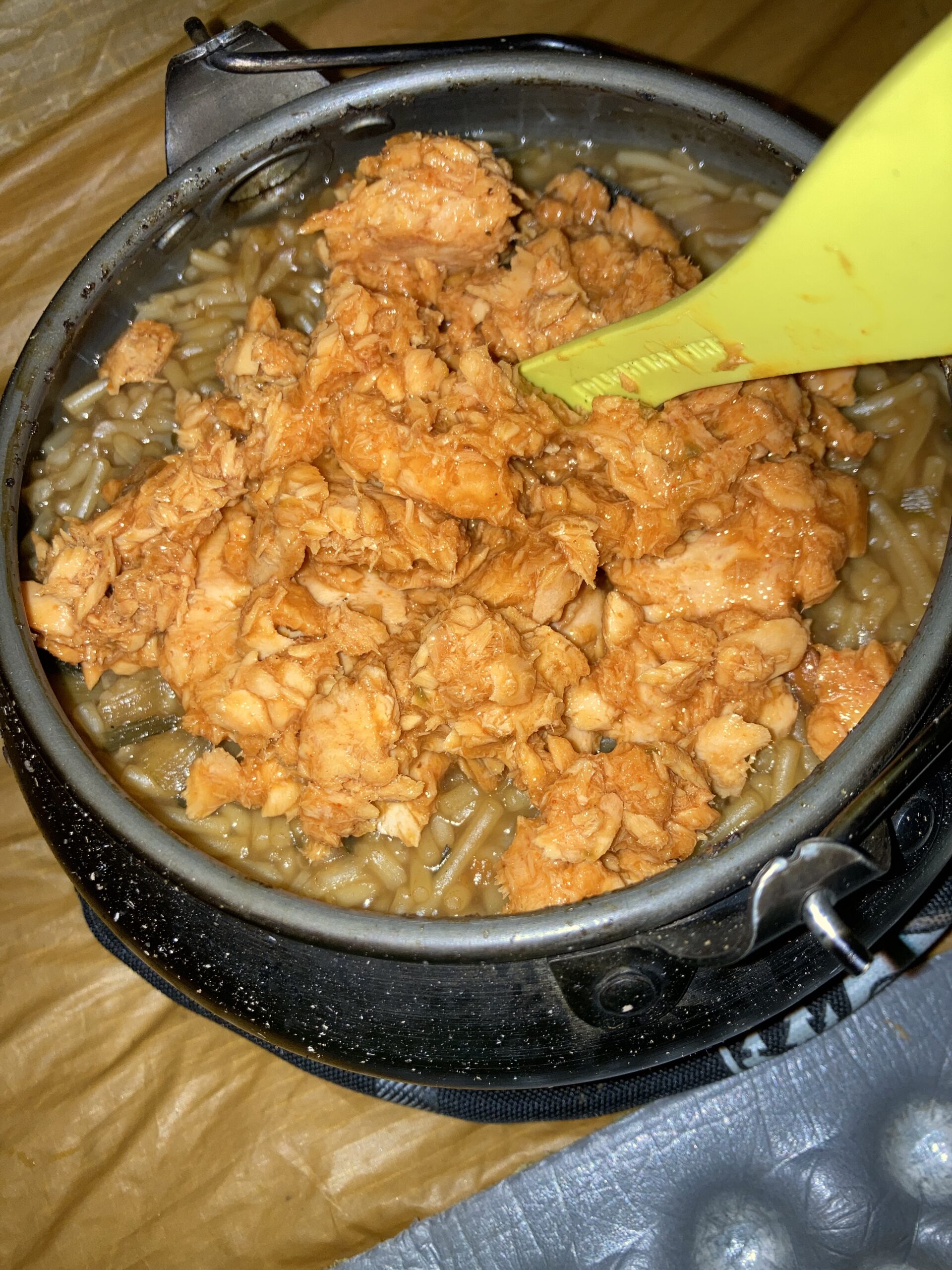
Once I wrapped up cooking, I left my kettle of mush to cool down and packed everything in preparation for rain overnight and relatively efficient departure in the morning. It was getting dark and I wanted my area to be clean before relying on my headlamp to collect my things. The constant worrying about losing stuff didn’t stop. But, I got it all in and brought my humble food dish in the tent with me to hopefully eat without the offending bugs to deal with. The food was pretty hot in my little tent and I was hot as well. I had prepared my rain fly for the impending storm, and that trapped all the heat and moisture and even in my undies, it was warmer and muggier than my rain suit outside. But, it was practically dark out and I wasn’t willing to go outside, start a fire, or sit in the dark. So, I mixed in two packets of flavored salmon to my rice mix and ate my dinner. It looked like barf but it was pretty good.
I drifted off to sleep pretty easily but woke up to a rain at some point. I noticed a few light flashes, and a few grumblings of thunder. It rained a bit harder. Then I became a bit more alert when I noticed a very bright light. I swear I could see the vertical bolt through my eyelids. I thought that I should maybe count to predict how far away the lightning actually is, and in the split second it took me to have that thought and then mutter “one” to myself, a very intense crack and subsequent explosion occurred. The thunder noise was extremely loud. The boom rattled me. Ohhh shit, I muttered to myself. That must have been RIGHT there. I know there are other campers on this lake – is everyone OK? My eyes were wide open at this point, and I checked my phone. 3am. I looked at the weather. It looked OK. There were signs of lightning all around but really, the system was passing and it was set to clear up in the imminent future. The forecast was correct and counting other flashes yielded thunder delays of 4 seconds, 6 seconds, then just light rain until I drifted back off to sleep.
Day 2: Saturday, June 25, 2022
Garmin Data:
I woke up with the light to see a pretty wet tent. Luckily, nothing inside was actually wet. Just damp. There was a small puddle under my water bladder. Huh, was that leaking? I wondered to myself, but just took a sip and drifted back to sleep. Morning sleep is the best. That cycle repeated several times until well into the morning. My body seemed to be holding up pretty well. I could tell the mosquitoes were out in full force, or perhaps just trapped in between my co2-laden tent screen and sagging rain fly. I check my clock and it was well after 8 and I figured I should get going. In addition to the rain and extreme lightning strike, I had been somewhat anxious about my paddleboard and paddle haphazardly schlepped onto the rocky landing and laying on a bush. What if the wind and waves toppled it out to the lake? Would I be able to swim to the other side and find it? I took a peek over the berm to confirm that the board was still there, then hurriedly packed my tent, my gear, and mashed food into my face quickly. I treated some water through my Katadyn BeFree filter and brought my gear down to the shore. I was pretty devastated to learn that somehow another tie-down fell off during the night. How? No idea, but it was off and all I could do is put it in a pocket and find a way to secure my gear. It seemed secure enough by wrapping the bungee around the back of my pack. As long as it crossed in an X shape over the front of my pack I’d be good, I figured. I also clasped everything together and onto my board so at least if there was a catastrophic loss of gear, in theory it would simply hang off my board and I could scoop it back on like I did the day before on the dang rapids up to Sea Gull Lake. Looking out onto Sea Gull this morning, it definitely seemed a bit breezier but nothing unachievable. I knew it’d be a bit challenging on Kekakabic Lake. That big southwest/northeast-oriented lake would have waves building from the southwest. I figured if I made it to Ensign Lake, that’d be about 25 or 30 miles, and I probably had 35 miles total left to go for the trip to make the nice loop. First things first was a short paddle to a long portage of 100 rods. So, I hopped on and set off.
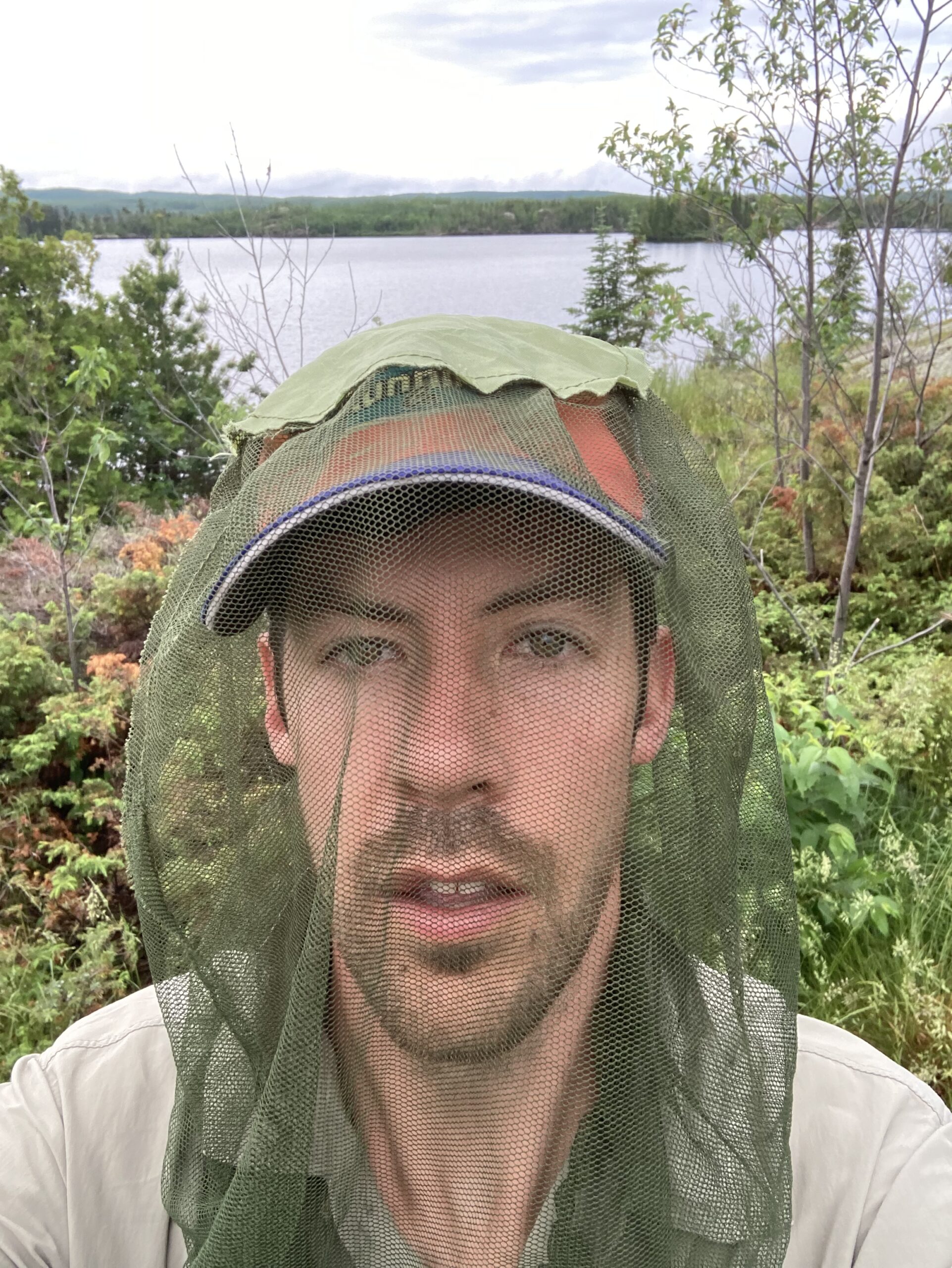
I scanned the lake to see if there was a smoldering tree and dead campers at any of the couple sites right away that’d I’d pass in the morning on my way out of Sea Gull. Nope! Good. Like nothing ever happened. Was it a dream? I started in my tank top again. I had a bad sunburn, and getting the pack on at the portage was not pleasant. The bugs were extreme. In the morning hours, a rather humid and cooler, cloudy day, I was immediately swarmed and the 100 rod portage was too much. If I kept going, I figured, they wouldn’t swarm me. I had to switch one time halfway through, and I was correct in my assessment. The mosquitoes completely attacked me. I tried to hurriedly touch every square inch of my skin within one second and then swiftly keep walking afterwards. I was also partially wrong in that if I kept walking and didn’t stop that the mosquitoes couldn’t latch on to me and suck away freely. I was able to swat with my paddle hand, but you can only touch so much of your own skin with one hand holding a paddle. In a flat stretch of the rocky portage to Alpine, I took a glance over my shoulder and was horrified to see that several mosquitoes were securely fastened to my exposed shoulder. I swatted them, had a minor panic attack realizing that there were mosquitoes ALL over me: on my legs. I awkwardly rubbed my legs together trying to squish mosquitoes between and kill them. There were mosquitoes on my face, so I was twitching wildly and rubbing my chin on my shoulder to attempt more killing. Then, I realized I just had to walk forward and get to the lake. My forearm burned, but I felt cool knowing I could do a 100 rod portage with just one change of hands mid-way. I was so excited to see the lake emerge from the densely wooded horizon. It seemed like the most mosquitoes of the whole portage were at the entrance to lake. I hopped on my board and paddled out to the lake where they’d leave me. The bugs didn’t leave so I killed as many as possible to reduce the swarm. It worked.
The maps cut around Jasper Lake, which is where I was thinking I could camp on the first night under outrageously successful circumstances. Hey, pretty close. One slow mile in and I got a bit confused where I was headed. I could see all of Alpine Lake. Floating on Alpine Lake, I tried to smartly organize my maps, but I needed to flip flop two maps twice. But if I memorized the route, once I get to Ogishkemuncie I’d be on navigational easy-street with perhaps 8 miles on just Ogish and Kekakabic Lakes. So I set off paddling towards a group of islands across Alpine. The winds whipped up once the narrows opened up to a bay. Yeesh, there’s the south wind, I thought to myself. I fought the wind. Yeah man, this is what it’s really all about. But I became quickly overtaken and unsteadily felt I had to kneel for stability. Wait, maybe this is what this whole day will be like. It’s only supposed to get windier, and I go more into the wind as I make it through big Kekakabic. My heart sank a little bit. But, I made it to the leeward side of the islands and was able to enjoy a beautiful, remote Boundary Waters morning on the water. Let’s go.
In no time, there was the portage on the south side of Alpine, and it was short with no hand changes. I just went with the left hand – hopped off my board and straight into the woods no stops. When I got out, mosquitoes violating my entire body head to toe, I kept walking straight into the lake like a robot, hopped on my board and without hesitation paddled out to Jasper Lake. Then freaked out in a mosquito-killing rampage. Then, “ahhh”, and I’m a human again. I saw the portage towards the northwest of the lake, a short 25 rod to Kingfisher, and knew I had to change maps at that point. I kept kneeling before taking off to change maps, but realized Kingfisher didn’t show up on the other map either. How would I know where to go? I looked at the other map, there it is. Gah, stumped again. Here is where I had to memorize. Wait, it was cut out. I had to go on faith that there is an opening? But it looked like just a curve to the south and I’d be on Ogishkemuncie. Oh yeah, had my watch! I remembered that handy resource and checked the map function. Again, it was hard to see. I thought I saw a portage line, though. Or, is that the creek. Wait, the portages are at creeks… Oh well, I started paddling and figured I could check in later. So, I set off on Jasper Lake. It was cloudy and a bit breezy. This lake wouldn’t have been that sweet to camp on, I figured. I made it around a point, the wind pushing me to the portage. Wait, is the this the one? I asked myself, and then kneeled back down and looked at the map. Can’t tell. Watch? It showed a creek, which I could now see, strewn with logs and branches and flowing pretty strong. I’m not paddling back around for another portage not any harder than this… So with four out of six tie downs, I paddled up the flowing water connection between Jasper and Kingfisher until I couldn’t anymore, veered to my right, jumped off and in thigh-deep water waded upstream to the cool-sounding Kingfisher Lake. But this non-portage was really stupid. The water was making me really unsteady, and I recalled what the flowing water did to me in an instant the day before about 40-something miles in! I was happy to reach near the end and wedge my board onto a downed tree. But then the downed tree proved to be a huge obstacle. Whyyy, am I wasting time, I asked myself. With a few more grunts I made it to Kingfisher. I looked for the bird, and didn’t see one. Kneeling, I reached the end of the lake quickly and hopped on another quick portage to Ogish. Ahh, it was a nice feeling to know I could just crank for many more miles just like yesterday. My mile splits were horrendous, at 5 miles on the day in two hours. It was already past 11am! It might be another long day, I thought to myself.
Onto the bigger, windier lake of Ogishkemuncie, the wind was bad. I had to not only kneel, but sit my butt down completely between my legs. But, I could actually make good time. This wasn’t fun, la-dee-da paddling, but this is what I sign up for. This is what we work for. I was constantly scanning the shoreline, and checking the map. Couple of paddle strokes, scan the shoreline, look at the map, repeat constantly. It felt like I had to make a navigational decision every 20 seconds, and this was after the winding network of tiny lakes from the morning thus far. And Ogish was a nice straight, long lake and I could crank. It was slow in the wind, but I made good time. I tried to pronounce Ogishkemuncie the whole time, and figured I’d be at Kek in no time.
The effort to move through the network of lakes to get to Kek was robotic. I had long sleeves on and was not afraid to get my feet completely soaked and my legs covered in bugs. I paddled to the portage, hopped out, heaved over my terribly sunburned shoulders the dry bag backpack, hydration vest clipped on, and safety kit clipped on, then lift my board, grab the paddle and charge right onto the portage, sometimes through dense packs of dragonflies. Ooo yeah, I told them that this was mosquito season. Without stopping or slowing down, I’d reach the next lake’s shore at the end of the portage and toss my board in the water and paddle away, swatting mosquitoes mercifully. Eventually I stopped strapping my backpack down and just paddled kneeling with the pack on to the next portage until I finally landed at Kekakabic Lake. I did 8 portages between Ogishkemuncie and Kek. I realized that the portages really ate up time, and my pace was suffering. It was about 2pm, near 12 miles in and just over 4:20 in on the day, which is worse than 3 miles per hour. I stopped for lunch in a very covered, leeward bay before the lake really opened up.
I put my food away, drank water and mentally prepared myself for a long, hard grind. Unfolding the map a bit, Kekakabic looked absolutely massive. The wind had been blowing south and west all day, and Kek faced directly southwest with the potential to foster rolling waves that can gather speed for a long time. Luckily, the most efficient route was directly along the north shore, so with luck and a shifting wind to the west, perhaps it won’t be a dangerous situation. Plus, staying to shore is a vital to the bail-out option. I paddled hard. When Kek opened up, it didn’t look too terribly larger than any other old lake. Then again, it was hard to judge the undulations of the land. I just paddled on. Yep, it was windy, but no different than Ogish and I felt like I was cranking pretty good in the seated “froggy-style” position on my paddleboard. I could see the big island or peninsula feature straight ahead and knew to skirt to the right of it. As I got further out into the lake, the winds started whipping. I could see the gusts over the water and although the waves weren’t terribly challenging, the gusts just felt punishing. I could tell on the big mount straight ahead and a bit to the left was getting hazier, and wondered if it’d rain. It was supposed to, and although was cloudy since I woke up, hadn’t rained at all. Then it started sprinkling. It felt good. The rain waned off, but the gusty winds didn’t. I grinded until around the big island to the much larger belly of Kekakabic Lake. I was to go a bit further than halfway down the lake to the portage on the north shore. Meh, not too bad, I thought to myself, and kept cranking away. My mile splits were decent.
Onto the big side of Kek, it was dramatic. I could see rain clouds from miles away. The waves looked to be forming to whitecaps far off on the big open section of dark grey and black water. Then the towering cliffs and undulating woods along the shoreline was pretty incredible. It was fun to try to interpret the elevation lines on the map to what I was seeing with my eyes. This is fucking sweet, I thought.
I tried to latch to the north shore of Kek around a decently wide-open bay, and the rain started again but a little bit wetter than ever. I felt a slight chill and immediately prompted me to put on my rain jacket. I was skeptical, but my new Frog Toggs jacket was very comfortable and I was happy with the decision. My hat was backwards, and I was thinking of a very lengthy YouTube video about the Border Route that had been very inspirational to me in the previous 6 months, and I had probably watched in full at least four times (albeit, mainly in the background). Scott Baste says “I’m gonna put my mean face on!”, and I said that many times in a battle to press forward. The rain got worse, and all I could do was laugh a little bit, convince myself that this is what I signed up for, and keep an efficient stroke. My mile times were pretty good. In what seemed like about as challenging conditions as I could imagine actually paddling in – 10-15 mph winds head on on a big lake with pelting cold rain – I felt like the roughly 3 mph pace was decent. Waves were crashing over my board and I got nervous about my pack that was bungeed down in a fairly sketchy manner. But, it seemed solid. When I got to the portage off of Kekakabic, I was pretty proud. That’s not so bad, I thought. I also figured that from here on in would be feasible for Sunday, so anything else is gravy. And I got plenty more juice left. It was six hours in, about 3pm and over 15 miles for the day.
The 80 rod portage was full of mosquitoes and hard. I looked at the map and was discouraged by the number of small lakes and portages. It made the big open lake seem not so bad, but it was good to feel out of the wind. The wind is intense. You can’t let up for a second. To have a little break on a leeward side is prime. The glassy water was so desirable. I kept the robotic lake-skipping alive until the sun peeked out on Missionary Lake. I had scoped out the two sites at the end of Missionary as a potential stopping point. But, for now, I had to stop to hang out. I deserve it. After another series of five portages from Kek to Missionary, plus the 180 rod portage to round it out, I had to jump in the lake. It was a buggy ordeal, that portaging. I stopped in a beautiful cove, with a steep rock drop-off. A perfect swimming spot. I saw something out of the corner of my eye – a loon thought it was a great swimming spot, too. In fact, I was encroaching. I was very conscious of my recent seagull ordeal, and treaded lightly. I took my time before jumping in. It felt so good, but it was brief.
It felt so good to stand up after sitting on my legs for so long. My knees and especially ankles for being flexed and smashed down for hours were sore. Missionary was small enough, and the wind had died down enough that I could stand and paddle. I saw a few other canoes out on Missionary, and realized that both sites on the end of the lake by the portage were occupied. Ah, not this again… I looked at my watch. 5:30pm, and I figured people would probably all have sites staked out by now. I had at least two more portages then. So, I put my mean face on again, and belted them out.
On Vera Lake, I knew there were a few site options. I could even go all the way to Ensign, which would be sweet. There are a ton of sites there. And the closer I get today, the faster I can get Culver’s or whatever else I want on Sunday. Nah, I figured I’d nab up the first site I could find at this point. I needed my last map, the one with Moose Lake on it. Sweet. I aimed for a pinch point in Vera with a site on either side of their peninsula. I saw the right-side one first. It just stuck out so prominently on a rocky outcropping. I could see it from across the lake. HMM! No tents, no hammocks, no canoes, no garments flailing in the wind from a closeline tied into several trees. EMPTY! YES! I furiously paddled towards the site. I found a suitable landing and almost in disbelief after the previous night’s panic, and a slight disappointment and subsequent physical suffering about the two sites on Missionary Lake taken, I looked around at where another landing could possibly be hiding kayaks in the brush. Nope!
I hopped off my board, stopped my watch and breathed a large sigh of relief to be at my home for the night. Then, I saw the pack. On the ground just a few steps from the tip of my board was a massive dark green and black canoe bag. This thing was probably 80 or 100 liters and just sitting there, right at the campsite landing. No, NOOO! I couldn’t fathom packing up my stuff AGAIN and setting off to find another site. I just couldn’t bear it. I’d be going to Ensign. Fuck it, I’m going back home TONIGHT. I can paddle another 11 miles, I told myself. No. Nooope. I ran up to the campsite. The camp grate was clean, the sites were empty. I ran back towards the latrine. There was nothing back there. Completely empty except one huge-ass pack. I went back to it. It was damp and dewey, and looked like it had been there for a while. It looked like it had been rained on, and I vividly remembered the days of yore a few hours back. So, this pack was here when it was raining maybe a few hours ago? Definitely not… one hour ago, I reasoned. I went in for a closer inspection, pondering whether to open it or not, and saw a slug. Yep, this thing has been here for a while. Then I got a little mad. Who would come here, claim this site with just a stinking pack at the landing, not take the time to even set up a tent? That’s b-s and I am not about that. When they come back, I promised myself, you’ll tell them that you didn’t see it and it’s too bad and there’s a campsite just across the way that doesn’t look occupied. Then, I thought about how in all reality, it was left here. Wow. That would be pretty devastating to find out. I had been keenly aware of my gear to an obsessive extent nearly every waking minute of the trip so far, and couldn’t imagine the thought of losing 100 liters worth of gear, food, or vital supplies! Yikes. I didn’t look in the bag and retreated. Despite the emotional reaction and state, I rushed to set up my tent and make myself at home. It was glorious.
At about 6pm, I had my gear all layed out, my shoes off, dry camp clothes and bug coverings on, and was enjoying the pristine evening. The wind had calmed, and was blocked by land. The sun was low along the right side of the lake as I looked out to the beautiful clouds and Vera Lake shoreline. What a treat. I also looked out to see if there was a canoe group furiously paddling to my exact location. Not in this fine moment. I pondered greatly my tent location, but first set up intricate ways to dry all my gear in the sweet late June air.
I enjoyed eating fruit snacks on a nice rock seat close to the lake. I slowly set up my tent, gathered firewood, ate food and prepared for dinner. And looked out on the lake. Then, I enjoyed a nice evening. I skipped the wood stove and cooked my second lovely meal over the fire. Knorr Pasta Sides, vacuum sealed flavored chicken, nutritional yeast and olive oil was on the menu. It looked a little like vom, but it was excellent. As dusk set it, I figured if nobody was here to claim the pack by 9, nobody was coming tonight. Then again, prime fishing is right at dusk… which is right at 9. Right? Too bad so sad, we can share. Maybe they’ll cook fish. I didn’t have service so didn’t have a good sense of how the forecast looked for the next day. I also didn’t get the chance to send check-in messages the whole day. Oh well, I’m close. I figured I had 12 miles to go to get back to my van. I remember winds coming out of the west and the last day looking the windiest. Did that say 10-20mph? Oh well, I was probably doing 10 or 15 over big Kek today, I reasoned. I tucked my maps away and eventually slinked off to bed with the rain fly off. I figured I’d put it on later. I drifted off and had a great night sleep.
Day 3 – June 26, 2022, Part 1
Garmin Data
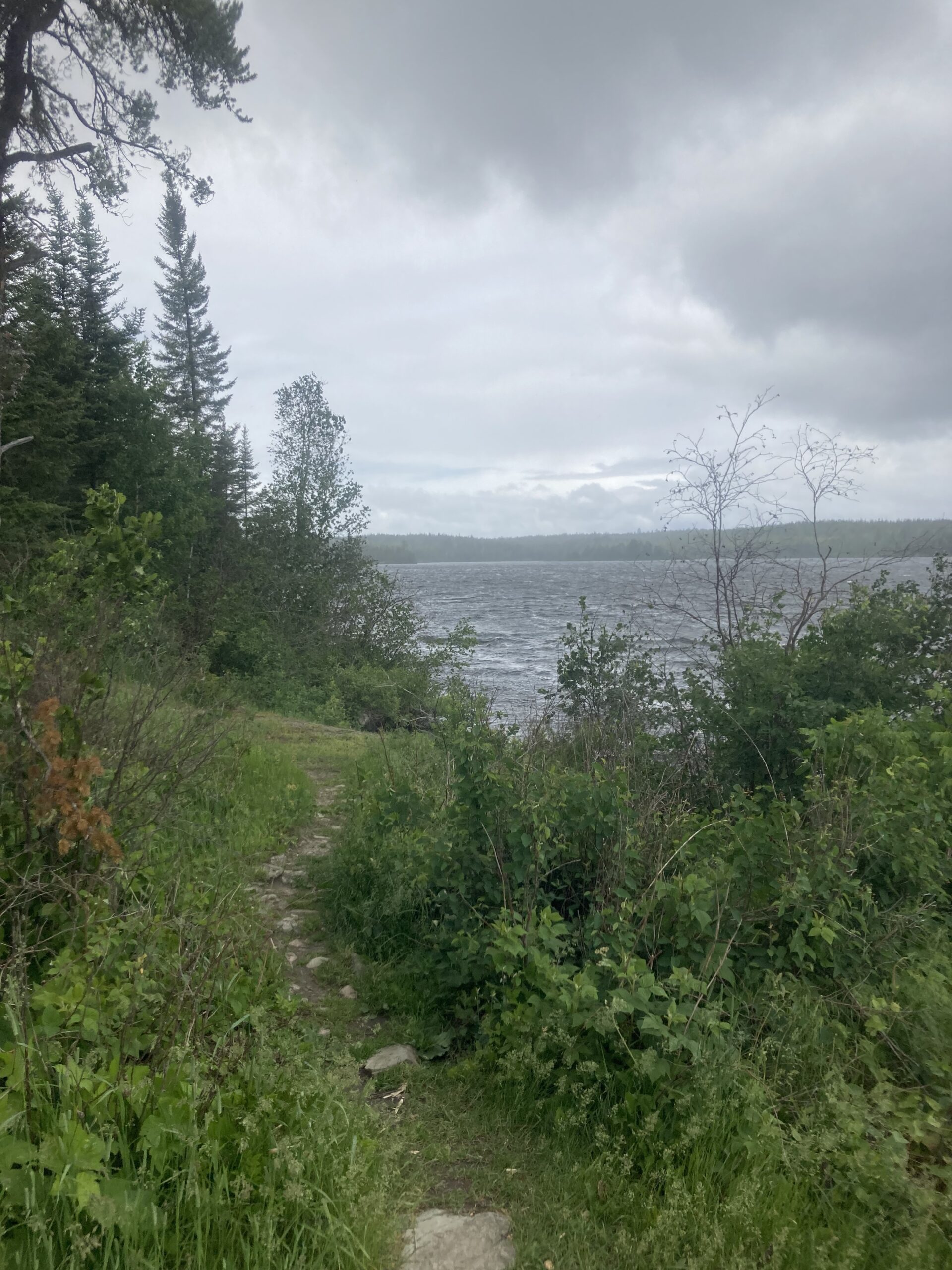
I woke up on my third and final morning to wind on Vera Lake. I could hear it. Moving through the threes, the lake moving. I packed up pretty quick knowing I didn’t have lunch, didn’t really have much to organize or plan for except a hasty retreat out of Vera Lake, one nice long portage to big Ensign Lake, nicknamed Trailer Park Lake on my maps by Garrett. Then two small portages to Newfound and Moose Lake back home. I could tell it was a west wind. I remembered better that it was forecast to be a wind. And I had to do a large stretch straight west. If you drew point to point, my route was strongly west-southwest. There was no getting around the wind. I was pretty confident from the day before, though, that I could beast through it. I did it over big Kek, what is this? The wind didn’t seem so much like a strong wind as much as a choppy, whipping wind. I could hear it blowing and blustering, and see the ever-changing kaleidoscope of wind patterns on the water. Better strap down tight and hit it, I instructed myself! The mystery pack was still there. Wow. Unbelievable. I was pretty surprised and in awe about that whole experience and wondered how much longer that’d be there for. I started feeling a little pressed to get on the lake and get out of there right at the landing as I was fiddling around with my gear. Better to get it right now, though, I thought to myself. Then, I launched and it was right about 7:30am. Good time, and I figured with the wind, I’d be back by noon.

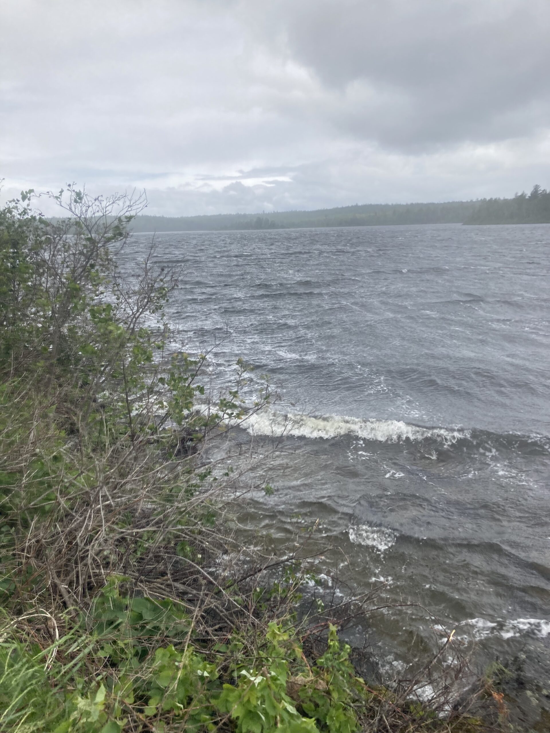
I was on a bit of a southwest shoreline and figured it was blocking the wind a bit. Either way, I started kneeling and the wind was definitely pushing me! I could tell the portage was on the southwest side of the lake, and figured I’d make my crossing at the pinch point, then ride the south shore in instead of trying to stick to the north shore and going around the leeward west side. A viable option, though. When I got to the north-end point, around the bend the wind hit me. I told Lake Vera that I knew she wanted to keep me here, but I had to get home! I yelled it. Then I anxiously looked around for seagulls. They don’t like that yelling. I went towards the opposite shore. It wasn’t long, but long enough where I could visibly see whitecaps and a strong wind pushing water right through the pinch point. I was barely in the thick of it. So I paddle on, and realized quickly I was in a losing battle. The wind and waves pushed me down on a seated position, butt on the board, ankles completely dorsiflexed and smashed down onto the outside edge of my board. An uncomfortable position that I spent plenty of time in the day before. Then the wind and waves pushed my board left and right, and I struggled to keep a bearing. Whitecaps were spilling over my board and I couldn’t hold it so bailed out. I took a big swooping paddle backwards, immediately overtaken by fear as I saw a big waved completely capsizing me and my gear sinking to the bottom of the lake in my mind’s eye. Luckily, that did not materialize and the wave just pushed my the exact opposite direction and I rode the waves into the nice cove I had just left. I had to regroup. Those waves were brutal. I could see the other shore behind the point. I thought about Scott Baste. I gotta put my mean face on, I told myself out loud. Then I went back for more.
The waves were utterly brutal. I remembered Em telling me I was most stable with my paddle in the water, and remembered the photos from Big Ole 2021 where my paddle was exclusively out of the water. Focus on keeping the paddle in the water, I reiterated. I again aimed for the south shore of Vera. She wants to keep me here! Vera, I gotta get home! I paddle hard, trying to keep my noise pointed perfectly 45 degrees onto the waves to avoid going completely sideways and risk capsizing, but also keeping on the bearing to hit the opposite shore, then follow that right on in to the portage. That 180 rod portage was never more appealing. I got a bit in front of the point, but couldn’t make it to shore. I could see on the map a campsite on the opposite, south shore of the pinch point. I did another complete turn maneuver and rode the waves into the cove. I wondered how I’d be able to get around this pinch point. I figured I’d just stay to shore. There were enough tiny undulations to break the waves a little bit. The wind was pushing waves right into the south shore. Maybe the north shore method would have been better, I pondered. I didn’t stop the forward progress, though. I kept pushing forward, on and on and on. Across Vera right on in to the portage. This would be a rough day. Ensign was much longer, but also skinner with plenty of islands and jut-outs. With this style of playing the landscape to block the wind, I’d be able to make it back just fine. But, it’d take a lot more energy and be a lot slower and less efficient. That, for instance, the first day. I remembered back to the first day cranking out 15-minute miles on glassy waters. Wow, I realized how much the wind would play a major factor in speed.
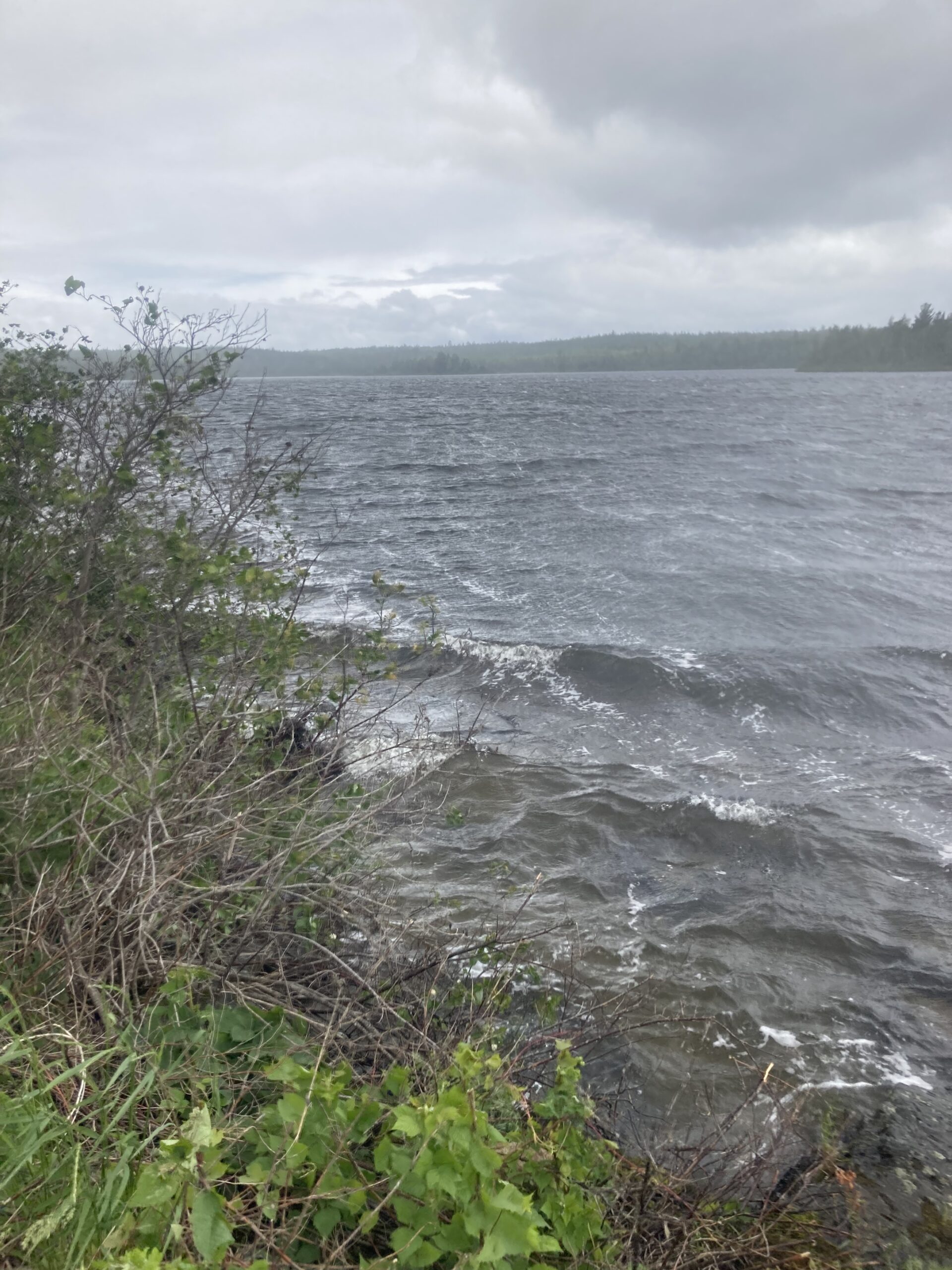
The 180-rod portage to Ensign was brutal. It was very windy, and there lots of big climbs to exposed ridges overlooking Ensign Lake. The views were amazing, though. It was a pretty grey day. Cloudy, blustery, generally shitty conditions. The portage went up and down. I was tired, and had to take lots of stops. Luckily, the bugs weren’t terrible. I had long sleeves on, anyways. I finally made it to the end and was excited to get onto Ensign. The start of the lake would be kind of fun. A bit into the headwind, then an s-curve out of the wind, then back onto the big lake. A couple sections opened up, and the final stretch had a nice blocker island to work with. I figured it’d be about a 5-mile trip across the entire lake from here. As expected, the first stretch was not super fun, but I stuck to the south shore just like on Vera and made my way. It was just slow and tedious. Yet, safer by shore. And seemingly less windy and wavy. But slow. I made it to the bend and the wind took me right away. The wind seemed to be coming straight west, but I turned the corner and the waves were pushing straight south. Nice. I rode them. Then, I felt the west wind. I had to paddle hard to keep south. The waves were huge. It was fun, but scary. I felt like I couldn’t stop paddling. The paddle in the water was keeping me on track, and even a brief pause took me off course, the exact direction of the wind and the waves. I felt the westerly push harder and harder the more I got into the open water. I saw the point I had to hit, and new it would be a strong wind coming around the bay. If I missed the leeward point and got too far west, I’d have a really, really hard time getting back on track. I couldn’t squander the ground I’d essentially made this far. In seemingly one change from left to right and back to the left side, on which I had to paddle at an all-out effort, I was past the point. I was past the point I needed to turn on, and past a helper island I could have utilized. But, I was headed to the east shore, the waves pushing me right in. I paddled backwards on my right side to get a better orientation. It was a risky move. I thought I could bail. I didn’t know what would happen, but I wasn’t going to try anything besides all out extreme paddling to get to the island. I could see the wind break. Right there. The force of the wind and the waves were seemingly increasing. A wind gust. It was pushing me off course, but I was somehow able to make enough forward progress to get into the leeward side of an island. Then, I was happy to find that I could snake the north shore from here. So, snake I did. Despite being far less efficient, I went in every little bay and undulation. I could see the whitecaps out at sea, and stayed close. My arms were pretty tired from the whole weekend. I was not hoping for this. I didn’t want extreme effort to be what my last day was all about. I didn’t want stressful situations and imminent capsizing to be what my last day was all about, either. But, here I was, chugging along slowly. It was almost funny. How can the wind be like this? It’s ridiculous. The gusts were frequent and challenging. I paddled to a campsite with lots of people at it. They seemed to be hunkered down. I waved and they kind of just looked at me weird. I’d have to snake along the shoreline the rest of the way out, but I was ready for it.
I left the campsite, paddled around the bend, and it was just unbelievable. I was 7 feet from shore. I could see the bottom of the lake, with whitecaps crashing to shore right beside me. I was bouncing up and down with water completely drenching my entire board. The gusts intensified. It was as if someone had a big dial to turn up the wind speed, and they were just slowly cranking on it. I couldn’t go forward. There was another group of a couple people in rain suits on the shoreline. That must be the same group of people, I thought. I wasn’t going anywhere. I looked ahead and it was a daunting widening of the lake. I was at the very entry to this opening, with the big stretch of west-east lake staring me down like through the barrel of a rifle. I became flustered. I couldn’t go on. I had to turn back. The site was right here. It’s too hard. I’m gonna paddle my arms into injury trying to make it back. I had to re-evaluate my situation so pulled a quick turn-around maneuver, once again, and limped into the site. As if they were expecting this to happen, the site’s occupants were at the landing ready to grab my paddle and help with my board. I clamored onto shore, asking if I could hang here for a second, and set down my pack, wet with waves, everything wet, and myself starting to get cold despite wearing all of my clothes. This was looking grim.
When I regained my composure, I started talking to the group at the Ensign Lake campsite. It was a group of nine with three boards, the BWCA max group size, and they’d been at this same site for 5 nights, and were planning to head out on this day. In fact, they had less than an hour to catch their 10am boat ride from Newfound Lake where motors were allowed and outfitters dropped off and picked up paddlers to avoid the long paddle along Moose Lake. Yeah, that pick-up was not happening. Yep. They figured, based on an emergency weather radio broadcast from earlier, that they’d have to reschedule for much later in day. It was supposed to be windy all day. Until 7pm. I set out my maps and looked long and hard. There was no way around the due west bearing. No blocker islands, just brutal waves and wind. I looked out on the lake. Impassable. Impossible. Barely possible. I checked my phone. No service. I paced… then walked out to the bay where I’d seen other people. I wanted to get a look at the whole lake. It was pretty intense.
I estimated the wind was 20 miles per hour with 30mph gusts if not more, and maybe 3 foot waves with whitecaps. This was all a total estimation. I had no idea about wind speed. It seemed so intense, and of course right in the direction I had to go. It did not look feasible to paddle, from what I could see. So I slinked back to the campsite. On the way back, however, I found a signal and tried to send out a text message to Em to let her know I was stymied by the wind. It was one bar of cell service.
There were maybe five or six adults and three or four kids at the site, and the kids seemed so happy, and the adults eager to get going, just like me. I looked hard at my map. I could probably stick to shore and make it, but there was an even more pronounced pinch point a mile or two away. Then, the biggest opening of Ensign, but with several small islands, bays, and not to mention that the further along in the lake, the closer I’d get to the leeward west shore of the lake. What a beautiful shore, I’m sure.
I heard stories of another paddling group that capsized twice just on the other side of the lake. Then, another group of people emerged from the woods. Huh… where did they come from? They were on the west side of the peninsula that this campsite is situated on. That group was with a guide and was mostly a boy scouts troop from Texas. Then, the group showed up that had capsized. It seemed that this was the pinch point. On the map, the one further ahead looks way worse – were there 10 groups stranded there? I realized that if literally none out of four groups couldn’t make forward progress, and the wind wasn’t supposed to die down until 7pm, and it was 10:30 now, and I didn’t have any lunch, and my hands hurt, then this day could suck really bad. If I can’t start paddling by 7, I’d be out by 9pm, home by 11pm. Culver’s would for sure be closed, and I would for sure be exhausted and sad. No way. I went back to the shore. It looked windier. Gah. I figured I should wait to check the weather. I waited and waited. I had one bar but it went in and out. My texts didn’t send, and the weather didn’t refresh. I finally got a glance. The forecast was correct. It was supposed to be 10-20mph winds all day, gusty on top of that, and rain. And just like that, I could see the rain come over the horizon and meet our camp. It was a misty, foggy rain, but wet nonetheless and of course sideways due to the wind. The campsite blocked a lot of it – the wind and the rain – and I found myself with almost everyone else huddle around this nice and comforting campfire. The group originally here were extremely hospitable. Everyone was just kind of bumming around, semi-anxiously doing nothing while wishing they were at Moose Lake. Another group had a scheduled motorboat escort in the very near future as well, and the original group actually talked to the outfitter to postpone their pickup time, and they confirmed my spotty cell phone forecast and their weather radio forecast that wind was supposed to persist about the same through the evening. Shoot. I had to go. I walked down to the shore AGAIN and looked out – still wavy. Maybe more. Do-able? I wasn’t ready to try. Back to the fire. Chit chat. We had fun. Everyone was in the same boat. Nothing to do. The boy scouts set up camp, knowing they’d be here the whole day to hit it tomorrow. I ate some snacks. I was still pretty chilled, but the fire helped and I was at least dry enough under my rain suit. So I sat.
Hours went by. I checked, and paced around, and checked my phone, and tried to get a signal, and sat by the fire, and stirred up some conversation, and studied my map looking for a way, and looked at the lake, then checked my map again. I thought long and hard about what it would take to make it to the portage to Splash Lake. One trip to the shore, it looked like it had died down. Well, there were no whitecaps anymore, anyways. The wind was still whipping, and the waves were rolling just fine. But, if I could make it along shore… then blast past the pinch point and stay north to the island, I’d be right there. So I made the call. I announced I was leaving. Nobody had made a similar proclamation and I wasn’t going to wait around until 7pm. It looked good enough, I felt good enough, let’s go!! So I packed up my stuff. A few gawkers helped me off and I set out.
Part 2
Garmin Data:
When I set off from the campsite on Ensign Lake, I was pretty nervous to get straight-up stopped once again. I didn’t want to have to pull the turn-around maneuver. But, I made it past my last turn-around point just past the campsite, and kept on. I looked back to see if they were watching me from the campsite, each separate group and probably 25 people in total wondering if their group as well could set off. I hugged the shore as much as I could, and it was fine. I was seated, just plugging along. Yes, the waves were cresting the tip of my board, pouring over the front, dousing my pack with water and running past my knees protected by my cool new rainsuit. Well, at least I got to test out this new gear! In no time, I made it to the pinch point that I had been scared of and staring at on the map for hours. It was easy. I made it right past and onwards to the island. It was a cinch, and I made it to the leeward south side of the island in a nice cove just like that. I could see the portage. Well, I could see the shoreline where it was probably at, and seemingly could make out where it was at the low point in the southwest corner of the lake. I figured it was another mile of brutal paddling into perhaps the most open part of the lake so far. I could swing it. So, I set off from my island hang-out and put on my mean face once again. When the cap flips backwards, it’s on.
Chugging along the south side of a nice island in the middle of Ensign Lake, and I figured the waves were decent enough where I could cross and go straight to the portage. If I bee-lined it, it’d get progressively easier as I get closer to the leeward shore, I figured. But, that was not the case. Huge gusts came out of that leeward shore straight ahead, due west. The waves were violent with whitecaps smashing my board and pushing me around. At a moment I was certain the waves would push me completely sideways then overboard, I’d get my paddle in for a power-stroke and right myself. That happened a few times until I couldn’t proceed forward. I knew what that meant – I was running out of strength and had to bail. So, again, I made a strong backwards paddle on my left side, rapidly switched to my right side and furiously thrashed at the choppy water with my paddle to make a 180-degree turn and go downwind. When I felt it catch, it was such a relief. Still haven’t tipped, I told myself in congratulation.
I could see on the map, and in person a nice campsite. Well, I thought, I at least fail right next to nice campsite landings. The waves pushed me way past it, and I had to struggle to turn around again, paddle along the tucked away bay adjacent to the site into a nice completely shielded landing. Stupid.
At this point, I was extremely happy to have made it an additional couple of miles. But, at this point it was 2:30 and I still had plenty of miles to paddle. I figured it was about 5 miles once I get past dang Ensign, two portages and onto Newfound and Moose Lakes. I would portage miles and miles instead of this god damn wind, I said to myself. Then, I thought about how I could perhaps portage back to my car. I plotted it on the map and quickly realized that bushwhacking would be substantially worse than paddling into the strong headwind. I also figured that once I got to Newfound, if I could make some big crossing I’d be able to stay on a leeward shore since the lake was in a southwest/northeast orientation instead of a direct west-east direction of stupid Ensign Lake. So, if I could make it out of Ensign, I could be comparatively smooth sailing. But, the wind was still absolutely brutal.
Part 3
Garmin Data:
At a second campsite on Ensign Lake, perhaps a mile or less from my highly anticipated portage, I sat below a tree as it started to rain. I was kind of surprised there was nobody at this site as opposed to 25 at the last sad lay-up point of three other groups and two of which going the exact same way as myself. I waited maybe a half hour but became restless. I can make it. I’m on the opposite shore. I should have kept going. The rain had subsided and the sun was out, a cycle that had repeated itself 15 times during the day already. I looked out on the shore. Yep, I can do it, so launched. It was pretty brutal right away, but substantially easier right by shore. Slow going, yes, but manageable. And, more importantly, not critically dangerous. If I was overtaken by waves, my shit was wash right into shore and I could at least collect it and move on with my life. Luckily, I didn’t figure out exactly how that would played out and made my way steadily along the final south shore stretch of Ensign. I was crushed to realize I forgot to start my watch, perhaps through the crux of this whole trek. Oh well, started it and kept paddling. The portage came clear into view. I realized that it wasn’t a portage after all, but a long and narrow channel. But, it had a portage on the map… but that portage was tiny. Into the channel and the waves stopped. What a great feeling. I saw the impassable section and tiny portage after all. Onto Splash Lake, which was also long and narrow. The winds were still pushing me, but at least the waves were majorly reduced on the relatively small sections I was on. Splash Lake opened up and I was nervous about big water. But, it was a relatively easy crossing and I made it to my final portage with ease. I was still seated, not willing to stand in the wind.
I made it through to Newfound like with no issue at all. The portages were all easy. I realized that under 80 rods was pretty easy, and over 150 took a little more pumping up to get done. I was becoming pretty efficient with getting off my board, but getting back on after a portage always took time. The silver lining of the windy day was a big reduction in mosquitoes. I saw one of the famed escort boats tying up to shore near the Newfound landing off that last portage. I yelled at him, to ask what percentage of days were this windy. He said, seemingly more and more. I said that his services were probably in high demand today, and he told me he was waiting for another group thinking that I was going to ask him for a ride. I yelled back that I was paddling the whole way to Moose Lake entry. He didn’t care whatsoever. I just was feeling pretty accomplished that I made it past Ensign. But, I had a long way to go. Probably another couple hours, I figured. It was getting well into the afternoon at this point, and I wondered if I’d make it to Culver’s. I realized I didn’t eat lunch, just some random snacks around the rainy fire around lunchtime. A couple handfuls of chips, a gel, some fruit snacks, and nothing since then. I wasn’t really hungry, though, but knew once I got out I’d be able to eat anything in any amount. I started daydreaming… maybe there’s a Culver’s in Ely. Or I could stop at a fancy brewery that serves fattening burgers and ice cream. I’d figure it out later. For now, get to Moose Lake.
I skirted around a few islands, made it past a couple of wavier breaks and then followed the south shore of Newfound. I was making pretty decent time, actually. I realized that this was probably an area I’d paddled already, and looked around trying to remember the landscape. It seemed like years ago, but it was just two days that had passed! I definitely remembered the couple of points to navigate which probably made the junction of Newfound and Moose Lakes. That was my new crux. I figured it’d be a bit choppy trying to get through, but it was easy. The winds were blocked by numerous islands and sticking really tight to shore yielded completely manageable conditions. I made it to the north shore of Moose, thinking that it would block the wind nicely, especially jut-outs that pointed south. I was checking my watch frequently because I was too lazy, or feeling time-pressured, to refold my soaking wet and probably ruined maps. I knew that the entry point where my van was at was pretty close by now, but at the far end of Moose Lake, essentially. I stood up and it felt great. But, just a bit out of shore or a rogue wind gust would make me seriously reconsider. I wanted to keep standing just out of principle. However, I remembered late on my first day getting dunked and I just couldn’t deal with something like that at this point. I became confused at wayfinding and kneeled down again, being pushed backwards by the waves, to realize that I’d gone too far! Great, because I was now really close. Not great because, well, I had to now paddle a bit backwards and around an island. I did so, and it was nice and calm. I thought I could see my landing, so paddled to it, and of course the wind whipped up again. It looked like rain coming over the opposite shoreline as well. This day just doesn’t stop! I paddle in, closer and closer and closer, to realize that it was indeed my landing. Nice, excellent, finally. It felt like afternoon had already passed to evening time. I was so ready to be off the lake. I landed and hastily got in portage mode to schlep my board up the final portion of stairs to the parking lot where my car was. I hoisted my board out of the water just in time for a last “fuck you” wind gust to push my board towards my head. The massive sail nearly knocked me over but I recovered, probably said a few swear words, and continued up those stairs. It was a sweet treat to see my van, but also not fun to deal with soaking wet shoes, stinky and nasty gear, and the tedious chore of securing my board to my van for the 2-hour drive back home.
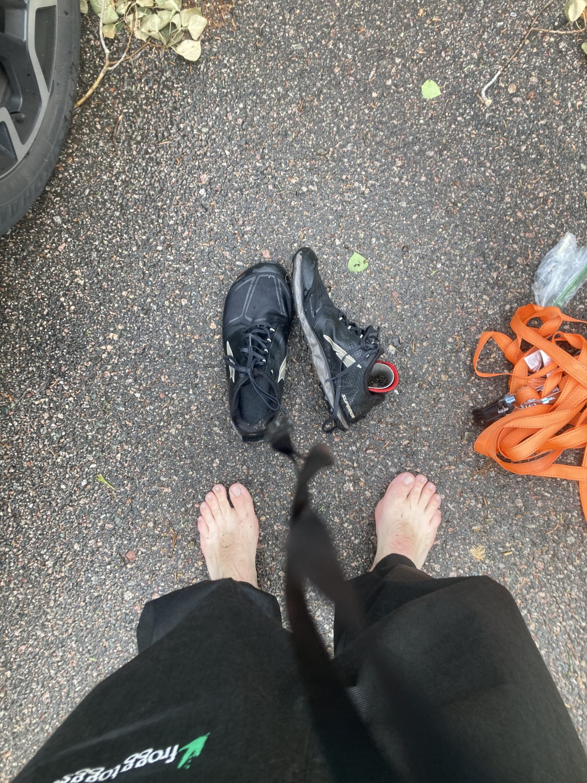
I called Em on the way home to let her know I made it. I figured I’d be to Two Harbors for Culver’s by 8pm. It was all worth it. You just can’t beat that type of experience! While I was in Culver’s I almost fell over in the ordering line, and felt really weird in the booth. I could still feel the waves. You can’t stop the motion and just have to deal with it.
All in all, the trip was a resounding success. I did confirm that 50 miles is possible in a day. I didn’t make that distance, but really close with a bit more juice in the tank. A few in a row would be a different challenge, but with some dedicated training, well within reach. My equipment worked pretty well but I learned a TON. First off, I needed to repair the tie-downs, which were a major cause of anxiety essentially the entire trip after the first two fell off within a few hours of the trip. That reinforced my need for redundancy. If something fell to the bottom of a lake or broke, how would I proceed? I didn’t have a backup co2 cartridge for my lifejacket, or a backup paddle. What if my paddle broke? I can easily carry a spare. So, I went back to the drawing board to plan for July with a permit for the Fall Lake entry point and the plan for another two-night adventure.
0 Comments