Day 5: Thursday, September 8: Granite River to Mountain Lake

After a very bright moon glared directly into my tent all night, my phone alarm went off at 5:15 and I immediately checked the weather. On my phone app, meteorologist Hunter said a storm was rolling in and it’d be rain on Friday into Saturday. Then he wished the viewers a happy Friday. Happy Friday indeed, Hunter! Wait, was it Friday? I was very confused. In the same weather clip from my phone app, the meteorologist alluded that it was Friday. I checked everything… phone, watch, tracking device, counting… it’s for sure Thursday. I watched the video again, he must have been mistaken. It shook me a bit by saying it was Friday twice. But the forecast itself also shook me. 10-20mph winds were in the forecast for the day, certain late morning and afternoon hours showing 15 and 17mph from the south. Intimidating. I unplugged the air stop on my sleeping pad and deflated to the ground. My hands were really sore and creaky. They felt as if someone smashed them with a soft mallet for a long long time. Swollen… just inflammation in every bone, joint, tendon and nerve in my hands. I’d need my left hand big once again today heading due east in a strong south wind. Then again, I figured that I’d be able to catch a decent leeward south shore for a lot of the day. I was hopeful, but I also learned that being too hopeful is dangerous. But I also learned that staying positive is key to cranking big miles.
I packed up quickly and efficiently. I used the very last of my toilet paper in a very economical fashion. I had been down to three or four squares at the sad bottom of a baggie. In the lightest morning light and not-so-light early wind at my back, I set off at perhaps the coolest campsite I’d camped at yet, to what should be my last campsite of this trip. Should be. Will be. Maybe I go straight through. Not on a day like today, I said. With all the inflamed tendricles from my hands concentrating at my wrist. I could feel things rubbing together. It was a slipping feeling if I gripped my paddle slightly off, or slightly changed my hand’s position. A little slip feeling, a little tinge of a nerve that radiates to my sore elbow. Why was the tip of my elbow getting more and more sore?? I figured it was my triceps getting worked hard and pulling at the connection point. I took a moment to try to reach down my back with my elbow pointing straight up from my head. My fingers made it just past my shoulders – muscles real tight – and a tendon from my armpit got way overyanked, having been in the same repetitive positions for days on end. Whoops, I wondered if I’d pulled something but it was indeed fleeting and I immediately paddled away past the campsite I saw with a bonfire the night before. I looked for the other two campsites around the Granite River area. A big north swoop was nice with a tailwind, but it turned right back south. Right away Granite River was super cool with tight narrows opening up a little bigger as I made my first few miles of the day. It was a direct headwind on the open part, but not bad paddling right into it. Yet… I knew I’d have some south stretches on scary open water. Namely, Gunflint Lake, North Lake and South Lake. From there it looked pretty narrow with plenty of leeward options. And if the wind was a touch west, I knew I’d get a little wave bending action since all of the lakes were pretty long and narrow with east-west orientations. I saw some paddlers up ahead, then immediately realized it was the group I saw at Saganaga Falls the day before, the ones with the WaterTribe group. I saw another boat or two launch from one of the final campsites in the cluster of 10 or so. I paddled past the guys. I was surprised they made it past me the night before, and asked what time they got in. They said right at dark. One guy again recommended that I go to the reception at the casino.
I planned my direction down a bay up ahead, then saw the portage itself on a dead flat, leeward swampy corner. I robotically recalled my portage process and quickly got out of the water. The three boats behind me were kind of waiting to land even with my seemingly fast transition. The portage was fun. My food bag was smaller and lighter than ever and although my hands and wrists weren’t happy to be gripping the entire board’s weight on this overstretched dumb strap. Onto the other side and I paddled quickly away, wanting to make time on the guys behind me. That was for no reason… just to prove to myself that I’m a fast paddler and fast portager by going so much faster than these other WaterTribe guys. I was gonna smash that record. I wondered when I’d see Scott. I could go through the night. I counted six portages before even sniffing Gunflint Lake, with its scary south crossing to the leeward shore. I also knew from studying the map and thinking about mileages for days, that I started the day at 180 miles. That means I had an estimated 70 miles to go. How could I do a 70-mile day? If I averaged 3mph, that’s 21 hours or so, which would be a Grand Portage arrival time of somewhere in the early morning hours. That’s less than 5 days. Or I could do a 40 and a 30 to finish it out. That’d be 40 today in tough wind. I already did that once, but these winds were supposed to be heavier. Then, 10 to get to Pigeon River, about 20 miles from there. That’d be 5 days 6 hours if I could do the last 30 miles in that 6 or 7 hours. The existing record is 7 days 10 hours. And still “5 days something”. But, in the 6th day. Really, that’s 6 days. Friday was as well looking to be pretty crappy to paddle through with rain, but at least without challening winds. For now, I just had to move.
I snaked through Granite River. It was slow but steady pushing against the wind but with plenty of narrow turns, then a portage, tiny riverway with lots of scary rocks, another portage, and so on. All 6 portages went one by one by one and I didn’t see anyone. Some of the portages were pretty rugged, some in the US and some in Canada. Towards the end I landed at a portage that was probably the most clearly marked with a large sign on land, but not on the map at all. 7 portages… The sign was for Quetico, very similar to what I saw at the Prairie Portage after Basswood Lake the day before. Dang, what I would do for perfect glass water like that day, I thought. That day was yesterday… it seemed like so long ago already.
I yanked my board out of the water, extremely fast with the paddle-to-hiking transitions, and looked up a sheer rock face. It was very steep but I made it up one step at a time. I banged up my board a little bit in the process, and could feel my heart beating more rapidly and stronger in my chest with the exertion. Paddling was pretty low intensity work, really. Hiking over rocky cliffs with a 25-pound paddleboard, and four different bags all attached together onto my backpack definitely got the ole heart pumping.
Around a falls, water still flowing against me to my right, and there was a very steep, oddly uniform rock face reminiscent of a concrete ramp you’d see at a skatepark. Down the ramp, board in the water and I paddled away quickly. I was trying to drink enough water and would pre-set how many gulps I had to take. 10 big gulps of water right now. 1….. 2….. all the way to 10. I saw a group of young girls packing up camp at a site to my right. Huh, not seeing a site listed. One of the people ran out towards the shoreline and yelled to me, asking if she could ask me a question. Yeah, I shouted back. She asked if I knew where the last portage was, right around the corner from where I came. Yup, I told her about the big rock face to the right of the rapids. As I padded away, I figured they more or less had to stay there. How stressful would that be? Stealth camping by necessity? With a bunch of young kids you’re responsible for? They did not have a pleasant paddle ahead. At least a tailwind… and after I took the last portage and got to Magnetic Lake, I got a real taste of what my battle with the wind would soon entail.
I rounded a point to Magnetic Lake, and the waves had gotten steadily larger as the narrow riverway increasingly opened up. I paddled more and more directly into the south wind. 8 and a half miles in in 3 hours meant I was making less than 3 miles per hour. Not terrible for the amount of portaging, and I didn’t have too many more of those for a while, but I was feeling decently behind getting into the mid-morning hours. I would have to average over 3mph to make 40 on the day. Onto the open waters of Magnetic, next to a sweet house on an island, I had to kneel down and then sit down to navigate the waves. They were getting to be about 2 feet high, nearly every one washing over my board’s nose. I hit them straight on, which was nice for evening out which side I could paddle on. I could easily spot the continuous leeward shore to my right, with houses perched high above on a cliffside. I wondered if I was out of the Boundary Waters by now. To the left of that, due south, was the entrance to big Gunflint Lake. I knew it was big, but couldn’t see it on my map. I had to refold soon. I looked on my watch. Big. I zoomed way out to see how far Lake Superior was. Too far to show the lakes I would be paddling on. I couldn’t be stopping, though, or else the waves would push me all over the place. They were fighting to push me the opposite way I was trying to go. As I got closer to the leeward bay on the southwest side of Magnetic Lake, I could see the bigger stretch of water and the bigger waves of Gunflint Lake through a narrow opening. God dang. Indiscernible variations in the shoreline became docks, canoes, boats, propane tanks and other personal property that I paddled past. It was a relief to get to the leeward side. Yeesh. As I took time to eat some food and drink lots of water, shake out my hands and take out my map to turn and refold it, I knew that Gunflint Lake would be a pretty raunchy ride. It looked to be about a mile of really tough paddling. I could try two miles exposed to wind, to try a straight line pinning more to the east, but that would be longer without being on a leeward south shore. I set off with my options in mind, nervous and dreading the difficult paddle ahead.
Around the edge, towards the point, the waves looked bigger and bigger as I got closer. More and more whitecaps. Ah. Was anyone out here watching me struggle? I was sitting down, completely anticipating the waves smashing me and my board. Gunflint Lake was roiling. The shoreline I was aiming for looked so far away, and that was the shortest, most direct way across. I had to go right down the pike. Right down the pike!! I thought of my inspiration, Scott. When would I see him? We started one day off, likely. The solo canoe from the day before said he saw him one or two days prior from when I saw him on the Ottertrack Lake. He could be a whole day ahead of me… Or I’ve caught almost all the way up. He’s dealing with this same wind I am either way, but I got the shitty crossing right now. The waves were cresting whitecaps, 2 feet high and smashing into my board. They turned me one way or another each time, and I was getting sloshed around on all sides and couldn’t afford to miss a paddle stroke. If I kept my board perfectly in the line of the waves, or at perhaps a slight angle, I could slice right through without too much issue. But at an angle, one wave can push me very far to the side. Two in a row, without powerful paddle strokes to keep pointed forward, and I’d be pushed completely backwards. Or potentially parallel with the waves, and potentially flipped over. I wondered if a wave could be big enough and curl enough to topple me and my bags in that situation. I remembered from my June trip on Ensign Lake how I got caught up when the waves and wind were too heavy. Back then, I was able to do a 180 degree turn pretty easily. I could always bank on that. And luckily I was making my way forward so far. The wind was whipping, though. Whipping bad. The waves were one thing, but the wind was just pushing me so hard. I could see the gusts come from a ways away. It was getting worse. It was getting harder. I had to put my arms to the true test The darkened ripples kept shooting across the water right towards me. Closer, closer, to the nose of my board and then I’d get blasted in the face with a gust of wind. C’mon baby! This is the power moment. Day 5, nearing mile 200 of 250 miles, the biggest lake left and all I had to do was paddle for 20 minutes straight, as hard as I could without stopping. Then, sweet relief.
I could see a large outfitter or resort or something on the opposite shore. That looked nice. They would probably have no idea the struggles I’m enduring, I thought to myself as I envisioned leisure vacationers on the beautiful leeward south shore of Gunflint Lake, still a ways away, relaxing in beach chairs and drinking coffee. Gusts of wind kept coming and as I got into the scarier middle of the lake, barely seeming to make ground, with the consequences of not being able to fight the waves and wind becoming greater, I wondered what would happen if I had to bail… I would get pushed way far onto the opposite shore of Gunflint Lake. There would be no coming back from that. So, I pushed hard. I had to get across. I had the power but could feel the effort of the previous day especially, not to mention an average of 44 miles per day or so before that. I’d never asked anything like this of my body before. But, this was no time to give up or go easy. I was able to paddle, and knew that once I was on the other side I’d have easy paddling. I knew I would, I had to. I had faith it’d be glassy on the leeward shore. Then that would be 5 miles on a pretty efficient route. I noticed Gunflint Lodge on the map, that’s gotta be the complex straight on. Then I picked out a point on a more southeast bearing. If I had just a tiny bit of west wind… I pleaded with the wind to give me a south southwest wind. Just a tiny bit? Please?
Land got closer and closer and bigger and bigger. I tried to pin more and more to the left, but the waves wanted to push me back to the north shore as I was at a 45-degree angle to the ever-smaller waves. So I had to switch to my overworked, painful left side to keep straight. I wanted to go more eastward but one or two strokes on my right side to turn that way and I would turn sharply with the wind. I zig-zagged a couple times, endured a couple more wind gusts streaming from the enlarging shoreline straight ahead, and it seemed so quick to calm down. The waves subsided. I continued to paddle hard, although my shoulders and forearms, wrists and triceps were gassed. I just felt like I didn’t have the same zing as I did the day before. I might have used up a little too much energy storage racking 50 miles, I thought to myself. I got to a very safe distance to shore, to where the water calmed way down and and I was able to stand up. I made it. PHEW. But no time to dwell on my accomplishment because I had some major ground to make up. My watch beeped 11 miles in nearly 20 minutes. I kept the same frenetic pace. After crashing into the waves, yelling and swearing, I felt like I was flying in the calm waters. I noticed a bit of a tailwind around the point. The west wind!! The waves curled due to the large landmass blocking the heavy south winds. Nice. I had a fast mile. I can go faster. I was cranking along the shore. My sweet spot. Is there better paddling than glass right along a nice shoreline? I was careful to get too close to any rocks, but made great time past docks, houses, other boaters, people sitting on benches. That was all mentally stimulating to see. It was great. I even commented to someone how beautiful the south shore was for blocking the wind for me. They awkwardly chuckled and probably had absolutely no idea what I was talking about. 13:16 mile, hell yeah. I went about 15 minutes per mile across the whole Gunflint Lake. What a blessing. I picked a point to turn in towards the north to get to the next lake. Off the shoreline, I rode a little raunchy downwinder. The waves got suddenly much bigger 100 feet from shore, and I was hoping I could get some benefit riding them cross-wise to get to my destination. That made it harder than going straight with the tailwind. I could have stuck it out longer to make an L-shape instead of diagonal, but in no time I found a beach that seemed to be where the next lake began. Was there a portage? I couldn’t tell. It was right on the US/Canada border, the thick lines blocking minute land features on my map. But, the closer I got I realized the beach was really just a little series of sand spits that I was able to zig-zag around. It was so nice to be out of the wind, and I paddled through a narrow sandy passageway, weeds, and a small beaver dam to get to Little Gunflint Lake without too much trouble. I wondered how the 6-person canoes with thousands of pounds of cargo made it through these narrow passages from lake to lake. They all had ’em! This route had plenty of big water crossings where 6-person or bigger canoes would just absolutely fly, but also there were probably hundreds of areas where I couldn’t even fathom how they made it through without hours-long portages that were taking me 10 minutes.
At the end of the shallow and narrow Little Gunflint Lake, I encountered an unexpected portage, but I was extremely efficient at that process and it took no time. It was so excellent to feel like the wind and waves were pushing me. Finally… After three solid days of fighting the wind, and digging deep in the tank to cross Gunflint, it was such an amazing relief to know that getting to the windiest part of the day, I had favorable wind and waves if I could stick to a south shore. And I had plenty of opportunities to do so for the rest of the day, through Mountain Lake really, which I figured would be the lake on which I’d hit 40 miles for the day. I scootched through narrows towards the very intimidating North Lake and hit 20 miles at nearly 6 hours, giving me 3 miles per hour on average. That was good given my slow first handful of hours. I really made up good time on Gunflint. High noon and I figured I could paddle at least another 6 hours with no problem to hit 40, which left me 30 on the last day. In fact, I figured that if I stopped now for whatever reason, due to the wind or waves or exhaustion or emotional breakdown, I’d have a 50 mile day to finish it off. I already did one of those, I figured, and could still finish this thing off and make restaurant dinner at the Grand Portage casino. I started thinking in that way… how many miles left in total, or if I was to stop now how many miles would remain for Friday.
North Lake required a large water crossing, straight south or even a bit southwest to the portage to South Lake. That was another lake crossing to the leeward south shore, but North Lake was one or two miles from a windy point to the portage by my guess. Another one or two miles straight into a headwind was daunting. I felt like I almost had a catastrophic issue on Gunflint. The wind had likely only gotten stronger and gustier. I rounded the point and started to see waves bending around the land mass. Yeesh, here we go! I told myself I could get lunch soon.. maybe at the next portage. I wasn’t even that hungry. I drank lots of water, though, to prime myself up for the challenge ahead and knowing that I probably wouldn’t get to stop until I got to the other end. A couple mental primers and I set off, sitting all the way down and after making sure all of my gear was strapped down and couldn’t get swamped or blow away. The waves would be running over everything. I knew they would. As my field of view opened up, the waves grew and the wind started smacking my face head-on, I could easily see the portage location. There were massive cliffs to the left. Nice, I thought, they’d block the wind better. I paddled straight on to the portage, wondering what strategy would be best. I figured I could pin east, to my left, to get to the leeward south shore then head west in. Or, I wondered if it’d be better to pin east and try to stick by land the whole time. I didn’t think due south would be feasible. Hanging to my right, I could peel into a little bay, then stick to another narrow point of land. Neither was optimally efficient… I pinned to my right right away, hugging the peninsula tight. It was definitely wavy and windy. I yelled. The gusts were immense. I could see them coming from 50 feet away, those ominous dark ripples. Then they’d just smack you in the face. I hid behind the next point. Just gotta do that distance twice in a row across the big bay, I said. But, I also knew that the closer I got to the south shore, the easier the winds would be. So I set off and paddled hard as shit. Last hard one of the day, let’s go!! I yelled out. GAHHH!! I was putting it all on the line by trying to generate powerful and deep strokes every time. I could tell that the south shoreline to the east of the portage kind of bowed out. I’d aim for that then, I said. I peeled to the left, trying to get near land as soon as humanly possible. The gusts were hard to deal with. At least I could predict them, though. Waves were probably on average of 2′ high from the trough to the peak. Every single wave washed over my board, rushing under all of my bags then spilling over the tapered sides of my board. Before long, I could tell I made it. It wasn’t nearly as bad or scary as Gunflint. Thank god… The winds started to bend more from the west than the south the closer I got to the south shore, which didn’t give me the break I’d hoped for. I could only recover by getting onto my knees, instead of sitting all the way down, and paddling towards the increasingly identifiable portage at a nice, sandy beach. I decided I’d eat lunch there. Before 12:30, I had my feet in the water, nose barely touching the sand and gravel beach between North and South Lakes, aptly named North South Portage on the map, and all my packs opened up.
I wasn’t willing to eat the spreadable cheese I had, so that remained in a squished-together baggie in my lunch bag. My food stores were getting so beautifully low. I had two dinners left, two lunches, one breakfast and probably a whole day’s worth of calories comprised of random non-meal-worthy snack items. After lunch of turkey meat sticks and potato chips, plus some candy and a mandatory 10 gulps of water from my near-empty water bladder, I was able to enclose my entire food stores for after today’s paddle in my food bag with the straps fully tightened. It was round, like a mini-basketball. I also requested a new weather forecast. It was looking good for the rest of the day. Diminishing winds, slight chance of rain late, 8pm or so, definite rain the next day while I’d be packing up the morning and setting off, then rain. It didn’t really matter at that point unless there was lightning. Bring on the waterworks, I’ll be paddling down the scenic Pigeon River at that point, not a care in the world! I noticed on the current forecast some additional data, namely a wind gust reading. The max wind gust listed was 30mph. Whoa. It was a strenuous, arduous crossing of North Lake, but I didn’t really think to put a number on the wind gusts themselves. 17mph with 30mph gusts. Fuck yeah. Let’s go. I did it. That prompted me to set off and keep making miles. After filtering a new batch of water for my hydration vest’s bladder, I got hiking. I seemed to be reacting slower. My brain said “go” but I just couldn’t efficiently and hastily unclip the clips I needed to, unbungee my bags, heave them onto my shoulders to set off walking. But, I made it in no time. I felt braindead, relying on sheer repetition and/or just thinking about it a lot. Either way, I had really optimized my paddle-to-portage-to paddle transitions. I made it to South Lake in no time, and set my board right in. I pushed off for yet another southerly lake crossing.
Onto South Lake, I realized quickly that I had it easy. The waves were small and the wind was negligible. It was a major relief, and waves seemed to be pushing more from the west than from the south right away. I took advantage, but veered south to try to be within a strike’s distance of the safe, leeward south shore. South Lake was still pretty bit, but my caution seemed to be unnecessary. Perhaps it was the large hills jutting up from the far shoreline. The absolutely beautiful and stunning land features were also helping me. What a treat. It had become cloudy for the past few hours, which was fine by me. It was a comfortable temperature and there was no rain to speak of. I made good time across South Lake with some solid sub-15 minute miles. Back to back miles over 4mph and I was across South Lake. PHEW. That was the true last hard crossing. Although Rose Lake looked pretty big as well, I could more closely follow a shoreline to get to the south shore. It looked better. And if South Lake was any indication of how the wind and waves can kind of bend around features, the general east-west lake orientation and my due east bearing sould make for no big battles with the wind, and perhaps decently fast downwind paddling. I was hopeful. I GOT HOPE! I yelled that out for all to hear. I noticed the Border Route Trail shown on my map, with hikers probably able to view me from afar but not me them due to the thick brush. I looked around, became wobbly, and realigned my gaze to my paddleboard, where I’d been staring for the majority of 4.5 days straight.
As I looked extra close, I figured there were two portages in a row, with Rat Lake inbetween. I thought that rats were only in the city where my house in Duluth is, not up here. Maybe it’s shaped like a Rat, I pondered. The portages went really fast. Rat Lake was full of lilly pads. My board’s fin seemed to be staying very weed-free during the trip so far, for which I was very thankful. I headed on a north bearing around a point to get to another small portage. I could see the other side, with a campsite just to the right, and a creek that sure looked to flow in the same direction I was traveling! Excellent! Instead of wandering around the campsite to try to find a portage trail, I figured I’d keep my bags on board and walk down the crick. I had issues doing this twice already, 0 for 2 times trying to make my way without removing my bags from my board and both times I regretted it. But, I could practically see the next lake so unstrapped my ankle leash and started walking my board. Tromping through creek rocks, I made it pretty well for a bit, but then rocks got closer to the surface and many stuck out, and my fin was not a fun item to drag through. I had to either lift up my board or press on the nose to raise the fin out of the water, and finally came to a natural or semi-beaver-made dam at the end. I once again try to bear hug my board to lift it, bags and all, above the obstructions to the open Rose Lake. It barely worked and I wondered if I’d ever learn that that method was slower and less efficient than just portaging like normal with bags on my back and board gripped from the handle aside my hip. I was excited for the prospect of the water flowing with me. Although, it didn’t feel like it either way. I tried to check my fin for weeds but couldn’t really tell. I spent unnecessary time and energy trying to check. My dang backup paddle had somehow come loose and wasn’t sticking up out of the water the way I wanted. It kept falling to the side and acting like a rudder. I didn’t notice evidence of it, but required the peace of mind that the stupid paddle wasn’t negatively affecting me in some way. I had to fix that for my last day, I told myself. I wondered if I felt slower because my board was slowly filling up with water due to a crack somewhere or something. It seemed to be sitting low… it seemed to be sitting lower than normal all week thus far. Then again, no it didn’t. And was that even possible to happen?? Maybe I felt slower because my muscles and tendons were tired and my hands hurt and I had 27 miles on the day. A 14-minute mile confirmed that I was moving along just fine.
The cliffs along the arrows leading into Rose Lake were amazing. When Rose Lake opened up, I heard a waterfall. The low, whispy grey clouds swirled around a trailing peak along the south shore of Rose Lake. I aimed towards the furthest looking south shore, which was likely two miles away. 13-something mile, another one a little faster, and I told myself I could go under 12 minutes if I really tried. I couldn’t though. My mind was always too preoccupied… wayfinding, trying to run math on my location or how long I had to go, studying the map and plotting simulations on the next mile or hour or afternoon. Or, checking the forecast, trying to drink water, fiddling with my tattered, smelly paddling gloves, or dealing with not-perfectly-even bungee straps. I had to check to see my ankle strap hanging into the water (or not), my hat being perfectly aligned on my head or splashed water obscuring my map view through the damaged gallon baggie I was using to hold it. By the time I got across Rose Lake, I was feeling pretty confident. Miles flying by, making good time with 30 miles on the day and less than 9 hours in. I was nearing 3pm and only 40 miles to go for tomorrow if I was to lay up to camp right here, right now on Rose Lake. Although, all the sites were clearly taken.
I approached a max-size group of four canoes and probably 9 young girls finishing up their portage with some seated and patiently awaiting to depart. That helped me locate the portage, and to look extra cool I put some thought and effort to making a fast departure. I had scoped the upcoming portages and was confused. It looked like there were several trails in the area including the Border Route Trail and portages on the US and Canada side. I saw were a handful of separate three-digit portage rod lengths listed and wondered if I’d get to paddle between them or if they all lined up to one big hike. If the past was any reference, the short paddles in between would be either weedy, shallow, rocky, potentially decent paddling, or a most likely combination of all of the above. As strenuous as long portages were, by far the slowest part of traveling was the transition between paddling and portaging and then to paddling again. It was sheer dead time, unless the wind was luckily pushing you in the correct direction. The process must remain as: remove bags while the board is flat, then portage with the board sideways and I’m gripping the strap, then the board has to go flat again, and then the bags go back on. I could barely move the board while flat despite trying really really hard and struggling three times over the days. And the bags can’t be on the board when it’s sideways, so the bag prep has to be on the water. I can’t paddle and do that at the same time, so therefore it’s completely dead time. The only way to be fast overall was to paddle constantly without stopping, remove and replace my bags from my board to my back as fast as possible, hoist my board and trudge ashore as fast as possible by running if necessary, then portaging at a maximized and focused pace. On the other side, I had to find a suitable spot to drop my board, get on top and strap in my ankle strap, remove and replace my bags from my shoulders to my board under bungee cords, then paddle away as fast as possible. I had it down, and when I asked the group at the end of Rose Lake if this portage was long like it looked to be on the map, I as OK with one girl blurting out that it was 1.5 miles and it was “the worst”.
Onto a potentially miles-long portage, I noticed my hands feeling pretty weird right away. My grip strength was great. It felt locked in. I was getting decent mileage before I absolutely had to switch hands, but the relief was increasingly brief and at a certain point my grip and forearms were screaming in discomfort all the time, and I just tried to ignore it. That was fairly normal, though, whereas the slipping feeling that I reasonably guessed to be inflamed tendons and ligaments and nerves all getting smooshed together was kind of a unique sensation. It didn’t feel good but didn’t necessarily hurt. I could just feel my hand nerves being encroached on and sending off some damage control request signals to my brain. Then the frontal lobe of my brain overrode those signals to tell my hands to grip and proceed forward to the next fallen tree in the distance. Then I’d get rewarded with sweet relief and a transfer of pain to my other damaged carrying hand. It was very mental.
The portage didn’t stop. I didn’t have an opportunity to paddle. I didn’t even see water. I was fortunate enough to be on the Border Route Trail proper and see the line on my watch’s map screen. I figured it was going to be two miles of a continuous portage all in all. So I counted on that. That’s a long-ass portage. Damn… On and on, I just tried to think about how hard I could stretch, how far I could go without changing hands. Then, when I absolutely had to change hands, I picked the most effective spot to quickly swap hands and proceed on. It was painful, but I could make good time with very little time completely stopped. The bugs were thankfully pretty pleasant. I saw a few mosquitoes, and would get pretty paranoid that I’d stepped into a bug hotspot if I saw more than one at a time, but it was a complete non-factor. Thank god. There were wide open swampy sections, sections with brush and tight turns that would scrape and catch my board, foam sleeping mat and bungee cords. The portage had areas easy to flip my 14′ stand up paddleboard around my waist to change sides, and steep and rocky, tightly wooded areas where even setting my board down was unsuitable. I approached a fork in the trail, one going south and other continuing to Mountain Lake eventually. I noticed the creeks to my left flowing against me. What the heck? I obsessively checked my watch’s map to attempt to put my mind at ease and confirm I’m on the right path. I saw the sign indicating the options for the three-way intersection and I continued on the Border Route Trail to the left instead of Daniels Lake Trail to my right. I went up and down a lot of hills, and added just a couple small scuffs to my board as my completely extended carrying arm failed to absorb shocks and undulations from the technical trail. The first split after a full mile on the portage flashed well over 20 minutes. Meh. 20 more minutes of agony. I thought of how many people were watching along on my tracking website. Maybe none. 3pm on a Thursday? Who knows. Then again, now is where it gets interesting. It was so easy for my mind to get completely focused on the exact task at hand in every passing moment, but it was fun to zoom out and think that I’d gone over 210 miles in the past 5 days, folding and refolding and turning over and refolding each of the three maps and I was nearing my last fold or two to show Mountain Lake and my campsite for the night.
I was nasty. Portaging generated a lot more body heat that paddling on the windy open water. I hadn’t jumped in the lake all day and many factors multiplied onto one another to make me feel pretty gross. I then saw a couple of hikers in sandals and casual wear. They stopped me to ask about Rose Lake, I told them a mile or mile and a half that way, and pointed behind me. I was maybe mumbling a little bit more than my normal self after a great night sleep and some coffee, for instance. Then in passing I awkwardly apologized for the smell. I shouldn’t have said anything, and it came off as neither a funny self-depreciating joke or a realistic warning. It was just in the in-between, a bad joke lost in comedy hell. Fuck. This portage is long. They told me they were out camping as well, and their boat was tied up at the portage. I asked how far it was, they said not too long as I’d started back walking and turned a corner, making further conversation impossible. I zoomed off with my board tucked under my arm and tight to my hip, speeding down a technical descent to look super cool and fast and to feed my ego in front of the well-meaning adventurers.
Keep moving, keep moving. Not too long, they say?! What the heck is that supposed to mean? I nearly gave them an itinerary trip plan to Rose Lake. “1 to 1.5 miles which would take 17.5 to 22.5 minutes depending on your walking speed and with no stops”. They give me “not too long” to the much anticipated portage?? That little girl at Rose Lake was right – this was the worst! At least the weather and conditions were prime. It was just so tedious and painful to carry my paddleboard. Yet, I could crank fucking ass. I got to the sweet end of this massive portage between Rose Lake and Rove Lake or Arrow River or Watap Lake or wherever the hell I was. I didn’t care, I had a nice long and narrow waterway to paddle down, then the listed Watap Portage of 89 rods and then Mountain Lake to my final destination for the day. Although, I knew that lake was perhaps over 5 miles long in its entirety. Campsites were spread out along the narrow lake’s south shore. Hopefully I’ll have a selection, I thought to myself. Please god, give me options!
I took extra time after pushing off onto the open water to eat a snack or two, drink lots of water and strap down all my stuff. I also jumped in the lake, which I told myself I had to do. I didn’t want to get my face under the water so kind of hopped in and immediately grabbed at my board, hung on for a second and reboarded.
Looking at the map, I saw little northbound travel which would be nice with the southerly wind, but the vast majority of the next handful of miles eastbound with a shoreline right to my right side blocking wind, so knew I’d have good paddling for a nice stretch of lake. And I certainly did. The sun peeked out a bit, the peaks off in the distance of all directions were fantastic, and I was only 35 miles from Lake Superior. 27 miles from Fort Charlotte at the start of Grand Portage. Only 15 miles from the Pigeon River. I could do that in the rest of this day, I thought, then leave the 20 remaining miles for Friday. Given it was about 4:20pm, that’d be to South Fowl Lake, the last one before Pigeon, at about 8:30pm. Nah…. but encouraging to put it all in perspective given the immense distance I’d covered. I told myself I could just keep plugging along without stopping for my customary afternoon break. Then I’d get to camp early and could set up before any rain came in. It looked unlikely that it’d rain much if at all before pitch darkness at 9 or 10pm. Still, any additional light, warmth or dryness that I could utilize before bedtime would be worth stopping early for. So I continued on to the Watap Portage without any stops.
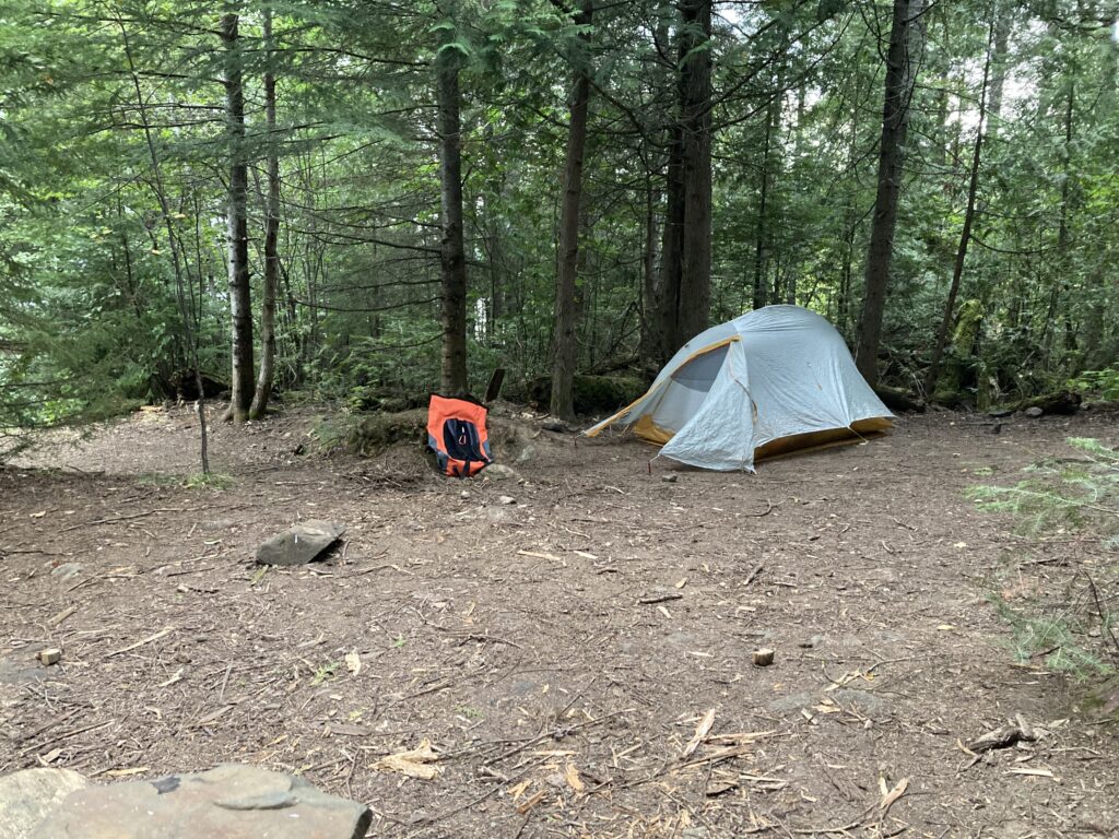
I enjoyed calm paddling up to Watap Portage and then blitzed the walk with no issue. My last portage of the day was fast and efficient and I was on Mountain Lake in no time. It seemed a little bit choppy right away, but I got to the nice south shore and passed an occupied campsite in no time. I enjoyed a sweet downwinder, the best of the day by far. The waves and wind were pushing me. I felt gusts through my back and watched the dark ripples flutter out in front of me. That is so much better than seeing them coming to smack you right in the face, like what I experienced when battling a headwind on Gunflint Lake. I thought it was funny get both spectrums on the same day. Thank god I had smooth sailing on my final stretch. My 37th mile was in 12:37 thanks to the breeze assist. Hell yeah. Thank god. I don’t believe in god… thanks be to allah, thank whoever! Thank you ancient wind gods! Another 12 something as I stared down the very long Mountain Lake. Gah, the miles-back shorelines were sometimes so defeating. A close US shoreline to my right helped keep the route interesting. I tried to pick out each campsite, figuring they were about a mile apart. I couldn’t even get close to being able to pick out indicative changes to the shoreline from one site to the next. The campsite icon seemed to frequently block an important feature of the land, like a hooking peninsula or rocky bump-out that each perfect campsite would be situated on. I wondered if voyageurs and native woodspeople used these naturally suitable sites for camping as well. I mean, ya gotta cook and sleep and poop somewhere! 12:22 was my last mile of the day, with 40 total. That was likely to be the fastest mile I’d done on the entire trip thus far. Mile 220. How lucky could I be to do that? I’d had 5 days of extremely favorable conditions. I figured I could push the limit and take a site on the exact edge of my map fold. As I neared another site, I tried to scope across a shallow sweeping bay to find the site and determine if someone was there. I couldn’t see that far, plain and simple. There was maybe a spot on shore where there was maybe the signature tan kevlar of most BWCA canoes pulled onto the shore of the site, or tan covered rocks or a downed tree or a large moose standing perfectly still or just another in a billion 20′ stretches of shoreline that are all tremendously unique and different while all stringing together to create a largely homogenous BWCA. Lake after lake after lake, deep blue waters, grey rocky shoreline, dark brown and green trees and blue and white skies encompassing every horizon and overhead. It’s disorienting, but when you really analyze the landscape, one’s spot on a map tends to be obvious. It wasn’t obvious to see if the next site was taken, and to proceed from there would require refolding my map. I saw a campsite to my right tucked into the woods. There was no prime rocky outcrop to collect water and view the lake and enjoy a sunset. I could easily tell it was vacant as I sailed by on a nice wave. It wasn’t even 6pm yet, so to stop now would be my shortest day. But, what if I could stop now, set up well for a solid next day to finish it out, and make absolute sure that I could set up my tent and everything for the certain rain overnight? Yup, the decision was easy and I took a hard right towards shore, pulling into a back entrance to the site with a pretty easy, calm landing. I schlepped my light- and manageable-feeling bag systems ashore, then pulled my board way up onto the trail to set it upright on a tree. I was nervous to be in the trees and have another dewey morning, but then remembered that it was set to rain overnight. I’d be getting all my shit wet regardless. In fact, the trees could provide excellent shelter! Plus I wouldn’t need any of my camping gear any more once I set off the next morning. I came up to a super cool, nestled and woodsy campsite for my final night in the Boundary Waters.
I carefully scoped out my tent site to ensure maximum drainage. I raked some duff out of the way with my precious camp sandals to ensure that water could flow to the lake from around my tent site. I spread all my gear out around a super cool fire grate area and started with the tent. I finally would put my rain fly on after 4 nights in a row open to the night sky. I was excited to be enclosed. I figured it might be an uncomfortable next morning but all I’d have to do is shove my shit in, close ‘er down watertight and hit it. My next time unpacking could potentially in my basement in Duluth, I remembered.
I stopped my tracker when I made sure it beamed my site for the night. I remembered to double check to turn off the device, and was completely possessed to do that check frequently at camp. I decided I’d start a fire and take a swim in the lake. I wasn’t overheated and didn’t really care about the stench of my shirt, but was hoping to somehow get a handle on the inflammation starting from my hands and going through my wrists, down my forearms to elbows, then back to my back, core, shoulders. Some arm circles in the cold water, then a fire and smoke treatment should do the trick, I told myself.
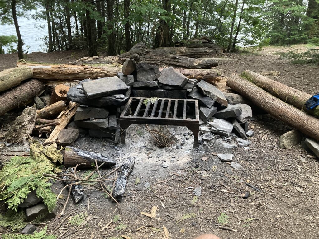
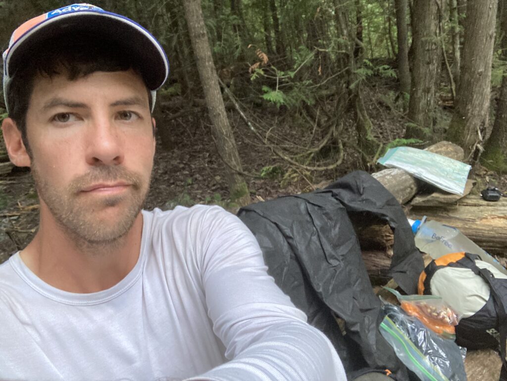

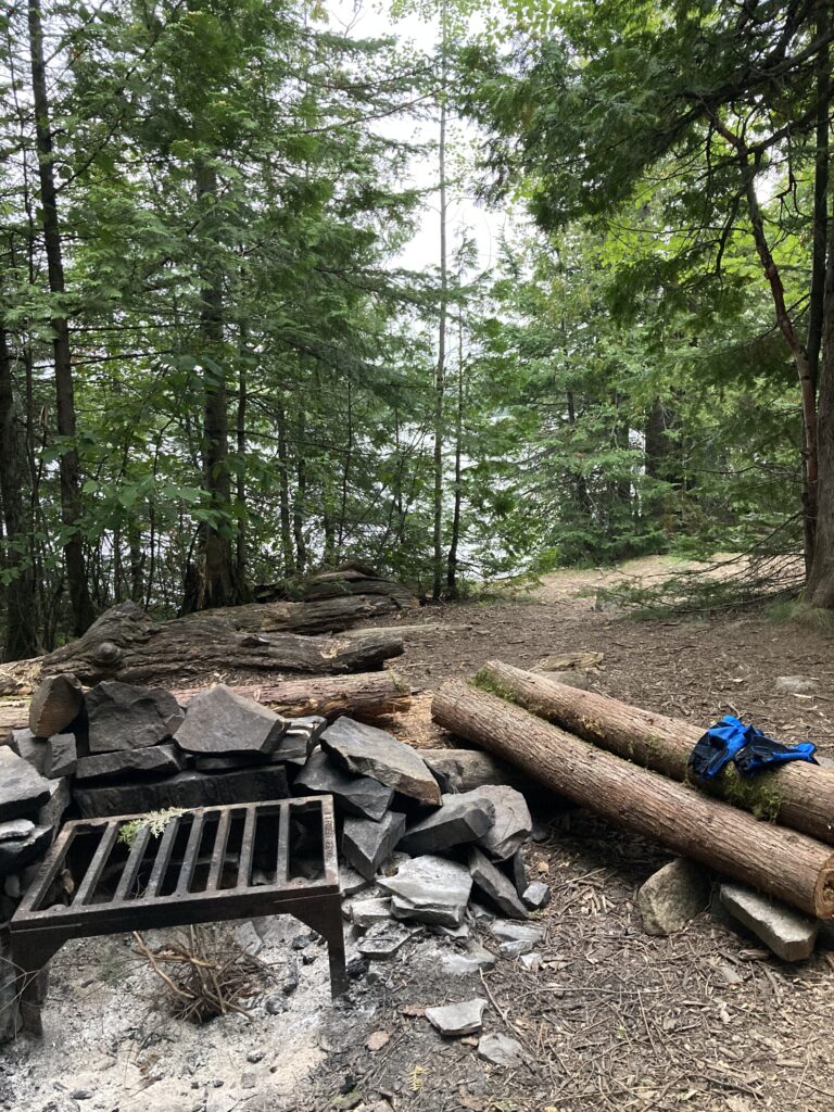

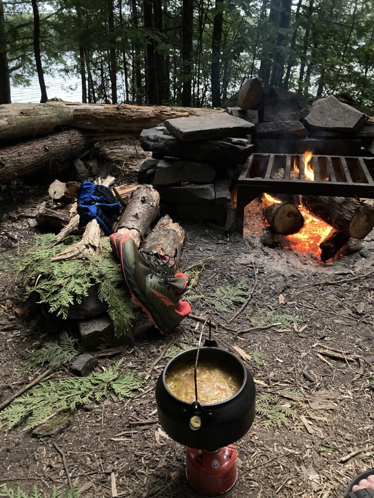
I got a fire going after struggling to ignite a twig pile without birch bark. My tent was set up very tightly, my sleeping system ready to roll, food laid out pretty well and lots of stuff drying out by the fire. I got dinner going, a teriyaki rice side with tuna packets, then went swimming. It felt nice but also a little scary. What if I can’t dry out or warm up? What if I slip and fall on the rocks? Or get my ween bit off by a river otter? I did a few arm circles, flexed my hands and wrists outward and circled them around in the water, clenched my fists then released and stood up and walked out of the lake. It felt great, and I dried off in front of the fire, which was ripping at that point. I got dinner mostly made and started sorting my food stores for the remaining trip. Plenty of food for tonight, breakfast for tomorrow, and lunch and snacks for the final push from Fort Charlotte 9 miles to Lake Superior on the Grand Portage. I felt a light rain start and looked up. Ominous clouds. Crap. I got the drying items shoved into my backpack or into my tent and then enclosed everything in my tent’s rainfly vestibule. I continued to cook in the rain and the extremely minor drizzle stopped. Sweet. I got my map out and peeped the next day. Short. I did my final fold and stuck it back in the damaged gallon baggie. I organized my snacks for the night and started eating dinner by the fire. I threw some logs on to get it roasty toasty once again. I housed my meal pretty quickly, then slinked off to my tent as the rain picked back up and it got dark.
My last night’s sleep was kind of comfy and kind of unpleasant. I liked having the rain fly on for once, and I felt nice and safe and enclosed. I could also sense my entire stinking paddling uniform and gear and rain jacket and rain pants all shoved into my bag, and was not pleased with crap strewn all about my small tent. I eventually shut off my headlamp at a good hour and had my alarm set for nice and early to get going on my last day with no time to waste. I didn’t have cell service. I figured it’d be raining by the time I get up and start paddling. I got very sleepy by looking at my final final map, a brochure for Grand Portage National monument, which shows the last half mile of the 12-mile paddle down the Pigeon River, and the Grand Portage. I thought about the voyageurs, and about indigenous people perhaps sleeping under this same tree, just trying to make it back to safety and comfort at Grand Portage. During the night, I woke up several times to my hands completely numb, as if I had slept on them and cut off the blood flow. But no, they were just laying right on my chest. Inflammation was causing a tingling numbness enough to wake me up. Luckily I didn’t need them for a full day. 20 miles of paddling left. I was close. I’ve made it this far. It happened several times where I woke up to numb hands. Each time I shook my hands and drifted back off.
0 Comments