Day 1: Sunday, September 4: Sha Sha Resort to Depthfinder Island Campsite N7, Namakan Lake

Garmin Data:
We woke up early at the Rainy Lake RV Park outside of Ranier/International Falls, MN in dewey conditions. Me, Em and the dogs roused awake to the 5am alarm and started slowly packing up our sleeping bags, tent, random junk and hit the road. Every surface was covered in a light dew. It was pitch dark and we could see the northern lights flickering dimly in the pre-dawn sky. It was cold.
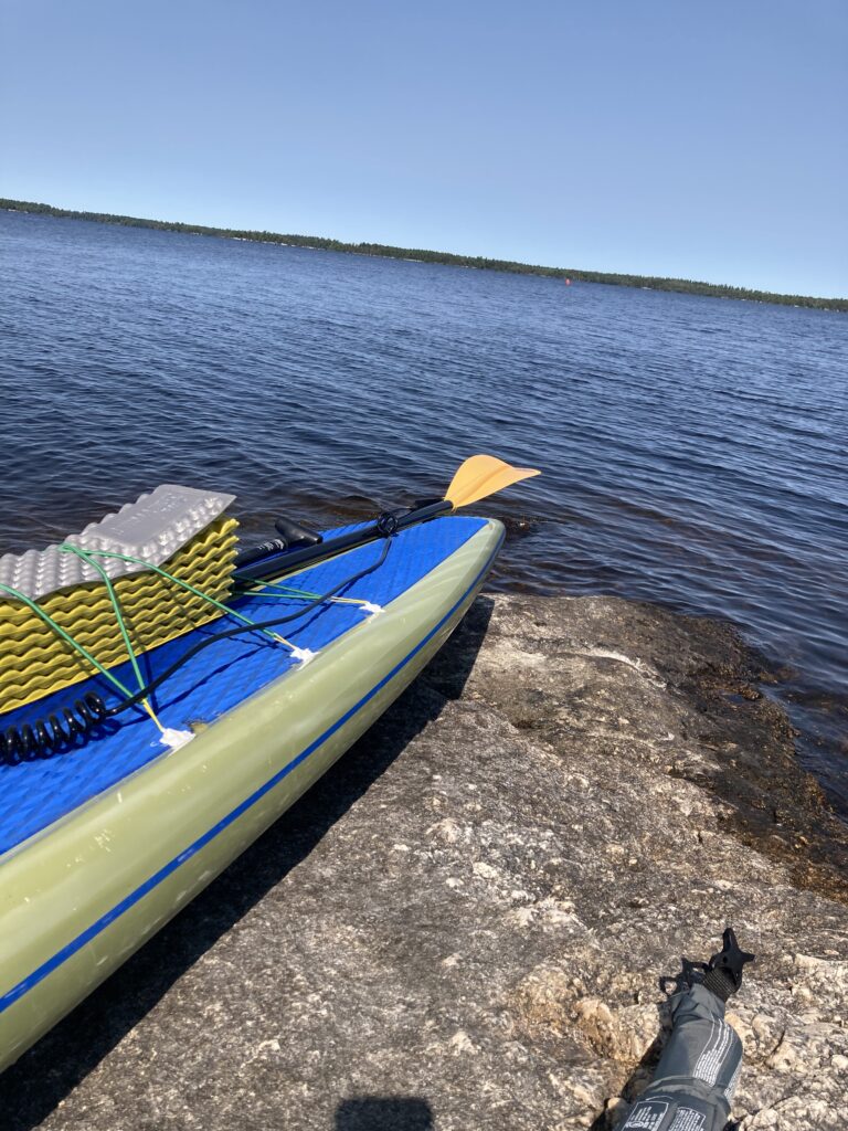
We drove 15 minutes to Sha-Sha Resort. The winding road led us to a boat launch that was listed for private use only, but I figured I’d be launching quickly and nobody else was around at this hour and didn’t want to backtrack. By 6am, the time I was hoping to set off, I was putzing around with final items, shoving extra ropes in my bag, making sure everything was tied down. I got my ankle strap on, my backup paddle tied down, then my massive food bag and dry bag backpack clipped together. I questioned how I’d get it all on my board. I also questioned doing this stupid trip altogether. It was so fun camping with Em and the dogs the previous night. We had pizza and beer and a nice bonfire. We slept in the huge spacious tent. We could do that for a week instead… but we actually couldn’t. I have to embark on this trip and this is the painful start. I got everything strapped down on an adjacent dock that was lower with the wind not doing me any favors.
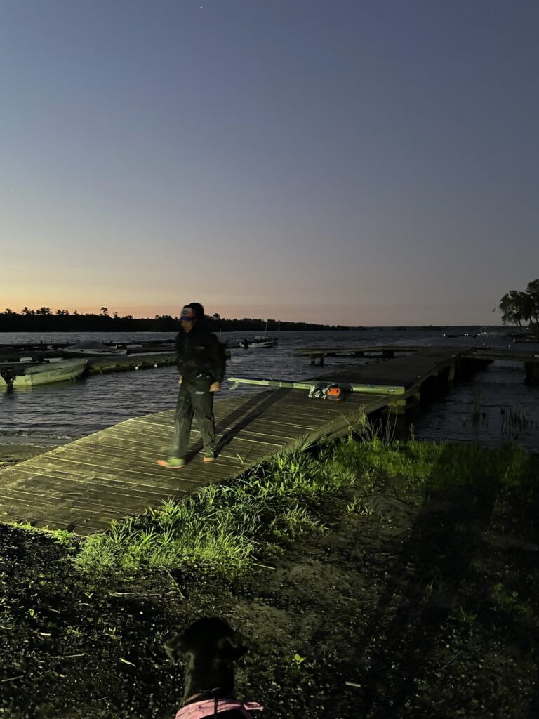
Photo Credit: Emily Andrews
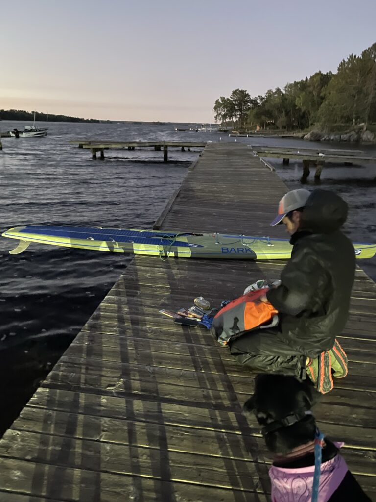
Photo Credit: Emily Andrews
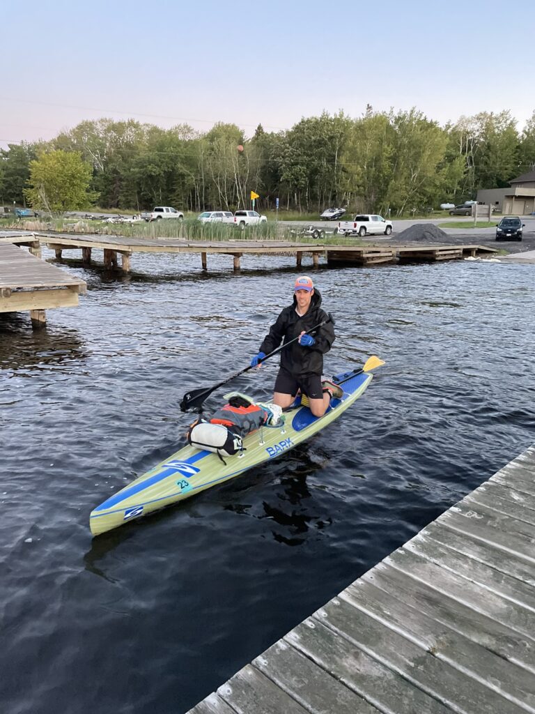
Photo Credit: Emily Andrews
The forecast was for a light south wind, which I figured would not have too much of an impact on the first day’s route except crossing the massive south bay of Rainy Lake. However, the waves were pushing my board around even at the normally-calm 6am hour! What the heck? I was so nervous to set off. Finally, at 6:23am, I pushed off, started my watch and paddled away towards the sun, standing up with my rain jacket on.

Photo Credit: Emily Andrews
I fought the waves a little bit, but quickly rounded the resort, found the next point and was in to Voyageurs National Park immediately. I knew I’d be on a leeward shore for the next few hours paddling due east. The fiery orange sun was blinding and I had to follow it all morning. My eyes are gonna burn out! It became blocked my an island, and I reveled in the stunning beauty of the morning – fog dancing on the glassy lake’s surface, the forest waking up to my left and to my right, and the excitement of starting an epic journey put a smile on my face.
I had lots to look at right away. I’d never been to Voyageurs National Park or Rainy Lake and it was interesting seeing out the different campsites and rest stops. I could see both types of landmarks noted on my map, and the actual campsites were pretty easy to spot when there were massive houseboats docked there. Maybe it was the nerves, or maybe the hefty portion of pizza from the night before, but I felt the need to make an emergency stop just less than an hour in. Planning a stop, there were plenty of options by way of campsites or a rest areas. I wondered exactly what that picnic bench icon entailed. I suspected a rest stop or picnic area would be promising, as I would hate to intrude on a National Park campsite that has been reserved to take a morning bathroom stop. I last-minute reserved one of my own just a few days prior, but it was over 45 miles away. Without time to spare, I stopped at a super sweet rest stop that had a very nice dock and the outhouse right off the dock, including toilet paper. Nice. That was about as pleasant as an emergency stop could possibly be in that situation. I thought of my friend Nick Nygaard who gave me some pre-trip advice to take an aqua-dump. Environmental concerns aside, one goal for the trip was to not take an aqua-dump. That puts a new meaning to “dragging ass”! Dragging ass was a legitimate concern of mine very early on in the day, with winds likely to only get stronger, and I quickly boarded my paddlecraft to set off. I had a huge day of paddling to make it to my reserved site 50 miles in. I had 3 or 4 on the day, and with a later-than-hoped-for start I’d either be racking 5 miles per hour with no stops, or paddling in the dark. I could already run that math to see I was not set up well to get there.
As the sun rose higher, I had fun on Rainy Lake. The sun was increasingly less blinding and I was a little surprised at the landscape of Rainy. On the map, it’s huge. In my mind, it was a massive basin, but in reality it looked like any other lake. I figured I’d been training on Lake Superior, which makes all other lakes seem small. Boat traffic increased throughout the morning, with fishing boats zooming to their spot, or anchored at an underwater feature, and houseboats and pontoons setting out for a day of fun. The waves from wind were a non-factor, even in bigger bays to my right, the south, where the wind supposed to be coming from. Waves from boats started becoming almost constant, though. On the big open water, I would see a set of waves with no corresponding boat every now and again. Those must be from a long ways away, I thought to myself.
I became increasingly nervous about the big bottom bay of Rainy. That was almost a 10-mile crossing straight southeast from the narrows in the northwest corner of the lake, to the narrows and portage to Namakan Lake to the southeast. The open water was maybe 5 miles wide, which was a ton of real estate for a south wind to whip up. Plus, it was getting later in the morning and the waves usually only get bigger and wind stronger into the afternoon. I admired the large wayfinding structures, green and red, showing boaters of all types where to go, and snuck close around a point to get to my destination in the shortest possible way. A south-facing bay straight ahead and the waves were decent. Manageable, but a wind at my face for sure. Closer and closer, and I knew I was slowly approaching a fight. Through an island I ran into a bit of weeds. It’s never a short-cut, I thought to myself. The end of my map was at this ominous point that I was to round. I wondered if I’d have to try to jet due south for two miles and paddle the leeward shore the whole time instead of taking a direct line. When I hit the north side of Soldier Point, I figured it’d be a good time to stop with the skinny landmass blocking the wind. I refolded my map. Yep, that’s a huge wide open swath of water. Yikes. I drank some water and realized I probably was dehydrating myself and needed to focus on taking in water. I was 3:18 into my trip, about 13 miles. Right on pace for 4 mph. Going for a mid-morning snack, I realized the splashing water had disintegrated my caramel M&M wrapper and they were free floating in a pocket of my hydration vest, the colored candy coating making a tie-dye scene on the fabric. Crap! I took the whole bag in one mouthful, accidentally dropped one straggler in the lake for a muskie to eat, took another swallow of water, stood up on my board and hit it.
I could kind of see the big lake through the trees of this narrow point. It didn’t look too bad. I passed a huge red pylon and was onto the lake. Let’s go!! I was ready to hit it hard, and told myself I would push it until I got to the leeward shore. Out a few hundred feet and it was fine. Oh my god, what a relief. Yeah, the wind was towards my face, yeah the waves were coming at me, but they were completely navigable while standing up. So, I stood up and cranked anyways. This one is for Jake, I yelled! My colleague Jake, an avid angler, had jacked me up about paddling Rainy Lake many times, and offered a few pieces of advice. He said he’d be tracking me. I peeked down at my Garmin InReach Mini 2 to make sure it was still connected to my inflatable flotation device. It was, was still tracking me. Last point sent. I thought about all the people tracking me. I wondered if anyone was. I’m sure my family and Em were tracking me. Jake said he was. This one’s for you, my man, let’s crush it! I set off directly towards my destination hoping to get the shortest route possible from A to B.
Hours went by and the shoreline barely changed. I desperately wanted to get closer to land but it just didn’t make sense to from a mileage efficiency standpoint. I tried to aim for a far-off point but it was so incredibly far off I more relied on my bearing of due east with a little bit of south to guide me. I could see where I had to go. Boats went by and the waves from them were more disruptive than the wind. Boat waves were a nice break in the monotony, though. I hummed and sang dumb little “la la la la la” tunes to myself and laughed. I tried to remember to drink water but mainly just paddled for many hours to cross Rainy Lake and get to my campsite at a reasonable time. I ran numbers in my head constantly. My mile splits were good but the pace to get to my campsite even at 8pm was not realistic.
I had a point to aim for and it took a long time to get from end to end. The point eventually started changing shape and getting slightly larger and easier to make out the landscape. The red pylon denoting the narrows from which I came eventually shrunk into the horizon. It took about 3 and a half hours to make it 13 miles across one large basin of water on the lower bay of Rainy Lake. The whole time I was constantly analyzing my form, securing the best grip and the most powerful stroke. I was constantly making calculations of where I was on the map compared to what I was seeing on land and how many miles my watch said versus how fast I was going based on how fast I’d gone and what I thought I could do for the next miles to stay on pace. I tried to predict different pace scenarios for a given time or distance. I wasted time trying to look closer at the map or changing the data screen on my watch or checking my tracker or drinking water. But, constant paddling was tedious and the practically unnecessary and minor stoppages were maybe necessary for my sanity. I ran math again, and figured the far point would be a good lunch spot. It’d be a late lunch but also the landmark would make for a good goal. I passed a couple of islands, ensured I was on a direct track, and was feeling really beat by the time I cruised in to land. I tried to find a good landing. There wasn’t one. I just paddled around to the left, the leeward north side, of a small island. What a relief to stop and get to land. I had conquered Rainy Lake. YEAH!
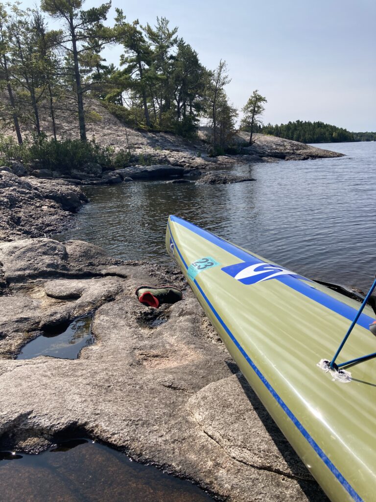
It took a while to unload my gear. I had to unload it all, there was no other way. My food bag was obnoxiously huge. I grabbed cheese, a meat stick, and an uncrustable hazelnut sandwich. I saw a woodpecker in a nearby tree. Cool! It was so nice to be close to nature instead of the open water, literally miles from the faraway treelines as I had been for hours. I had neared the end of my map and took it out of the ziploc bag to refold again. I took some photos. I was surprised that the red pylon and far shoreline has completely fallen out of sight on the horizon. The curvature of the earth was enough to block the far shoreline that I had just paddled from. Cool.
It was hard to get going again but I got up and started shuffling stuff arounk, took some extra food for my pack and was ready to get going in no time. It was a hurried break… shove as much food as I can in my mouth and chew as fast as I can so I have time to prepare for the rest of the afternoon of paddling. I left a bit past 1:30pm, excited for some curves and narrows. I was curious what the Kettle Falls was going to be like – it seemed like there would be a portage. I tried to sneak around some islands to stay nice and tight to the north shore and with plenty of land to block any wind. The wind remained light around 5mph or so from the south. I was constantly trying to determine from exactly what direction the wind was coming from. My backup paddle seemed to be holding firm, but I was skeptical of the curved side of the paddle staying out of the water off the back of my paddleboard. I was constantly checking behind me, which is a good way to lose ones balance… There was always something to be checking on or calculating.
It seemed to take forever to get to the opening of Kettle Falls. I saw a couple of kayakers paddle ahead of me then land their watercraft onto shore. The wind was right at my face as I turned due south, and that wasn’t really pleasant. I was fighting. I got to a narrow section and three fishing boats with huge outboard motors zoomed past me as I tried to hug the inside of a curve. I almost got hung up on a rock, then the boat waves met each other from the corner, and all three conglomerated to a series of mega-waves, and I had a minor freak-out moment as the rolling turbulence raced towards me. I got onto my knees, paddled in reverse, went around the other side of the rocks and narrowly missed the waves. Phew. Those boaters were really zoomin’! Why….
I checked the map screen on my GPS watch. No help. I zoomed way out, became disoriented, zoomed way way back in. Check the map. Gah. Just keep paddling, I had to tell myself. On the map, the portage appeared to start from a side bay to the right, then the river continued upstream to Kettle Falls and Namakan Lake to the left. I went down that bay and it did not look promising. Very weedy. The map made it look like there were roads… there has to be some type of infrastructure somewhere in this bay, I muttered to myself. No. I got frustrated and turned around. Why wouldn’t I just paddle right up to the mouth of the waterfall or as much as I could and see what I see? I furiously paddled back around the point. 5 minutes more and I saw a dock. Then a landing, and lots of docks, and people, and boats tied up, and the falls off in the distance. I shouted to some people on the dock to ask if that’d be the best place to portage. They pointed me around the corner. One last corner and there was a big beach and a road. I paddled closer. A quarter mile on land there looked to be a big building, perhaps a hotel. I paddled ashore and someone asked me where I came from. Sha-Sha, I said, pronounced “Shay” like the RV park owner Kari had corrected me on the night before. They were in disbelief. A guy shouted to me: “Hey we gotta decon you”. I thought he meant he was offering to give me a ride in his ATV next to him. I shouted back that I’ll walk. He repeated himself that he had to decon my board. I kept collecting my items clumsily to prepare for the portage. The lady yelled at me “he has to decontaminate your board, honey!” Ahhh…. yeah yeah… I got my hulking pack on my shoulders, wet hydration vest draped around my front and and went up to the guy and his rig. It was a big machine the size of an electrical transformer box, and there was a tarped 20×20′ square in the sand. I brought my board up and he immediately started spraying this steaming liquid onto the deck of my paddleboard, on my folded and strapped down foam pad and all. I immediately got nervous that it would mess with my rig. He said it was 140-degree water to kill the zebra mussels. Huh, that probably isn’t too harmful, I thought. In a minute, he was done and sent me on my way, pointing me down the road to the other side of the falls. I followed.
The portage at Kettle Falls was a nice wide gravel road. It was definitely net uphill, but a hill really just in one section. I did the walk with only one change of the hand. My food bag was smashing back and forth against my lower butt as I shuffled my feet. The 1 liter quick-access bag was swinging around my neck annoyingly. There was a “trading post” and an attendant that probably had cool beverages and snacks. People were everywhere, families on their docked boats and kids wandering around on land. I went to the landing and put in as fast as possible. There were huge buoys and some type of barricade at the mouth of the falls so unassuming boaters wouldn’t get catastrophically swept down the rapids. I paddled out a bit, then carefully tried to slide my pack off my back, piece by piece. Hydration pack and quick-access bag clipped together; dense food bag and dry bag backpack clipped together. My ugly epoxy job on the tie-downs seemed to be holding up good. I struggled to get it all bungeed down with cords and straps and clips getting tangled all together, and drifted away a bit. I could hear a family on their boat close by. I probably looked like a maniac. I rushed to stand up and paddle out of there. My gear was strapped down well. Looking at my map, I knew I’d get a nice couple of leeward miles, then straight south for a while, then the map cut out but I knew it’d be a long stretch due east before turning south again for my campsite at mile 50. The paddle break was good and I was ready to crank.
Namakan Lake was sweet right away. The waves and wind were working with me. The dense forest was classic up north lake country. I passed an angler reeling in a fish, and craned my neck back to watch it jump out of the water. “Fish on!!”, I had to yelp out. I was feeling good, but boats were scooting by like a procession – boat after boat – and I started getting a little frustrated with battling each one’s wake. I made good time to what seemed to be the corner of a point where I’d turn from westbound to south. I’d be hugging Canada as much as possible. I wondered about being in Canadian waters. I mean, it’s right on the border… are there online scrutinizers really out there that would care? I couldn’t see the Canadian side on the dang map, though, as it was kind of greyed out for some reason. Why couldn’t they make it all the same color? And why is the border line so thick? Oh well, I knew where to go.
Across the first half of Namakan Lake I was just cruising away. My mile splits were decent and I was making my way along. I noticed my paddling gloves were starting to tear a bit. What crummy quality! I was thrashing them, though. I could feel my fingers hurting and a hot spot at the base of my middle fingers forming. I tried a few different grip formations. I stayed towards Canada. There were lots of boats and I kept navigating the incoming waves. It wasn’t so bad, though. Just like Lake Superior on a weeknight, my training grounds, I told myself while thinking back on the miles of training that I logged. Around another Canadian point and it seemed to get winder and more wide open. I could tell where I had to go, and the shoreline seemed really, really far off. I knew the tiniest trees that I could see off in the distance was where I had to go. I thought that I deserved an afternoon stop so picked an island. It was wavy but I was determined to stop for a rest, drink water and see where I was at. It was about 4:20pm, 10 hours and 36 miles in. I shoveled food into my mouth and realized I was completely out of water. I filtered as much as I could and realized I had a long way to go before my reserved campsite. The map looked daunting. I shoved off of my island and headed back into the wind.
With a nice 15-minute break behind me, I felt rejuvenated and paddled hard for a good long while. Into the evening hours it was just a little light wind, but enough to my face and a bit to the side to make paddling harder than I desired. I made a small navigational mistake going around an island to my right, thinking I was hugging tight to a Canadian island. I could tell from my watch’s map that I missed the straight shot. G dang it! I was frustrated and tried to calculate the added mileage. Probably… a quarter mile! That was a waste of energy to dwell on the minor mistake… No matter, and I started heading more eastward for a long stretch to the end of Namakan Lake where it narrows and turns south again to Sand Point Lake. The whole day was zig-zagging: east then a little south then east then a little south.
My reserved campsite was on a few miles down on Sand Point. Three miles in after the narrows, I figured. I tabulated that 50 miles was a spot-on estimate for the mileage, and I was doing pretty well to hit 15 minutes per mile, 4 miles per hour. With about 12 or so miles to get there, that’d put me at 8 or 8:30 to get to my site. I knew it’d be dark by 8:30 and landing right at 8 would give me practically no light to set up camp. It’s been a long first day, I reflected to myself, I did some crazy paddling today! I started seriously thinking of other options besides pushing hard to get to camp in the dark. It had been in the back of my mind all day that I wouldn’t make my campsite. I noticed lots of sites on my map, right by the narrows before Sand Point Lake opens up. But, from there it’d take no time at all to get to my site! Well, it looked short, but I figured it would take at least 45 minutes. All I can do it get to the narrows and see where I’m at, I thought.
Closing in on a spattering of islands in the final miles of Namakan Lake, I figured I might as well crank if I could. But I was tired. I decided I’d paddle across a big opening, against the wind coming across a bay from the south, on my knees to break it up a bit. I had been standing with decent conditions all day. It felt really nice to change positions and I cruised along. Another option, as I saw on the map, was to camp at a rest point. The closer I got to Sand Point Lake, the less I wanted to make a push. I was really feeling it. My body was hurting. I really wanted to be able to get to a site, lay out my stuff, eat a big meal and lots of snacks to work down my food bag’s weight, and get some sleep in preparation for another big day right away in the morning. I started late at almost 6:30 this morning! Being able to just pack up and go, I figured I’d be able to get on the water at first light. The picnic area would be convenient and quick to stop and sleep at, but I didn’t really feel too good about not only not stopping at my reserved site, but camping at a rest site not meant for an overnight stop. I didn’t need much, just an area to lay out my tiny tent.
I kept paddling. I saw my narrows, undulations on the land that had to be the corresponding islands shown on my map, and points with several campsites and a day use area that I had been eyeballing on the map for hours. I could pretty well visualize where to turn down to Sand Point. By 7pm, I was physically and mentally ready to stop, and thus not ready to do another 5 miles to be done past 8. I passed an empty campsite to my right. I paddled straight to the day use picnic area and could spot it right away because there was a houseboat there. Darn, I guess I’m not illegally camping there… probably for the better. Right nearby was another site, however, and I checked it out. Dock right there, empty. Peering through the trees and brush, it looked empty. I paddled up and clamored onto the dock, wrapped my ankle strap to a dock post, and saw a beautiful empty campsite on land at the end of the dock. Nice, I’ve gotta stay here right now, I told myself. It took no time to schlep my various bags up and lift my board up onto the dock itself. I stopped my watch, stopped my InReach and save the track. That was a relief.
As I started to set up camp, I got nervous. What if the houseboat at the rest area had reserved this site? But why would they be hanging at the rest area 500 feet away? Oh well, they can go to the other site very nearby. I could plead with them that my site is just 5 miles away and I’m too tired to paddle all that way. I was super excited to get settled in. I had it all planned out – I’d get water to filter and fill up my kettle, then get the kettle boiling, then take a dip in the lake. After I had my tent fairly organized, of course. I went to work. The bugs were a total non-factor. Excellent. The night was amazingly beautiful. I was so glad to be out there camping in the woods. The swim was shocking, and a little freaky. What if I beaver attacks me? I knew I wouldn’t have a fire, but cooked a nice meal of Knorr Pasta sides with some packaged tuna. I was comfortable. It took a bit by headlight to get my stuff re-organized and set into the bear-proof box. I checked the weather forecast on the InReach. Clear skies, nice. I played a bit of music from my phone, charged my watch and had the rain fly off as I laid down for my first night. My body was really sore, but I was excited to hit it the next day. Day 1 couldn’t have gone better, all said and done. Sure, I didn’t get to my actual reserved National Park campsite, but this was pretty dang good with almost 46 miles on the day. I drifted off to sleep at a decent hour, 9:30 or 10, and slept great under the stars.


0 Comments