Day 6: Friday, September 9, Mountain Lake to Lake Superior

GPS Data:
I woke up to rain on my last day. I closed my eyes for just a minute more. Couple minutes. 10 minutes and I jolted awake, not fully understanding how I could take my needed next steps while I could hear the rain. First step, unplug the air mattress, I told myself. Then, I did so, and slowly sunk to the ground and one tangible layer of comfort deflated beneath me. Next, pack up my sleeping bag and liner, exposing my bare thighs to the rainy morning’s cold air inside my tent. A few more layers of comfort stripped away. I quickly got dressed with everything else I’d need. Same old paddling shorts, same ratty-ass white paddling long sleeve shirt, no socks, rain jacket and hat plus headlamp. It was still dark out, with little sign of the sunrise in any direction. When I stood up out of my tent, I noticed a nice haven beneath the tree where it wasn’t raining hard, but everything was wet and would go in my bag wet. What made rolling up the tent a little easier was knowing that I wouldn’t be sleeping in it the next night but rather in a luxurious hotel room at Grand Portage casino. I wondered if my mom secured that or what. I wondered if they’d have a room for me to sleep in. I envisioned myself walking up to the front desk and asking if they have a room. And they do, and it’s ready for me and they take my credit card and hand me my key and I take a hot shower and my gear magically dries out instantly. I snapped back to reality and finished rolling the sopping wet ground cloth in with my tent and soaked rain fly. In you go! It didn’t take long to pack everything up, and I got my board launched and bags loaded up before it was light enough to take my headlamp off. I needed it to see in the cloudy, dark morning. When I set off right after 6am, the rain was very light, but present. I got my watch started and tracker tracking my final day to Lake Superior. It was just 3o miles to go.
Mountain Lake was a little tumultuous. It wasn’t that windy, but there was some chop. The skies looked a kind of scary in the early morning hours when light can play tricks on your eyes. It didn’t seem to get much lighter from when I was in the woods to out on the open lake, which surprised me. I confirmed that the campsite I was eyeing down the day before, across the shallow bay, was occupied. It was nearly a mile away, and I still had a couple more miles to get to the end of Mountain. I stayed kneeling for a while, but around a little bend and within sight of the portage to Moose Lake, I stood up and brought in a sub 15 minute mile to get three on the day before my first of a couple last walks aside a towering cliff on the aptly named Mountain Lake.
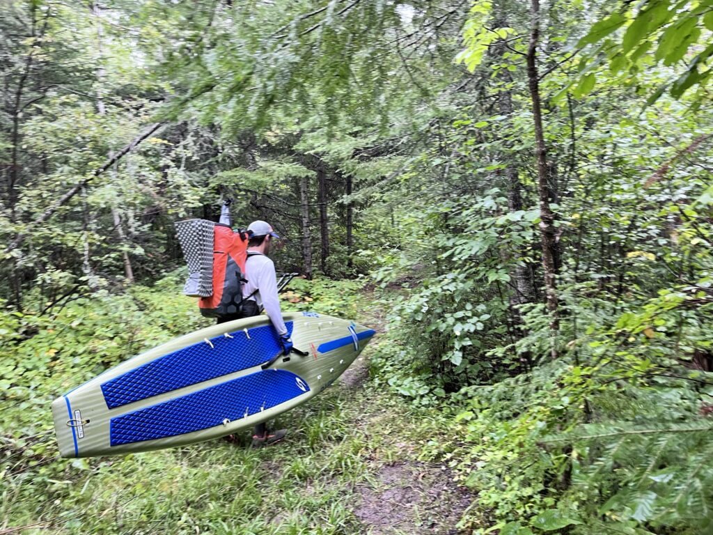
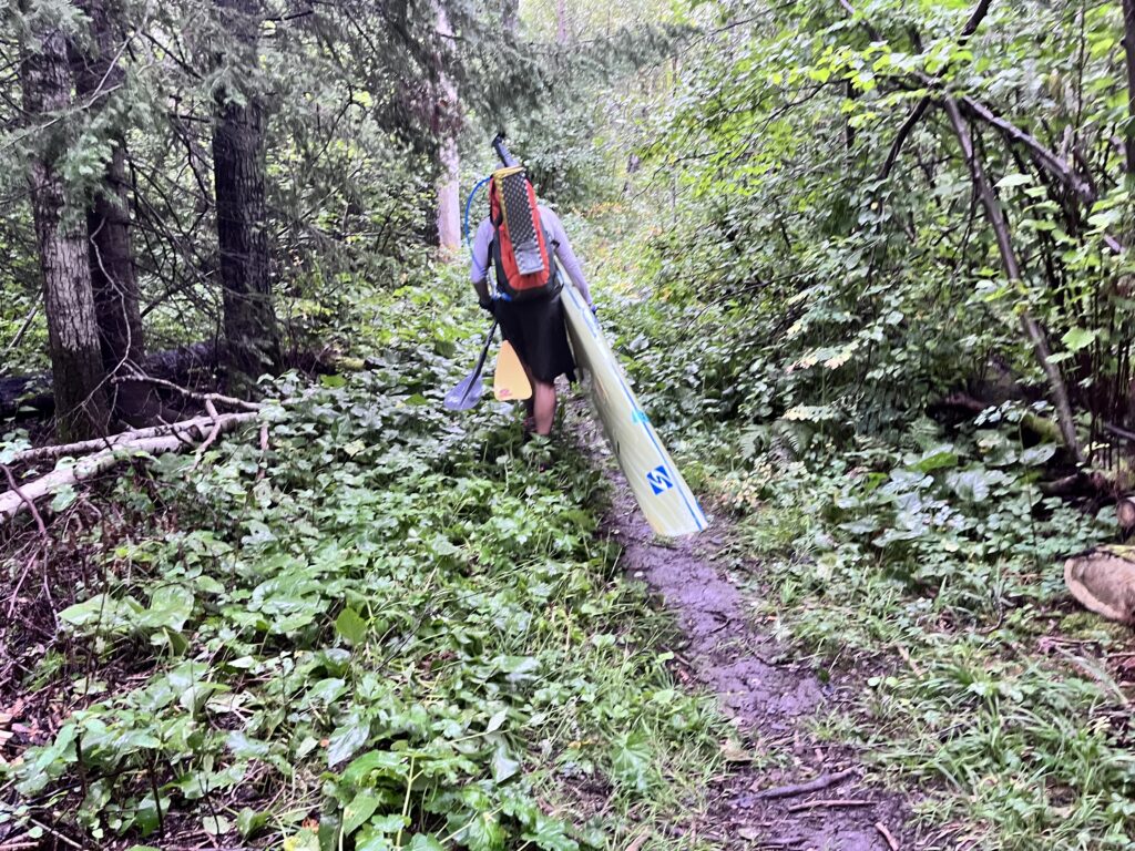
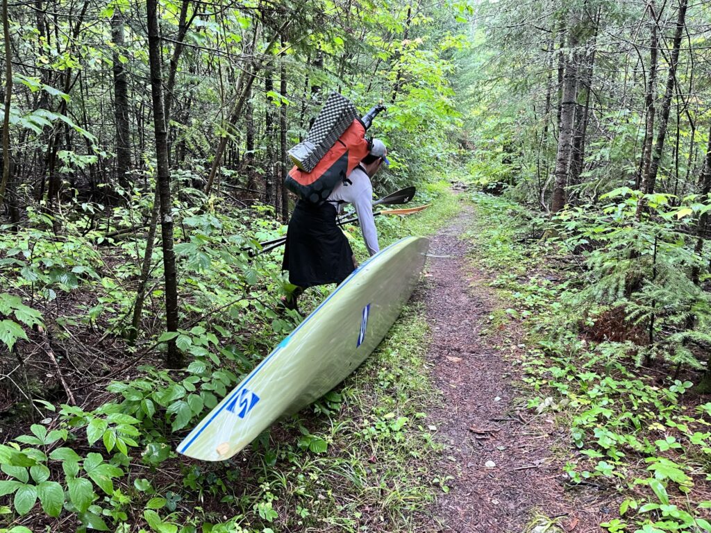
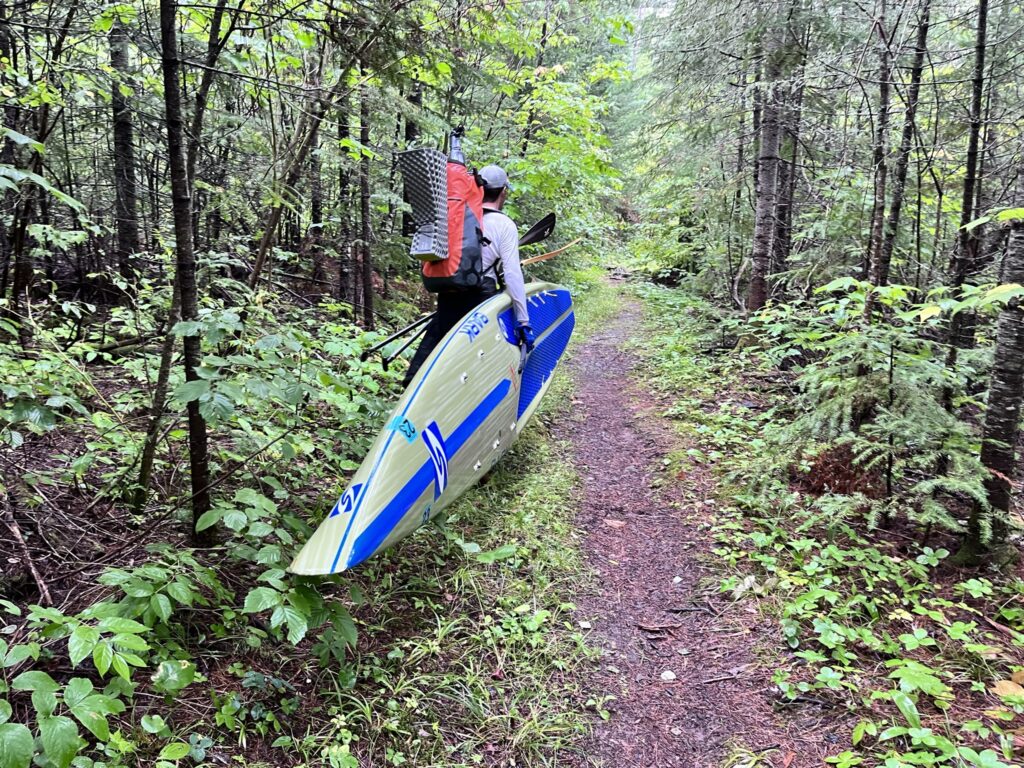
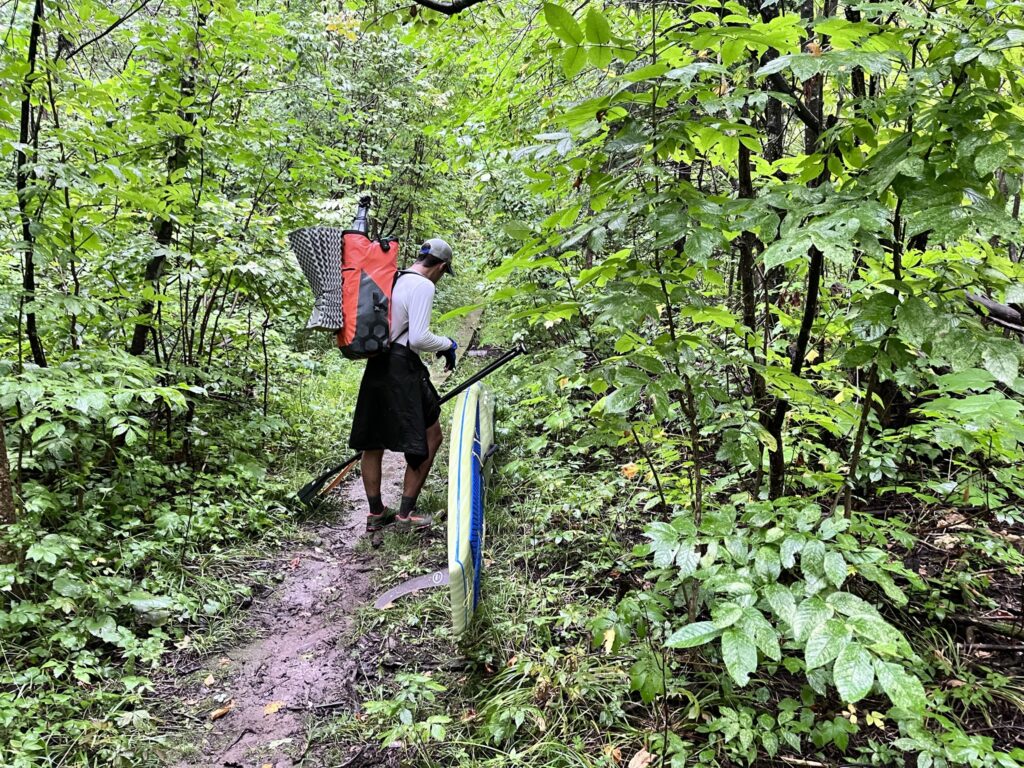
I was able to fit my food bag in my backpack, which made the portage transition even faster. Into the deep wet woods. It was still pretty dark out. Miserable conditions really, but the blast to my senses almost made it easier than prime weather, I thought. I luckily did not encounter any disadvantages with the wet conditions and was able to make it over slippery roots and rocks and mud pits pretty quickly. The rain was loud on my hooded polyethylene jacket. My gloves were wet and the cuffs of my jacket started to feel a little wet as well. I didn’t have my rain pants on and was pretty comfortable. The rain was coming down. On the way to Moose Lake, I wondered if I’d see one. It was a pretty tight portage. If I was going to see a big animal, here was the spot. It just seemed like it – I sensed a moose. Harsh conditions with the rain coming down in the dense forest of far northern MN, literally right on the border of Canada and where the scary big animals like to play. I did not see one, and motored through the portage. I felt strains in my wrist, the ever familiar slipping of nerves against tendons. Yet, I could grip well. I didn’t want to burn out my arms for the Grand Portage so I felt fine with taking breaks and switching hands. The breaks were never more than the time it took to switch hands, though. My water bladder hose dangled and I drank from it while walking. I went through a narrow lilly pad pond before the final landing from a long portage to start the day.
On the other side, on Moose Lake, I ate some caffeine gummis for breakfast. The rain tapered off. It was still pretty dark. I knew it had lightened up significantly since I started off in the morning. My headlamp was put away long ago, but I was definitely experiencing a traditional dark, gloomy, moody early September morning. I thought I heard thunder amidst my swooshing paddle strokes that never stopped except for the most brief moment to check my watch or take sips of water, or kneel down to inspect my map closer. I made good time across Moose Lake. The miles clicked off. I spent my time on Moose dwelling over the clouds. I was encouraged by the rain clearing out but swore I heard a couple very faint rumbles of thunder. I tried to determine what direction the clouds were moving and where the system was lighter or heavier and if the heavier-looking clouds were moving towards me. Looking up while paddling was dangerous, though, and I couldn’t dwell too long before refocusing back to the nose of my board cutting through the water, same as all the other 225 miles of the trip. An updated weather forecast from my tracker was encouraging. How accurate was that really, though, I wondered.
Another rain soaked portage and I was onto North Fowl Lake. I remembered the 2020 video from Scott Baste having major issues at the landing of North Fowl, and calling it a “foul” portage. I had no issues getting through. Yes, it was very muddy. In fact, it was the muddiest portage of the trip. But I was able to get back up and paddle into the rainy lake quickly and efficiently. I had to de-weed my board’s fin but was making up fast miles in no time. The rain came back on heavier, picking up to a solid soaking stream of water sticking my shorts to my skin. It still seemed dark out, probably due to the heavy rain. I could see the far shoreline that I had to aim for and made my way down North and South Fowl Lakes. It was cool seeing cabins to my right, on the US side. How the heck did people get those windows out there? Not to mention food…
I hit 10 miles on the day. I figured I should have been at Pigeon River by 10. My mileage as scribbled onto my map was off once again, but I kept going into the rain because that’s all I could do. That’s all I had to do. The lake was a little choppy but I had a kind of downwinder and could paddle hard standing up with ease. My map was hard to read due to the rainwater on my baggie enclosure, which had several holes and tears in it. I didn’t really need it anyways, I just had to get to the end of the lake. Pressing on, I came closer to a final island and lots of reed sticking out of the lake. The reeds seemed more and more like a continuum of the island the closer I got. I didn’t know if I’d be able to get through. At a certain point I realized that there was no way and I had to go around to the left, around the island, and then back on course. It was frustrating missing the direct route. But once around the island, I could clearly see the low point where the Pigeon River started nestled in between towering rock faces. Peaks into Canada were exemplary of classic sawtooth mountain description with a sheer dropoff on one side and long, low gradient on the other side that made the string of ridges into the distance look like the blade of a saw. Rain kept coming, and harder. Just a drenching soak. Looking up, I wondered if it would ever lightning… I hoped not.
My maps cut off completely at the Pigeon River. I could see the last little piece of South Fowl Lake, then that’s the end of the map. I hand drew a fake Pigeon River and noted “12 Miles down P. River”. Then, I knew 9 miles from there by foot. My body was feeling good. Just a normal ole day on the lake. In the drenching rain…
I got closer to the Pigeon. I double checked my watch to make sure it was the right river. I knew there were a couple other creeks and rivers in the area but I was correct and right on track. I noted a spur trail of the Border Route Trail on my watch but could not see in real life. My watch also read 25% battery. Dang it, Mike! Ya could have charged that up completely but ya didn’t. I was a little frustrated but wondered if I’d make good time down the Pigeon and it’d be a moot point. I was a little concerned and anxious, yet hopeful. From the mapping app on my phone, I remembered a narrower illustration of Pigeon River right away, then after two miles it opened up wider. I wondered if there were any rapids or anything. Please be a river cruise, PLEASE be a river cruise, I pleaded to the god of Pigeon River. I got closer and closer and then spotted a man-made structure. I paddled to the US side to find a spot to get out. I didn’t see any portage on any maps or in real life but didn’t wanna get too close to the dam itself. I knew water was flowing down at this point, and could hear it. I hadn’t been able to find the point where the flow of water switched directions.
On land, 20 feet away looked like a big stone u-shaped dam. With the low point in the middle for water to flow over, then walls on either side and lots of rocks forming a steep embankment. I got my bag onto my shoulders and carried my board up some jagged, moss-covered boulders to the dam’s rock wall. I climbed up, straddled it and looked over the side. It was definitely an impassable dam with a couple trees jammed up in there, making it an even taller dam that had a 45 degree smooth concrete chute on the other side directing water to rocky rapids as far down from there as I could see. Hmm… I sat and looked around for a bit. I couldn’t see any pathways, any portages, I couldn’t see a way to paddle on the river, but figured I’d just have to make my way one step at a time.
I started my much anticipated late-stage, 12-mile section of Pigeon River with not a step, but a leap down the stone walled dam to rocks below. The rocks were endless. Steeply strewn on the river’s embankments, generally about a foot long on average with all types of sharp corners and edges and protrusions. Moss and rainwater falling from the steady soak above made each footstep difficult. I couldn’t easily carry my board on my right side because the rocks were too high. The left was kind of sketchy because if I had one little slip I could drop my board down 10 feet onto more rocks or worse, directly into the river then right down to Lake Superior. Then, I’d be walking 20 miles to go find it, instead of cruising down the river for 12 of those. Then I wondered if I’d be cruising any miles at all. It took my 10 minutes to make it .1 miles, and to realize that the river was not paddleable. I decided to stop trying to traverse the rocky embankment, and headed directly to the river. My feet were wet, my shoes had been wet for 6 days straight, my legs were dripping, shorts soaked, and so it wouldn’t matter to trudge through a creek a little bit. I figured it least it was flat down there…
Once down to the Pigeon River itself, I was in the midst of rushing rapids. It was shallow, just 6″ deep on average, washing over lots of rocks and boulders. I trudged right through, following the river to my destination. I didn’t know when I’d be able to paddle again, but I was hoping at most 2 miles of this walking. Two miles would be brutal. My next mile split showed over 50 minutes. Oof. I wondered how long this would actually take me to get to Grand Portage. If I do all hour miles, that’d be 12 more hours, plus 3 for the Grand Portage. Hmmm. Bad. That would not be optimal. I was surprised I hadn’t seen Scott Baste today. In fact, I hadn’t seen anyone thus far, except people in rain gear at the last campsite on Mountain Lake hours earlier. A bend around the river, all I could see was rocky rapids. Walk, slip, bend my feet around, agonize about the pain of carrying my board, and dread the Grand Portage until I regained hope at the next bend. I’d cross the river to find a nice, flat and rocky river bank, stepping in deep spots along the way, or stubbing my toe on a large underwater boulder, only to see yet another stretch of rocky rapids. Fucking TERRIBLE! If I had to endure these conditions at the start of the trip: the shallow river, portaging my board through the creek in the drenching cold rain, I would have bailed immediately. Since it was the last day, I ignored the signs of pain in my wrists, I tried to ignore the shuddering cold as best as I could as I felt moisture seeping in towards my core. My rain jacket was only doing so much to keep the water from running down my arms. It was almost laughable… I thought how unbelievably ridiculous the situation was without any context. What if someone just saw a snapshot, like a movie reel, of this exact moment for me? Nobody would ever do something so stupid. It was really just blatantly stupid, this hiking down the river. I thought that there must be another way…
Before I logged 2 miles on the Pigeon River, I finally got to an area that seemed good enough to paddle. It was easy to get onto my board in a knee-deep section of water, and I thought that this was it, THIS was the start of the river cruise. Please, please be a river cruise from here… I strapped by bags down, checked for rocks and stood up to paddle away. It felt nice, and I paddled hard to try to keep my body temperature at a less concerning level. One measly bend in the river, though, and I ran into more rapids. It was defeating. But, I didn’t even think to take any action besides swing my gear onto my back once again, get off my board and stand up on to the rocky river bottom instead, hoist my board up from its strap and proceed forward as fast as possible right down the shallow, rocky, rushing river. It was really, truly terrible traveling that way.
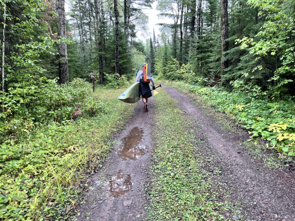
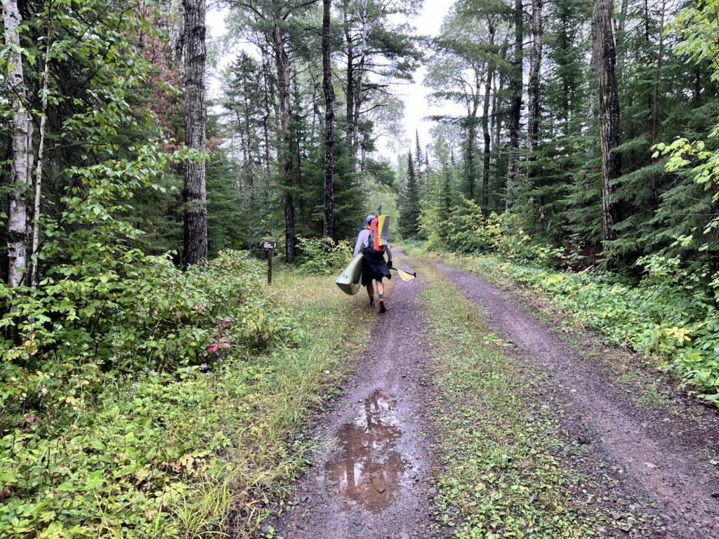
At a certain point, I figured it’d be like this the whole way, and I just had to make the fastest route possible no matter what. I looked at my watch. The battery was draining slowly towards dead. At this rate, no way I’d make it to Fort Charlotte, the start of the Grand Portage, with my watch still tracking. The rain didn’t let up. Luckily, wayfinding was easy. Just follow the rocky rapids. I got pretty sick of walking down the river and noticed the Border Route Trail to my right from my watch’s map screen. It was kind of funny… my battery was down to 17%, I had probably 10 miles of this shitty-ass river travel left, averaging 1 mile per hour, and that watch was my only map. I doubted I had cell service at all. Luckily, I did have plenty of charge left in my two battery banks, but those were stowed deep into my backpack, probably in a bag within a bag within a bag. I couldn’t actually imagine stopping, opening my bag sequence, digging through to find a battery charger, then actually charging my watch while trying to move in this cold, driving rain. So, I just kept moving forward as-is. I could tell that the BRT followed the river for a while, and so decided then and there to veer off. I would be able to walk a ways on the trail and skip the stupid trudging down the river, then get back on the river, but at the risk of passing up some sections I could paddle. It was worth it the risk. So, I trudged into the dense forest. My board immediately got caught on some vegetation. I moved it aside and plowed forward. I just realized how absolutely ridiculous my life was at this point. Any of this is shitty… walking with sharp rocks in my shoes, carrying a paddleboard under my arm, walking with a heavy pack, straight-up bushwhacking through remote wilderness, wearing wet clothes, being on 6 days without taking a shower. Any one of those is shitty, and that shit is multiplied by cold rain. And I was experiencing all of it, all at once. I had a second of regret with my choice to pursue the Border Route Trail, stopped, looked back to the safe river, then back where my board’s nose was pointed into an extremely thick bramble of branches and leaves. I just pressed through, and luckily noticed an established trail just steps further. Onto the BRT it was a breeze, and I was thankful for the trail to walk along as opposed to shallowly submerged, slippery rocks with flowing water over top. I made decent time but didn’t want to be walking with my board any more than I had to. I’d be trying to blitz the Grand Portage in just a couple more hours. Hopefully just a couple…
I had to reference my watch several times to make sure I’d get back to the Pigeon River from the Border Route Trail. I got closer and closer, and could easily tell where I had to peel back off to the river and where the BRT turned to the south. A few changes of the hand, no issues despite the rugged and muddy trail, and I got to a steep clay riverbank that I had to go down. I slipped a bit but no landslides, and made it down to the Pigeon River once again. I couldn’t paddle, unfortunately. I had my backpack on, and went through a few sections that I thought I could paddle through. Sick of carrying, I spent a bit of my travel time pushing off with one leg, my board fully in the water, knee on my board, paddle in hand. It didn’t always work and I smashed my fin and board’s bottom on lots of rocks stubbornly trying to float instead of walk. A few forks in the river threw me off, but I could always confirm with my low battery GPS watch that I was continuing on the right course. I finally came to a section of the river that was deep enough to paddle with no rapids and no terrible shallow rocks. My next mile was less than 30 minutes. PHEW. I thought that the map screen on my watch took more battery life for some reason, so tried to keep it on the timer screen. I thought that switching screens took even more battery life, but I couldn’t help it. I had to try and figure out how many more miles of this terrible Pigeon River I’d have left. I was about at mile 13 when I climbed over the dam. My 16th mile took less than 15 minutes. Things are lookin up for old Mikey, I told myself. Yet, I figured I had 11 more miles on Pigeon. Oof. The rain seemed to be letting up a little. Well, no it wasn’t. I was standing up and paddling, thinking to myself that I had to make up time, and work hard to stay warm. That was my mantra: “work hard to stay warm”. I was increasingly nervous about how cold I felt. My core was being infiltrated with cold moisture slowly and surely. Another faster mile was extremely encouraging. I had at least 10 miles until Fort Charlotte.
After over two miles of solid paddling, I was devastated to see another rapids ahead. I got my bags back on my back, unstrapped and jumped off once again. I can do this… Luckily, it was just a short jaunt and I was back to paddling quick. Paddling again was very brief, though. So I carefully set down my bags all clipped together, didn’t even pick up my board but drug it across the shallows, scraping and smashing it terribly in the process. I’d hop onto my board, push off and kneel forward at any chance I could get, which commonly resulted in banging and scraping. Regardless of the scraping, which I barely cared about that that point, I wasn’t able to cross certain areas. Large rocks prohibited my forward progress. I frequently tried to float down the terribly shallow Pigeon River by shimmying up towards my board’s nose and trying to press it down, thereby raising the tail and my fin out of the water. That worked, but then I’d jam my front up. There was no easy way to make it through. Back on my board to paddle a bit, get jammed off, jump off, schlep my board, put it back in the water to paddle, can’t paddle, repeat the process. It was brutal, and seemingly endless. Miles of walking by heavy-ass board and rain soaked gear only by trudging down a river on slippery sharp rocks. Plus, the relentless soaking rain. I started really looking forward to the Grand Portage.
I struggled for another hour in rocky rapids. That was good enough for two more miles, and I knew I was getting close. I hadn’t really eaten anything since breakfast. It was noon by the time I hit 20 miles, and I just wasn’t willing to go into my pack for anything, or otherwise stop my forward progress to get that damn shit over with. I was so sick of struggling in the rain. I figured I had 5 miles to get to Fort Charlotte.
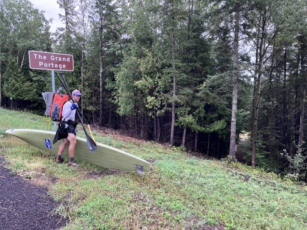
I was lucky to get to a nice paddling section where I felt comfortable standing up. Bags went back down and I stood up. If I paddle fast, I’ll keep my body temperature up, I told myself. Work hard to stay warm, work hard to stay warm. I knew I was getting close to Partridge Falls, and thanks to my little Grand Portage National Monument brochure, knew that there was a little portage around, and could match how the river on my watch looked compared to the small section showing on that brochure, to what was showing my low-battery watch. I remembered from studying the satellite view that there was one northbound section of river which I passed long ago, then the second time the river turned north was at Partridge Falls. I paddled hard and was able to nab a few fast miles all standing up. I had to battle the weeds. There were clumps of weeds floating around everywhere, so easy to get caught up in my bashed fin. I don’t know what was more frustrating, dealing with the endless weeds or dealing with shallows that could not be crossed. They both sucked ass, but I could at least make 14 minutes in a mile while paddling. I was lucky enough to get one more mile of paddling on the Pigeon River, then came up to Partridge Falls. I was so excited. I could easily see the portage to my right, and I hooked right in to the landing with another fast transition to walking. I figured an intersecting path to the left went to the scenic falls itself, which I wasn’t interested in stopping at. I kept right. I wanted to get my board in the river. I wanted to get to the Grand Portage. I desperately wanted to get to Lake Superior. It’ll be here soon, I told myself. I kept going at a fierce clip along a double wide ATV trail or very minimum maintenance road, down a large rocky hill. I could see yet another fork in the road and chose to go left towards the river. I hoped it was correct. And if it wasn’t, well, I could probably just walk down the river like I had been for the previous 4 hours. Luckily I was able to launch on the other side. I was real close.
I was so excited to see Fort Charlotte. The rain started tapering off. Amazing. I starting running numbers. It was about 2:30pm. If I could get repacked and walking by 3pm, then do 3 hours on the Grand Portage with an average of 20 minutes per mile, I’d be good. That was do-able. I figured I’d take a moment at Fort Charlotte to charge my watch, which was below 10% but would surely make it through the final paddle. I for sure would drink as much water as I could to leave just enough for the 9-mile walk. I’d also put everything from my board onto my back somehow. I envisioned strapping my sleeping pad onto my pack’s bungee cords, then untying my bungee cords that had successfully and faithfully held my gear down for 6 days, only losing 1 out of 12 tie-downs. I pictured sliding my paddles onto my back bungee cords, which was everything. Then my board would be as light as possible and I could go further without stopping to change hands. My shoulders could take it, my hands could not. I’d eat some food for the final surge of energy I needed to finish off this trip. I wondered if I could run it… I could definitely run it. I’d run it. Why not try??
Around another bend and everything calmed down. No wind, no rain, no noises. I noticed a small beaver poking its head out. It looked at me. It didn’t slap its tail and disappear under the water. Then, I saw three other little heads poking out. I got closer and noticed they were kind of hissing at me. Those might be otters, I thought. Not so cute when they’re angrily hissing at you… They had an angry glare from their beady, black little eyes. Yeesh. To my left was visible and audible rapids. Straight on, a portage. Here we go! I was so excited. When I got closer to shore, I could easily make out the wooden stairs. Was this really it?? I saw a sign on land. I was a bit skeptical that this was the main landing at Fort Charlotte but hit the river bank and got out. Wouldn’t there be some grandiose landmark? I thought of the terrible 12 miles down Pigeon River. How in the world did they get 6-man canoes with thousands of pounds of gear down that god damn terrible shallow riverway?? Unbelievable.
I landed at Fort Charlotte, acknowledging that I was done paddling for the rest of the trip while I grabbed my board and gear and quickly tried to find my way. I saw signs pointing to the the campsites and toilet and followed. At the first campsite, I saw an unused table. I also saw campers on the other side of a fire grate. Gah… whatever. I set down my gear and hollered out to ask if I could use the table. Sure. The guy started chatting with me… asking if I was part of the WaterTribe. No, I said, and asked if he was. He said yep. Scott Timm was the guy’s name, and he said he thought my fellow ultra-distance paddleboarder Scott Baste had finished up today. He asked if he could let him know that I was on my way down. Oh yeah! I pictured finally meeting this guy. What a better spot than the end of Grand Portage? We chatted a bit as I struggled. I couldn’t get everything back into my pack. I didn’t really need to fully roll it… I just snapped the top clip closed without rolling it down at all. My gear was sticking out of the top and I was nervous it’d fall out on the jostling trek. But I couldn’t get it pressed down any further and didn’t care enough to find a better solution. My paddles barely stayed secured. They slid right down to the wet ground. I couldn’t walk like that. I told Scott “see ya” and set off. The paddles would not work on my back, and I had to set my board down just a few steps down the trail, seconds into a fresh Trail Running activity on my watch, to remove my 2 paddles from my pack’s bungee cords and just hold them in my hand. No problem. Except my hand felt like it had nerve damage. A quick charge of my watch to a comfortable 15% and a meal bar to charge my depleted energy stores set me up for the run. It was more of a shuffle, but I was running the Grand Portage. Yep, I could do this, I thought. I was happy to carry my board without anything else strapped to it. It seemed lighter.
Barely a quarter mile down the trail, and I heard and then subsequently saw someone hiking towards me with a rain poncho on. It was my mom! MOM!! I was surprised and happy to see her. I ran past her, barely stopping to acknowledge her existence. My ego got a boost and I ran a little faster. She was right on my tail, so after a couple minutes I finally started chit chatting. She asked me how it was going. Good. I asked her lots of questions, did she get the room? She told me how there were none left but they had the group rate and she got the group rate. SO DID YOU GET IT OR NO?!?! I couldn’t really think clearly. Yes, she said. Ok. She said she had been hanging with the WaterTribe people the whole week and they were tracking and had all these people, and this lady was kind of the organizer. Uh huh. This was all interesting information, but I was too braindead to absorb any information besides the most critical details. She said Scott Baste was on the Grand Portage earlier when she was out hiking. He came in around noon. NOON!?!? FUCK!! Damn it. What a crock. Oh well, it was a fun trip anyways. Wait, if he started Saturday, and we finish on the same day… My mom confirmed that I had the record locked down. She said we started almost exactly one day apart. So, that’d be about an 18 hour buffer that I’d have, if he finished up at noon and I finish up at 6pm. Sweet. Phew. My mom said that she thought that the WaterTribe thought I could do 4 hours on the Grand Portage. She said the fastest time any one of their group had done the 8.5-mile stretch was 3 hours. I wanted to do 2. The trail sign said 8.5 miles, so that’d be about 13 or 14 minutes per mile. My first mile was about 14. Nice. It was arduous, though.
I kept running, but had to stop abruptly to switch hands every now and again. I didn’t foreward my mom, I just couldn’t muster the energy or desire to announce that. Just a dead stop when I absolutely had to, the fastest possible change of hands and then back off to running the trail. My mom said my brother Andrew was out there somewhere too. Another mile about 15 minutes, and I hit a beaver pond area with a big boardwalk. Keep running. Keep shuffling. Keep it up. Let’s go. Another big blue swishy rain poncho in the distance and I saw my brother. He saw me, his eyes bugged out and big smile came on his face. I passed him quickly and we set off running all together. Shortly after the beaver pond, nobody was talking. We were running through the damp forest, wet leaves touching me all over. It didn’t matter, I had been soaking wet for hours. The rain had stopped, luckily, but everything was wet. The trail was in decent shape, a standard singletrack hiking trail. This is my game. This is what it’s all about.
I overheated and took my rain jacket off for the first time on the day. That warmth was a relief, after feeling like I was 10 minutes from low grade hypothermia had I stopped moving through the Pigeon River section. I couldn’t take it anymore, though, so had to tie the jacket around my waist during a quick stop to set down my board, step over it, hand over my two paddles to the opposite hand, then grab my paddleboard carrying strap with the other one. My hands were doing fine, but felt weird. They felt injured, but they could grip. The act of carrying my board along the trail was just overall too exhausting to bear and when shuffling along, I was constantly thinking about when I could slow down, stop and/or change hands. I just had to get to a certain point. A big uphill and I power hiked up it and past it. A few fast miles, and I just had to stop. I made over 4 miles in an hour. Hell yeah. But once I started walking it was impossible to fathom running again. I tried to a little bit, but stopped. Hiked a bit, had to stop. Switch hands, briskly walk, but I just couldn’t take it and stopped again. Tried to run again, no go. I had a 20+ minute mile, and through 6 miles I was absolutely slowing down. 251 miles in, 2 miles to go and I was gonna walk it in? Hellllll no! I started grunting more and more, which was a little embarrassing with my mom and brother well within earshot. I was swearing and felt defeated. But, I was able to get back running strictly off brain power. Really, it was more accurately a lack of brain power that made me slow down.
From the middle of the woods we came to a fairly wide dirt road. We crossed Old Highway 61, the trail went down the road for a bit, and we ran down. Then back into the woods. There were plenty of muddy low spots that we just trudged through.

It seemed like the Pacific Northwest, like a rainforest. I had put socks on before starting off on the Grand Portage, despite my soaking wet shoes, and it was a great move to make. However, they were soaked through as well by mile 7. 15 more minutes, I told myself. 15 minutes of excruciating pain left. With me out front the whole time, we only stopped so I could change hands. I could hear my brother and mom breathing heavily behind me as I struggled to complete my challenge. I was locked in. My adrenaline started pumping more and more as I sensed Highway 61 ahead. I knew it was the road crossing near Mount Josephine, then a short downhill jam to the next road, and then the fort right there, and Lake Superior right at the fort. I heard cars. Let’s fucking go.
Across Highway 61 was fun. It was a true semblance of civilization after being in the wilderness for nearly a week. Paved road, a car driving off in the distance, and the easy-to-miss road sign for motorists traveling near the US/Canada border a mile north. I changed hands while I had a wide open area to do so. It was all downhill from here, so I really brought it in. The sweet relief of not having to carry my board anymore was so close, I could smell it.


2 hours in and I was about to smash those WaterTribe people’s record. My mom was saying that I could stop at the sign. I told them I was going to the lake and I didn’t care. I hoped I could go through the fort. I sensed it was right there. I approached a newer-looking bridge with narrow railings. My board didn’t fit. God DAMN IT! Why the FUCK is this so narrow! I couldn’t handle the tiny obstruction. I shifted my hips to get my board and hand through, a turn in the trail and another duplicate bridge. Stupid. I was so mad about the bridge rails. But right after the two, a little grove of trees and I could see cars, the road, the clearing, the sign. Yup. I popped out and saw my dad peering into the forest from the road’s ditch, and my sister sitting in her car, then another old guy in a chair across the road. I said “hi” but kept running. They probably thought I’d stop at the sign, but nope. I ran right to the entrance of the Grand Portage National Monument fort. It was closed, locked up. I set down my board. Man… what do I do? Stop? No, I’m right here, and could see a path around the fort, along the palisade. I got to get to Lake Superior. The footpath led right to the lake, and I was happy to see it. There was a decent chop on the lake, debris floating around everywhere, and grey as far as the eye could see. Grey sky, grey lake, grey rocks. I jumped down a rocky embankment and into the lake. My bags got tossed down on shore, my board in the lake, and stopped my watch. DONE.
My brother ran up behind me and was yelling and hooting and hollering. We kind of just looked at each other weirdly. He was probably wondering what I was going to say. I was too braindead to think of anything to say, and too tired to even mutter words. But, I smiled. I also thought of what I told myself I’d do for several days. I’d been fantasizing about this moment. I told myself I’d jump in the lake. I did not feel like that at all. I was already pretty soaking wet, why would I need to get more wet? I took my nasty white long sleeve paddling shirt off and jumped in anyways. I told myself I’d hop on my board and kiss it. So that’s what I did. I could hear my brother laughing. Then I snapped back to reality and waded back to shore, attempting to pick my board back up. Oh, anything but this! My brother offered to help but I was already there… I just brute force tossed it up on shore, just as my dad, mom and Scott Baste in the flesh rounded the corner. My mom looked pretty tired out from the run, soaking wet just like I was. I checked on, and then stopped my tracker. Oh, that felt good too. No more worrying about the tracker, or my battery life, or my safety. DONE.
Scott commented on my board. I said it was banged up bad. He said it was in great shape. Sure… one spot was definitely chipped up. He said it was just the paint. Meh. My brother was nice enough to take my board back to my van, and I had no problem carrying my bag back. The rain kicked back up. Stupid rain. We quickly got my board onto my van and drove to the casino. I was just hunched in the back of my van, and it sounded weird back there. I was talking crazy talk… “I think the wheel is loose guys”… it just sounded weird from the back of the van instead of the drivers seat, as my dad drove us all to the casino. I think my stress hormones and adrenaline and heard rate had been so jacked up for days, I couldn’t just turn it off. When we got back to the casino, I stood in the lobby, dripping water into a puddle on the ground as the nice attendant checked my room and then came back with my room key. I had to dig out my credit card from my one tightly packed backpack, which was not ideal. But, it was worth it. My mom dropped off my fresh clothes, I took a nice hot shower, then had beer, pizza, a burger and cheese curds at the restaurant. The meal was amazing, and shared with my two parents, brother and sister. What a great meal. What a great trip.
The icing on the cake was to talk to other paddlers with WaterTribe. One guy, Beav, did the route solo in 66 hours. Scott did 6 days, 6 hours. I did 5 days, 10 hours, 30 minutes all said and done. The tips and tricks, dreams and stories from these like-minded adventure paddlers were extremely fun to hear. I felt a little weird that I wasn’t really part of the group, but they brought me in. I had a lovely time in Grand Portage, and stayed in the hotel room for two nights for full relaxation. It was wonderful. My wrists and hands bore the brunt of the damage, and were pretty fuzzy, tingly and numb, on and off the whole rest of the weekend. On Sunday, I drove back to Duluth alone, with the lovely drive down Highway 61 to reminisce.
0 Comments