Day 4: Wednesday, September 7: Basswood Lake to Granite River

GPS Data:
My watch’s alarm went off early – 5am. The moon was bright all night. My sleeping bag was pretty moist. I could tell it was a little wet towards my feet. Ahhhh crap. Not good. I laid back down and shut my eyes just for a moment. I checked my phone – yep, I made a backup alarm. Eyes closed, I could just feel the dew all over everything. I could feel it throughout the night, but was able to curl into a ball and comfortably sleep well in my dry cocoon. But, what was I ever going to do about my wet bag now?! What a dilemma. I couldn’t even get back to sleep despite being extremely sleepy. My hands were definitely sore. Just creaky, having stiffened through the night. I pulled the plug on my air mat. Time to roll, I can’t make the same mistake waking up late, I told myself scoldingly. I shook my finger at myself, then packed my wet shit into each respective bag. It’s like ripping off a band-aid – get it done without hesitation or thinking and deal with the consequences later. Cold legs don’t matter.
It was pretty dark out, although I had a great vantage from my site to the opposite shore of Basswood Lake as the sun was rounding the horizon out of sight from the east. Headed straight east, let’s go! I could tell it was going to be a clear day. I got an updated forecast before I set off. I didn’t know how many forecasts I got. I always selected the “Basic” forecast instead of the “Premium” option. I had started to memorize the screens and commands to pull a new weather forecast and did it quickly. Yup, still looking prime. Pretty much 2 or 4mph from the west or southwest, or north northwest? Hey, if it’s 2mph I don’t care where it’s coming from. I was excited to crank.
I fiddled with my board a bit – I was questioning the light setup. I strapped on my bike light to my dry bag backpack and carefully nestled it so it’d be pointing downwards. I got my backup handle out. Now you’re thinking, Mike! I strapped the light around the shaft and wedged the handle end into the bundle of bungee cords protecting my entire livelihood from the bottom of Basswood. Meh, good enough for me, and I pushed off before 6am for once, into the pretty dark, but pretty light morning of Day 4.
I had my headlamp on and was kneeling. The last thing that’s going to happen is I smash a rock and fall off into Basswood Lake again. Although, I’d warm up before too long. It was forecasted to be hot with no wind. I thought about thru-hiking back in 2016, where I once took a lunch break on a bridge to air out and dry my dewey, soggy camp gear. What is more effective, I wondered? To stop and air out in the heat of the day, or just crank ass to get to the campsite and potentially deal with wet gear? Hmm.
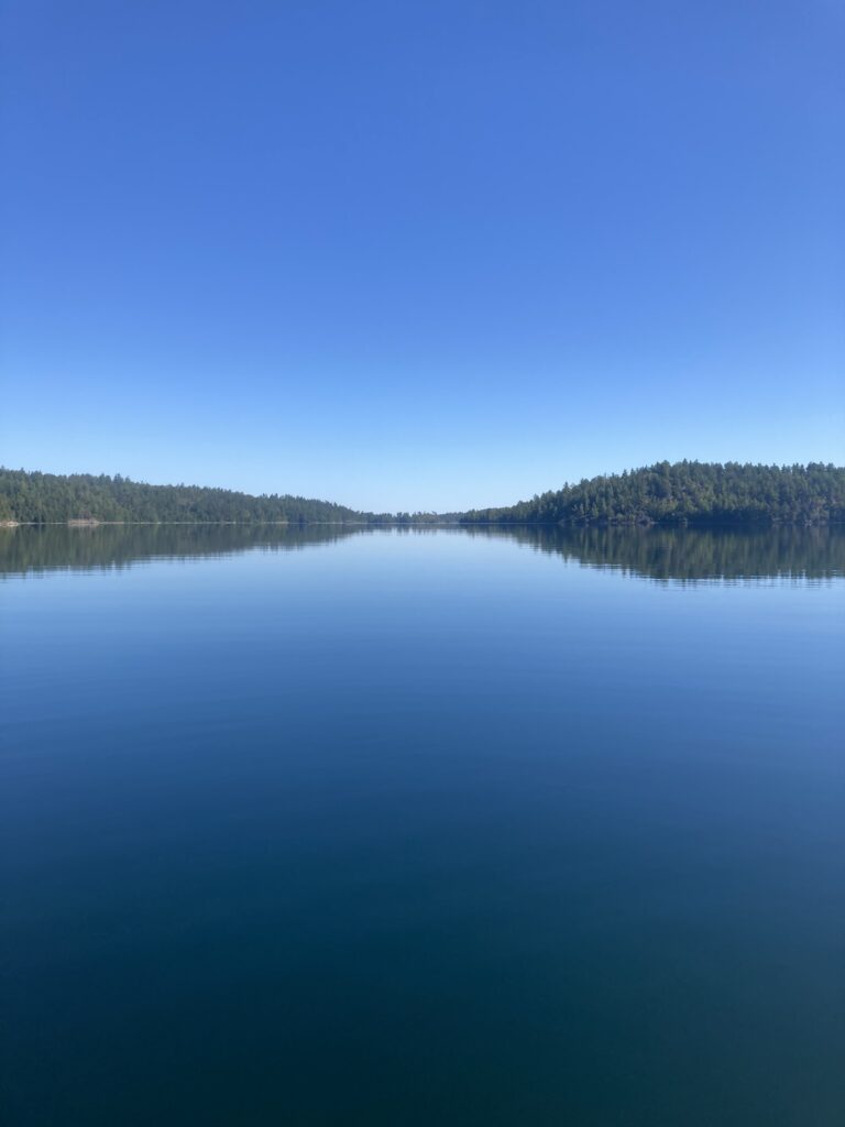
It was a beautiful morning. After very little time I had my headlamp off, and only turned it on to peek at the map, which was still hard to read in the dim dawn of day 4. That means… Sunday, Monday, Tuesday, WEDNESDAY! My brother and sister were set to arrive at Grand Portage tomorrow, my dad today. I didn’t know for sure what my mom was doing, or Em. I thought of who might be tracking me… my homies? My work people like Jake who was cheering me on? Dang, what about that project I was about to schedule… I should have sent an email that I was out. Crap. Work stuff is the last thing I should think of right now. The stress of even thinking of what is going on in my absence is detrimental. So is this paddling to my hands… I had my tattered glove tips shoved back in and my watch cuff tucked in as well. Who would think that I had my shit on such lock?!? Well, nobody is out there, and nobody is probably tracking me at this hour. It didn’t take too long to get too warm and take off my rain jacket, pull my headlamp down around my neck, turn off my front light that really didn’t do anything, and stand up. Two miles under 14 minutes was a good sign headed around Ottawa Island onto a nice extended south shore with a few nice bays and peninsulas to spice it up. It was daunting to see so far down the lake and know I was headed to the smallest, furthest away possible shoreline. But I wanted to hit 12s. My body was feeling good. I’m getting trail strong, I told myself. It was true… I felt different from other days. My hands even felt great as I tagged an hour in on the day. My deep, previously sharply painful yet not-fully-formed blisters went away somehow, instead of getting worse like I feared. Due east, baby!
I made good time headed right into the sun. It felt like the first day on that sweet south shore of Rainy Lake with the morning sun deep orange and right in my eyes. Pull the hat down and crank fucking ass! I figured I could really bust ass and make 4mph in the good conditions. My arms would be able to take it. I can physically make miles today. I knew it. In fact, I thought about how I could still do 5 days. Why not? It was looking a little dicey towards the end of the weather update from the morning on my inReach. It only went out 30 hours or so, and although this day looked prime, the next day, Thursday, looked a little rough with 10mph winds in the morning. Then, a mystery. I’d have to get another updated forecast to see. I told myself I could wait until lunch, or my afternoon stop, to check again. Because, between now and then, what difference does it make? None. I remembered the original forecast called for rain or thunderstorm potential on Friday into the weekend, but my memory wasn’t very good, and 6 days is still decently far out to forecast. But, I’d found through other BWCA trips that weather forecasts were pretty accurate when it came down to it. Since I started at 5:45am or so, I could paddle 7:45pm or so. That’s the 14 hours I thought I could do all along, and hadn’t really even sniffed it… I was two hours off that the day before! So that’s… 10 by 4 is 40 plus 4 by 4 is 16… 56 miles? Sheesh. I ran the math on how many I had done thus far… I knew I did 90 the first two days. That was easy to remember. Then just under 40 the day before makes 130. So, that’s 5 miles over halfway. Halfway… sweet. That was a fun reminder, but also a little daunting. Only halfway? But the last bit would be at least different than this endless lake paddling. I was excited for the portage. Having walked by board down to Lake Superior so many times during training, I felt like I was about in as good as shape for the portage as any other part of the trip. Even on the high end, 60 miles would put me at 190 today, leaving a final 60 mile day to make under five days. I figured I was just about at 3 days and 1 hour or so. One 60 miler, wake up and do whatever it’d take to get to Grand Portage. I’d finish this day around 9pm if I can really crank, and then hike the final miles of Grand Portage essentially in the dark. Then what, hope the casino restaurant was open? Hope my dad has tasty food in his trailer? That one is a definite possibility, though. Drive to Grand Marais for the McDonalds? Do they even have a late-night food option? Gah. Or… go through the night. What if, I thought, I could just go full send? One push from here? I could avoid the wind that was looking to be against me once again on Thursday, and really put up a good time. I could do 3mph through the night. Even 2mph. What about 3mph average to finish it off? 3 for 100 miles is 33 hours or so, add a few more in… like 40 hours? From 8am Wednesday, that’d be like 10pm the next day? Jesus that’d be rough. But so badass.
As I paddled to the anticipated Prairie Portage to get to Birch Lake and Knife Lake, and the straight northeast waterway to Saganaga that I figured would be very fun in the calm conditions, I tried to envision actually going through the night. I assumed that past Gunflint Lake would be lots of portaging. Could I do that at night? I thought a lot about making a big push. I tried to psyche myself up about it, as if I pondered it enough that it might actually happen. But, all I can do now, I told myself, is make miles while the gettin’ is good. As the sun rose higher out of my direct line of sight, became more yellow than orange and my miles stacked up, the boat traffic increased. I got some interesting looks. Out to the next point, across the next bay and by no time I was making a turn to the end of Prairie Portage. There was a bit of boat traffic and I could see some big signs and a clear landing straight on, and then another dock to my right, on the US side. There were a bunch of young bros, and they were all staring at me dead on. It was funny. I saw a canoe team depart the landing straight on, and could see the sign indicating it was Quetico and therefore on the Canadian side. I wondered what direction was best. I paddled straight on, which was where the other paddlers were coming from. Nice, I crossed them close enough to ask if I should portage at that same spot. They said I should, so I pushed on and landed ashore. I noticed my food bag was smaller than ever. I jumped in the shallow water on the gravely and sandy beach landing and started gathering my items. A suited person came up to me and asked a general question like “so you’re paddling?” “Yup”. He certainly looked like he was a Quetico ranger. I quickly wanted to ask if I could portage there. Yep! He told me there was an old treaty somewhere that said US and Canadian travelers could portage on either side as long as that’s all they do. So, I shouldn’t stop and start a fire. I wanted to make a joke so goofily said something stupid, like “or set up camp huh?? HUH?!? Ha ha ha, he he”. Oh noooope! He agreed. He also commented that his colleague hadn’t seen a stand up paddleboard for years and years and now he’s seen two in two days. A guy the day earlier, and now me. Oh, hmmm!? I wondered if that was Scott. It sure looked like the previous record holder Scott Baste was going to start the Kruger Waddell Challenge from Sha-Sha on Saturday and I wondered if I’d see him. I asked if it was maybe a little older guy, looking like he was making good ground. The ranger commented that he didn’t know… he had more stuff than me, though. I mumbled a few niceties, wished him well and confidently set off across the portage. The last thing I wanted was to have another confrontation like two days before at the motor portage to Loon Lake. That seemed like a lifetime ago.
I hiked up and over Prairie Portage with ease. Water was still flowing against me, I could see. I remembered that that was the case through Saganaga as well, and wondered when I’d be going with the water. I didn’t dwell too long at the dam or rapids or falls or whatever was at Prairie Portage. There were big buoys indicating that you would probably ruin your boat by getting too close. I got a little confused in Sucker Lake before it turned into Birch Lake. The dang border line was too thick to see minor islands on the map. I fiddled with my watch, trying to zoom in. I went to the right of an island due to three back-to-back-to-back speedboats to my left of the tiny island. I had to swerve around the island to get back on track, plus navigate the waves crashing onto my board and swamping my gear. Hey, as long as it all stays strapped down, I reassured myself. It did. Getting into a nice narrow, I could begin to see the long Birch Lake. The water was dead flat. Not a ripple, besides my board slicing through with each powerful stroke. Ahh, finally. I saw a loon. I was in a good mood but held myself back from talking to the animal, referencing a scary experience back in June on a lake I’d be crossing in just a few hours. I couldn’t see it on the map yet – it cut off at Knife. The flat water was exciting. Time to crank. 13:12. Faster. I can go faster. The next mile was 13:05. I was zooming across Birch Lake. I could see underwater rocks very far away, with the sun illuminating many feet below the clear water and the perfect glassy surface making each looming fin-smasher easily avoidable well in advance. 12:29. Hell yeah. Fuck yeah. More. I stopped for water. I made myself drink five big gulps. Then back off. I wanted to make sub 12. I paddled hard to do it. 13:18. Dang water stop.
I could see a few portages coming up on the map that I vaguely remembered from June when doing this same stretch to Saganaga. One bigger portage to start. Before I got there I planned out the portage in my mind. Kneel down, unclip hydration vest from pack, move the bags up, move bungees off the food bag, shove it back towards the nose, move bungees off the backpack, hoist backpack onto my shoulders. Unclip safety bag from my board, toss hydration vest with clipped safety bag on my shoulders over the backpack, unstrap ankle strap and strap to handle, jump off, grab paddle, lift board out of the water and run down the portage. Then, I executed. Well, I didn’t run the portage, but I hiked fast and made excellent time. I didn’t plan out the other side as well, but it went fast. Hydration pack off my shoulders over the top of my head in between my kneeling legs, swing the pack around to the front of my board and bungee it down. Clip hydration vest to both my backpack and my paddleboard handle strap. Proceed with paddling as fast as possible. I wanted to test my speed on the next little portages that were on the map. Small lake, extremely fast portage, little narrow stretch, portage. I could see an upcoming hike looking to be in Canada and one in the US at the very end of the map. It looked from my watch that that was the entrance to Knife Lake. I didn’t remember it from June, though. Was it really that long? Over 100 rods? I sent it. Not too bad. I could tell with just a couple portages under my belt that my grip strength suffered. I had to change sides more often. I remembered one other harder portage of the day, with lots of border pylons marking that it was between the USA and Canada. I had plenty of paddling before that. And, plenty of paddling after that with the big Saganaga Lake to look forward to on a calm day. PHEW. I knew I had to cross that today. I figured it’d be doable, but it’s a long way northwest. I figured 10 to 20 miles.
At the very western edge of Knife Lake, I took the time to nicely fold the Boundary Waters West map and take out the last of three maps, Boundary Waters East. I couldn’t believe I was on my last map already. This one would take me in. It was kind of a cool milestone. I spent some time to eat food and drink water. I had my feet, shoes on, in the water while straddling my board. It was getting pretty hot by the mid-morning, nearing 18 miles on the day and a bit past 10am. Eventually I got back up, knowing that I’d have no excuse to stop a constant paddle stroke for a couple hours. Let’s go.
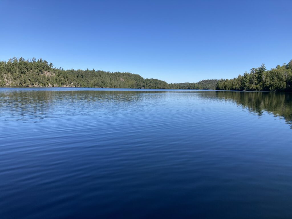
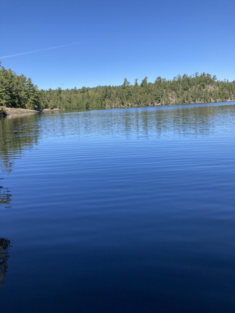
Knife Lake was amazing. The water was pure glass for miles. I passed a couple other canoe parties close enough to feel obligated to happily comment on how nice the conditions were. I raced other canoe teams, unbeknownst to them, as they headed to the South Arm Knife Lake and I continued towards the north. I could feel my leg getting scalded by the sun. The back of my right knee was in direct sunlight. It’d gotten some solid sun for now over three days straight and I could tell it was burned. I had to stop. I made myself stop. Hastily, yet carefully I kneeled down and opened my emergency pack and tried to fiddle out the sunscreen. Everything was packed to dang tight in little bag to get it to close and be water tight. I applied sunscreen to my right leg mainly. As I head east, and the sun shines most on the south side, my right leg gets all the sun’s abuse. So, I lathered it on even knowing that it’d probably wash right off at the next portage. I took the opportunity to take pictures to capture the pristine conditions.


As I set back off, I agreed with myself that total calm and a nice sunny and warm day made for the optimal paddling conditions. I continued on with the game of “get under 12”. It was fun to tick each mile off. Navigation was simple and took very little effort or risk. Knife Lake is so long and skinny I could just zone out and crank miles. It was just a perfect day. I saw another paddling group towards a back bay of Knife Lake. I remembered from June the rocky passing that was probably a tiny portage in low-water conditions. Nope, paddled right through. There were campers at the nearby site. It was kind of nice to see people. It was lonely otherwise. Even just to see people moving around was somehow comforting. There was a bit of ego, too. I wanted people to see this crazy stand up paddleboarder. Haven’t seen that very often, huh? If only they knew I was racking 50+ miles today. If only they knew where I came from. They’d probably be super impressed. Yeah, cool, Mike. I traveled past what looked like a previously burned section, or just light twiggy forest along a rocky and high-rising shoreline on the Canadian side. The US side was lush with endless dense forest. You could get so, so lost back here, I thought. I checked my watch… right on track. What about those voyageurs? They had no way to check for sure where they were. What about the native people?? They probably didn’t even have maps! That was all memory and intuition, stories and repetition. Insane.
I thought I passed the area that seagulls dive bombed me back in June. Getting close to 1pm at this point, and encouragingly close to 30 miles, I felt it time to stop. Perhaps it’d be the exact same spot as back in June? Months prior, I stopped at the very end of Knife Lake. Maybe, I figured, I could stop after the next portage and eat lunch right after, before my bags are strapped down. Perhaps I could get into the shade. I saw more campers, a bunch of dudes probably maxing out a site with 4 craft and 9 people. Man, that looks nice, I jealously pondered. How about having jack shit to do except hang at the site? How about having jack shit to do except paddle? Yeah, that’s where I’m at! Paddle, drink water, eat food, sleep. That’s about it. It felt freeing.
I made the portage leaving Knife Lake quick and was eager to stop moving on the other side to eat lunch. Right after launching, I straddled my board once again, with my feet hanging off each edge. I didn’t care that my shoes were on still. They hadn’t gotten even a little dried out at any point. Shoes can only get so wet. I mowed on some food. My last uncrustable sandwich was no more crusty than the previous two. I wasn’t willing to eat any additional cheese. But, I slammed some really smashed up honey mustard pringles, meat sticks, and candy-encapsulated licorice bites. Those made for the perfect lunch dessert. Delicious. I took plenty of time and made myself drink lots of water. I tried to filter a whole bladder full, then packed away the chips, trail mix and some other small snacks into my hydration vest for an afternoon snack. Nearly 30 miles in by lunch was great. Then again, another 7 hours would be past 8pm. 60 miles by 8? Then another 60? Or, what, 40 and 20 to finish on Friday? Doesn’t matter, just paddle to Saganaga. So that’s what I did.

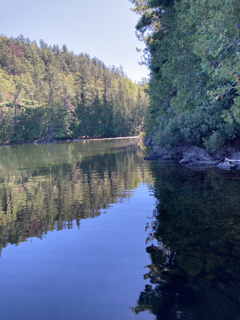


It was tough to start back up. I wondered if I went too hard during the morning. Luckily my shoulders, back and core all felt pretty good. I could tell my left tricep was completely overworked. It was still firing on all cylinders, though. It was such a relief to paddle equally on both sides in the calm conditions. I didn’t know if I could ask that much out of my left arm for another whole day. Ottertrack Lake wasn’t as pure glassy as Knife and Birch Lakes. The wind didn’t seem to have picked up at all, but perhaps enough to show tiny ripples. Still prime conditions. I eventually got back in a groove and clicked off some good miles. The seemingly narrow Ottertrack Lake kind of dragged by. Sheesh, I lamented, it’s already afternoon. I got a long way to go through Saganaga. I pushed to Mud Bay. Nice name. No issues with my fin, though, and then recognized the steep pylon-strewn portage ahead and set off in the sunshine. It was an efficient transition, but I had a take a few brief stops during the hike to change arms. I felt a little gassed. It was steep hiking, though, and I was charging. I saw another group towards the end of the portage and split between their conversation to put my board in. One of the guys snuck in front of me to move his boat. I said I’d just sneak through. It was a little awkward but I think he could tell I was in a hurry. Or, that’s just how I justified cutting him off! He noted that he saw another stand up paddleboard just the day before or the day before that on Ottertrack Lake. Oh? I asked if he looked like he was moving fast. Eh, yeah maybe. I asked if was a little older guy – he couldn’t tell because he saw from afar. Aha. As we both set off from the portage, I explained my situation. I was going for a guy’s record and I thought he was out here, and trying to rack miles. I could have been talking to the wind. I heard him shout “Cool!!” as I finally got my crap strapped down and paddled away. There was another small portage less than a mile later. The portage was literally a stone’s toss. I wanted to just schlep my board across. I bear hugged it. It was a disaster and waste of time. I smashed it down on a rock but ignored any potential damage and paddled off. There were a couple campers at a site in Quetico. I hope they know they need a Quetico permit… maybe they don’t even realize they’re in Canada. Is that even an official site? Yeah, I spotted the fire grate. Then I realized I was straying south, the wrong way, and looking at a Boundary Waters campsite in the United States after all. What the heck? I’m getting brain fog, I told myself. Focus, Mike! I paddled around the point, headed north through an opening, then right back to some tight, twisting narrows. I was careful to avoid lake weeds and lilly pads. I had to navigate some downed logs and rocks. It was slow moving compared to paddling right down the pike through the dark void of Knife Lake. Right down the pike!! I quoted a phrase from Scott Baste’s 2020 record-setting stand up paddle that was memorialized on his YouTube video I’d watched many times through the previous 12 months.
I was ready to get to Saganaga and crank. Soon enough, it opened up and I recognized the little spit of land that blocks the wide open lake I was eager to paddle across. I inadvertently went through Canada, and realized from behind my shoulder that there was a wider entrance. Oh well. I was eager to hug the south shore of the west side of Saganaga that points almost directly northeast/southwest. I figured that was two miles. In fact, I wanted to run a test to see if my mileage estimates for this map were correct. Like a calibration run. I figured it’d take me a half hour to get to Rocky Point and be two miles. I cranked. I thought about jumping in the lake. A ways down, I saw campers swimming. Dang, that looks nice, I thought. Maybe I’d jump in now… I see you! By the time I could make a decision, I had paddled out of sight without stopping the continuous motion.
At Rocky Point, there are the unmistakable rocks everywhere. The big lake had formed some light splashing waves pushing me right to my destination. Excellent. My distance and time estimates were right on – two miles to the point. I had made great time, with a couple sub-14 minute miles. I was able to lock in the 13’s. That’s about 4.5 mph, I calculated. Nice. With a clear view of the spattering of islands that I was aiming for, I tried to pick a point that was due west. Checking my watch, checking the land, checking the map. It’s right there! I was set to head east for 2 miles to get between the tight islands, then another 2 mile crossing, then another two miles to Saganaga Falls. 6 miles. That’d take an hour and bit. I wondered if I could make to the next islands, if the light wind wanted to shift west and push me, maybe pick up a bit in the process, and I could get to my first milestone by 4:20pm and take a nice little afternoon stop. I set my mind to that, drank five big gulps of water and paddled hard, telling myself that I could keep continuous paddle strokes for just two miles. That’s less than 30 minutes, I promised. I couldn’t paddle continuously, though, because I just had to check my watch to make sure I was going in the right direction. I wasn’t. Dang it! Back in June I pinned right, to the south. Even remembering that issue this time around, I still aimed for the wrong island to the south of my straight shot. I wanted to go north of Munker Island, but for whatever reason the appealing route to the eye is to the south. So, I again altered my course in the middle of a huge bay on Lake Saganaga. My arms felt as deflated as my spirit, but I kept on, ignoring both. Bit by bit, little by little, one paddle stroke at a time I made it to the big Munker Island as I hit 40 miles on the day. That was excellent, having not hit 40 the day before. 40 on the day! I said that out loud. I stuck with my planned stop and justified pulling off when I got to the land’s shore despite a few-minute delay due to my slight navigational error.
As I sat down on my board and stopped the incessant paddling, I was determined to get into a shadow after the beating sun had been inescapable all entire day. I drifted around on northern side of Munker. I ate some food, drank as much water as I could, refolded my map and requested another weather forecast. I had a nice brain break and set off after 15 minutes or so.


Inspecting my map, I had just a few little skips across Saganaga, then what looked to be two portages and a due south shot through a channel leading to an area with lots of campsites available. I knew I’d camp at one of these in the clump. I figured I could track along each one and select the perfect one. That’d get me right about to 50 miles, I figured. Despite thinking about paddling through the night, I knew at that point that I was absolutely not going to do that. My math indicated that I would be at… 90 plus 40 plus 50. 180. 180 miles on the trip if I could make it all the way down this straight south stretch after Saganaga to any one of these sites. That leaves 70 miles. A 40 and a 30. A 50 and a 20. If I go by averages, I ought to do a 45 miles and leave 25 to go for the last day. I almost couldn’t think out that far… there was no point really. So, I ran different math, focusing on wayfinding across the other big bay on Saganaga. It was a smooth crossing.
I tried to pick the tightest line but was weaving in and out of lots of different islands. I was conscious of rocks bucking me off my board as I slid by island after island. There were plenty of navigational options and I figured I was taking a good path as long as I’m headed east. Continuously checking my maps, my watch, trying to make sense of the land in front of me, then zooming in and out on my watch to corroborate what I was seeing was not efficient at all. If I just cranked miles then I could afford a navigational error or two and make better time. I had continued navigational challenges as I turned back south to take on Saganaga Falls, an area I had never seen before. I picked the wrong islands to go between and swung wide to the Saganaga Falls as listed on my map. I couldn’t really find it as was not confident. I could hear water moving and kind of see an opening. I just kept moving towards using my intuition as my main guide, but checking my watch plenty. I got there and was pretty efficient at preparing for the portages at that point. Not like previous days where I needed a dock. I had it down to a tight, efficient system and made great time down the portage. The water was still flowing against me. When does it change? Maybe it shows on the map, I hoped. I saw a party of paddlers at the end of the portage. They were as well talking about another stand up paddler. Yep, that’s me! I said I was doing the border route. They asked if I was in the WaterTribe group, because they didn’t recognize me from the start or something. I didn’t exactly understand what they said. Ah, I said no, I’m not really with them. They told me to come to the dinner at the end, on Saturday. Mmk, and I left them as they piled everything into their canoes. I previewed another portage relatively shortly ahead, so kept my pack on and paddled sitting down. The guys in canoes but using kayak paddles quickly caught up. I took that as a motivation to do the next portage fast. As I got there, I smashed it. Right off, onto the trail and I was hoofing it. It was short, luckily, and I put in on the other side with a sense of urgency, tossing down my board and quickly strapping my gear down then standing up. I thrashed at the water to paddle away quickly. Let’s get a 12 minute mile, I told myself. 19 minutes. Well, that included the portage. The wind was not perfect, but easy enough to paddle through. 13:10. Not bad. I was working hard to move forward with speed. 15:02. I was tiring out. I looked back periodically and didn’t see the other paddlers at all. As I neared an open bay and a view to the first set of campsites, I lost sight of the portage miles back. Maybe there was a red shirt or hat, but I couldn’t see them. I made big time on those guys. Not quite 7pm, the sun getting low but still visible and I wanted to push. A few more sites, I said.
A left turn back eastward and I started thinking of what the perfect campsite would be for me. Ooo, a nice view west of the sunset. A nice landing, lots of flat rocks. A nice flat and open spot where I could dry out my god damn terribly wet gear. I pictured my damp sleeping bag, just sealed in its bag all day. I paddled faster. I had to get there to ensure I was going to have a nice night sleep. I wanted to get to the one last site before the narrows. Then, I saw a big smoke plume. That was probably due to an occupant at that site. I looked to the next site south. It was pretty close to my direct route, but with a nice west view. Good enough for me. I paddled that way, scanning with the knowledge that I could probably see four different sites at that exact moment. I didn’t see many obvious occupied sites, and couldn’t see any of them with complete confidence. Around an island, and I thought I spotted it. 5 minutes of paddling, and I saw the beautiful open spot. Bring it in. Yep, that’s the site. 49 miles. Oh well, I don’t care about 50. I care about a nice site with some extra daylight, I told myself. I saw my perfect site right there, and paddled to the fire grate. There was about a 3′ cliff to the right of a nice flat slab point. I kneeled to remove my bags, then heaved them onto the grass and paddled around to the tip of the site where the slab rock was closer to the water’s level. I pulled my board ashore, took off my shoes, my waist lifejacket, and began to set up. Smooth. Yes. I’m here.
The site was sweet. Perfect. The sun was below the trees already, a bit past 7pm. As the orange hues were becoming increasingly mixed with purples I wanted to get my tent and bag out immediately. I spread all my crap out over the whole campsite, on every clean-looking rock surface. What a day. I was super pleased with the effort but didn’t have time to reflect on that. I had to get my shit in order and dinner going. I planned to eat another bag meal. It dawned on me I’d just have one more camping night. Although, the next day was looking raunchy. According to my tracker, 15mph winds by noon, again from the the south. That’d make a few crossings hard. Without looking too far ahead, I knew there were some bigger lakes. Gunflint being the first one that comes to mind. Garrett warned me if the wind was bad that Gunflint would be shitty.
My arms were dead but I spent the energy waving my tent, ground tarp and sleeping bag all around in the dusk air, desperately hoping to disperse some moisture back into the air and out from my precious sleeping gear. I poured out the damp contents of my safety pack. I took my phone out, snapped a few pics and checked to see if I could get service. Nice, two bars! Texts started coming in hot. I looked at some but didn’t text much back. Garrett had texted me “take the shortcut now!!” I had no idea when that was sent. I called Em. She didn’t answer but called me back. It was nice to hear her voice, but also kind of stressful. I didn’t know what to say and she seemed in the middle of something. I was in the middle of three things, trying to air out my stuff, prepare dinner, organize my sprawling gear pile and still had to filter water. I hung up with Em, played some music and tossed my phone aside with the intention to head back near my board and fill up my water bladder. Bugs weren’t bad, but there weren’t zero mosquitoes. I had the genius thought to check the weather forecast on my phone, which is much more comprehensive than my tracker’s feed. The forecast read 10-20mph wind from the south all day Thursday. Then, rain overnight and rain Friday, and I was instantly glued to my phone. It didn’t look like storms, luckily, but definitely rain at some point. The forecast made it seem like the rain may be kind of spotty… on and off. But, certain. Yikes. After four days of essentially prime weather, it was shaping up to be a tough two days to close it out. The biggest wind of the trip was to be Thursday, day 5, then rain overnight after four nights without a rain fly and rain the whole last day as I’d be trying to blitz the Grand Portage. I snapped to. Cripes, Mike! You can stare at your phone in bed! I gotta get dinner going! I filtered about as close to two liters of water as possible, which was a tedious process every time. I left a bit of water in my filter bag for dinner and the night. I filled up my kettle and got it boiling. I was happy that most of my stuff seemed much drier than when I took it out. My tent was set up in a great spot and super solid. One more night after this, I told myself, and apparently in the rain. Live it up now. I had a perfect site to live it up.


I ate my tasty meal in my tent on my stomach. It was nice. I selected several food items and told myself I had to eat them all. It took forever. Simple tasks take forever out here. Why is that? I wasn’t necessarily full, but eating was a chore and I seemingly had to focus on it. Eventually I ate everything I set out to eat, drank lots of water, then shoved all of my remaining belongings that I didn’t want to sleep with into my main bag, along with my sealed food back, and rolled it all up. There wasn’t a good tree to hang my food bag, so I figured several layers of waterproof bags were enough to discourage opportunistic forest creatures. I laid in my bed, hands behind my head as the moon rose to my right. I was laying with my head to the west, feet to my east, and a big moon, bright as hell in the south sky. I’d have a nice big night light tonight, I guess. I could feel that my hands and wrists took a beating on the long day. I did what I had to do, though. I drifted off to a really nice sleep.

0 Comments